Copyright © Panorama Group 1991 - 2024

Specialists of KB "Panorama" have prepared and placed the map of the Orenburg region on the geoportal . The map was formed using OpenStreetMap data. To work with the map, you can use the program or other software products of KB "Panorama".
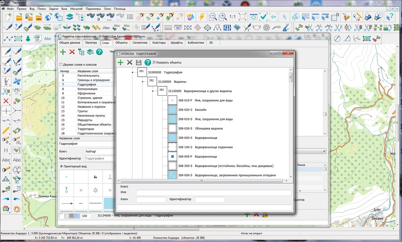
The map was led to the modernised classifier of large-scale plans of scale 1: 5 000 (map5000m) and was saved into a packed project (MPTZ). The MPTZ format project includes a digital map of the region's territory (country, subject of the federation, administrative region), a map of the administrative-territorial division of the region and a digital classifier. Publishing of updates in bank of spatial data is made by using the program of . Publishing contents of bank of spatial data on the geoportal and data access for downloading are implemented by means of .
Free maps on the basis of OpenStreetMap data are available for download on the page "Digital maps".


In KB "Panorama" the version 8.1 under control of has been developed. In the new version, in the dialog, the mode for generating sheets of the air navigation passport of an aerodrome (heliport, landing site) of civil aviation has been improved in accordance with the order of the Ministry of Transport of the Russian Federation dated November, 05th, 2020 №449. Formation of the sheet "Radio navigation aids and landing aids" has been added. The information in the document is presented in the established tabular form. There is implemented an automatic filling of the fields: type of facility, magnetic declination, frequency, channel number, coordinates of installation site of the transmitting antenna, and others.
Creation of the passport of aerodrome (heliport, landing site) is carried out on the basis of MS Word format templates included in the installation package of the program. At filling of templates the data from the database of the Complex of format PostgreSQL version 9.4 and higher is used.
The dialog has been improved. The "Frequency (MHz)" parameter for VHF omnidirectional radio beacons (VOR) is displayed to three decimal places in accordance with the requirement of Annex 10 (to the Convention on International Civil Aviation) - Aeronautical Telecommunications (Volume I).
The complex for preparing documents of aeronautical information is a set of tools for maintaining an aeronautical data base, a modeling and analyzing the aeronautical situation, generating aeronautical maps and exchanging data with other information systems through export and import in the ARINC 424-19 exchange format and export in the AIXM 5.1 format. The task "Flight procedures design" is used to design the routes of departure, approach and landing and to analyze the safety of flights on them. The task "Assessment of compliance for aerodromes with the requirements FAR" is intended for the analysis of the aerodrome and the aerodrome environs for the suitability for operation and aircraft flights in accordance with the Federal Aviation Regulations.
The new version of the program, examples of aeronautical information documents, , video lessons and presentations are available for download on the page.


Specialists of KB "Panorama" have prepared a video lesson on using mode the . The task is designed to create a complete set of image fragments of spatial data of given sizes according to the selected scale series in the Mbtiles format. This format is a SQLite database that stores images in png, jpg, png8 formats.
Pyramids of tiles can be created based on a combination of digital vector maps, space and aerial photography, matrixes of heights, data from geoportals and other data.
The purpose of forming a set of rasters (tiles) is to accelerate the display in WEB and mobile applications of spatial data containing a large number of objects or occupying large amounts of data. Display acceleration is achieved by the method of image caching - the display of the vector map area is replaced by the display of the area of a pre-built raster, which is cached on the client using a WEB browser.
Using the Mbtiles format will allow offline access to pre-prepared spatial data.
You can get acquainted with the training materials in the "Video lessons" section.


In KB "Panorama" the version 14.5.6 has been developed. In the new version the module has been improved, which supports formation of reporting documents by results of complex cadastral works in accordance with the Federal Law of July 24, 2007 N 221-FZ (as amended on December 19, 2022) "On Cadastral Activities". To support complex cadastral work, a new mode has been developed. The mode generates an XML document provided to the Unified State Register of Real Estate in electronic form, approved by the order of Rosreestr dated March 16, 2017 N P/115. The initial information for the formation of a map-plan of the territory is taken from the digital cadastral map and from the database of cadastral works.
Complex cadastral workы is carried out simultaneously in relation to all land plots, buildings, constructions located on the territory of one cadastral quarter or the territories of several adjacent cadastral quarters (with the exception of linear objects), as well as objects of construction in progress, information about which is contained in the Unified State Register of Real Estate. To start the "Formation of a map-plan of the territory" mode, it is necessary to select a cadastral quarter or other object on the cadastral map that limits the territory of work. To prepare a cadastral map containing the results of complex cadastral works, the survey.v6 digital classifier has been refined. The necessary objects are arranged in the form of a separate layer CADASTRAL PLAN OF THE TERRITORY.
The program analyzes the map, reads information about all objects of complex cadastral works and displays information in a dialog for viewing and editing. The information of the general sections of the map-plan of the territory is stored in the tables of the cadastral database of the SQLite format and is linked to the cadastral map object that limits the territory of cadastral work. When the program is restarted, the entered values are automatically read and displayed in the dialog elements. The dialog is supplemented with tools of maintaining information about the points of the geodetic base used in the preparation of cadastral documents. Information of cadastral objects is stored in the semantics of land plots and real estate objects located within the territory of complex cadastral works.
The mode has been improved. Formation of electronic XML document of the certificate of inspection by XML scheme InspectionAct_v03.xsd has been implemented. The mode supports the creation of XML files for the new and old scheme. The dialog "Data input for the document" has been improved, the list of document details has been expanded. The mode has been improved, processing of several initial XML files in a streaming mode has been accelerated and automatic updating the image of an updated map was executed. For mapping conditional cadastral objects that do not have a spatial component, the analysis of information about the CsID coordinate system is disabled, since such information is not available.
In the "Technical plan" dialog, the order of inserting "Floor plan (parts of the floor)" graphic files into Word has been corrected. In dialog , the formation of AppliedFilePDF element for the "Document on the category of land" and for the "Document on permitted use" has been corrected. Into the task "Cadastral documents" into the mode the button "Formation of the text report" based on .DOCX templates has been added. The form of the forest declaration, the procedure for filling and submitting it, the requirements for the format of the forest declaration in electronic form were approved by order of the Ministry of Natural Resources and Ecology of the Russian Federation dated April 29, 2021 N 303. The forest declaration reflects the following information: about the person who filed the forest declaration; on a lease agreement for a forest plot or other document in accordance with which the use of forests is carried out; about the location of the forest area; on the volume of forest use; on the types of use of forests. Input of information for filling the form of the forest declaration is performed by selecting values from a directory and from semantic characteristics of selected objects. Reference information is stored in SQLite database tables.
In the module "Geodesy editor", in dialog the possibility has been added for interruption of process of stream processing of selected objects when inserting data into several files. There is added a formatting of strings inserted into Excel with leading and trailing spaces. A space at the beginning of elements the "name of a piece", "length of a piece", "DeltaX", "DeltaY" is inserted for elimination of Excel autoformatting. Otherwise, it performs date substitutions for records like "5-4" in "Apr 5", for "3.12" in "Dec 3", and others.
The task of has been improved. Into the list of geoportals the geoportal of Krasnodar territory has been added containing the layers: Administrative territorial division, Contours of fields of agricultural land, Fishing grounds, Vine plantations.
The new version of the program is available on the website in the Download section.


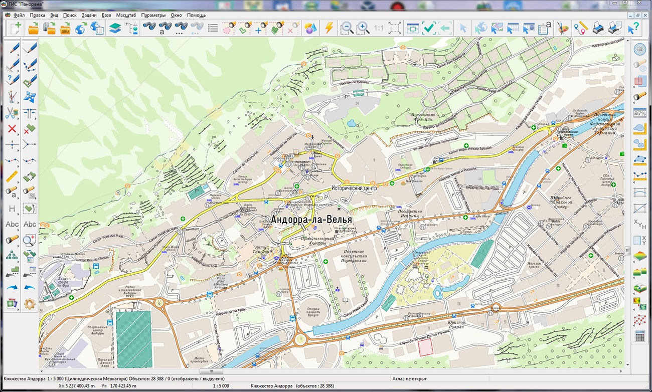
Geoportal has been supplemented with a map of the Principality of Andorra formed using OpenStreetMap data. To work with the map, you can use the program or other software products of KB "Panorama".
The map was led to the modernised classifier of large-scale plans of scale 1: 5 000 (map5000m). Publishing of updates in bank of spatial data is made by using the program of . Publishing contents of bank of spatial data on the geoportal and data access for downloading are implemented by means of .
Free maps on the basis of OpenStreetMap data are available for download on the page "Digital maps".


Ph.: +7 (495) 739-0245, +7 (925) 221-1603
www.gisinfo.ru | panorama@gisinfo.ru
105005, Russia, Moscow, Baumanskaya Street 7, building 1, office 229 (m. Baumanskaya)
Copyright © Panorama Group 1991 - 2024


 Mobile version
 Full version