Copyright © Panorama Group 1991 - 2024

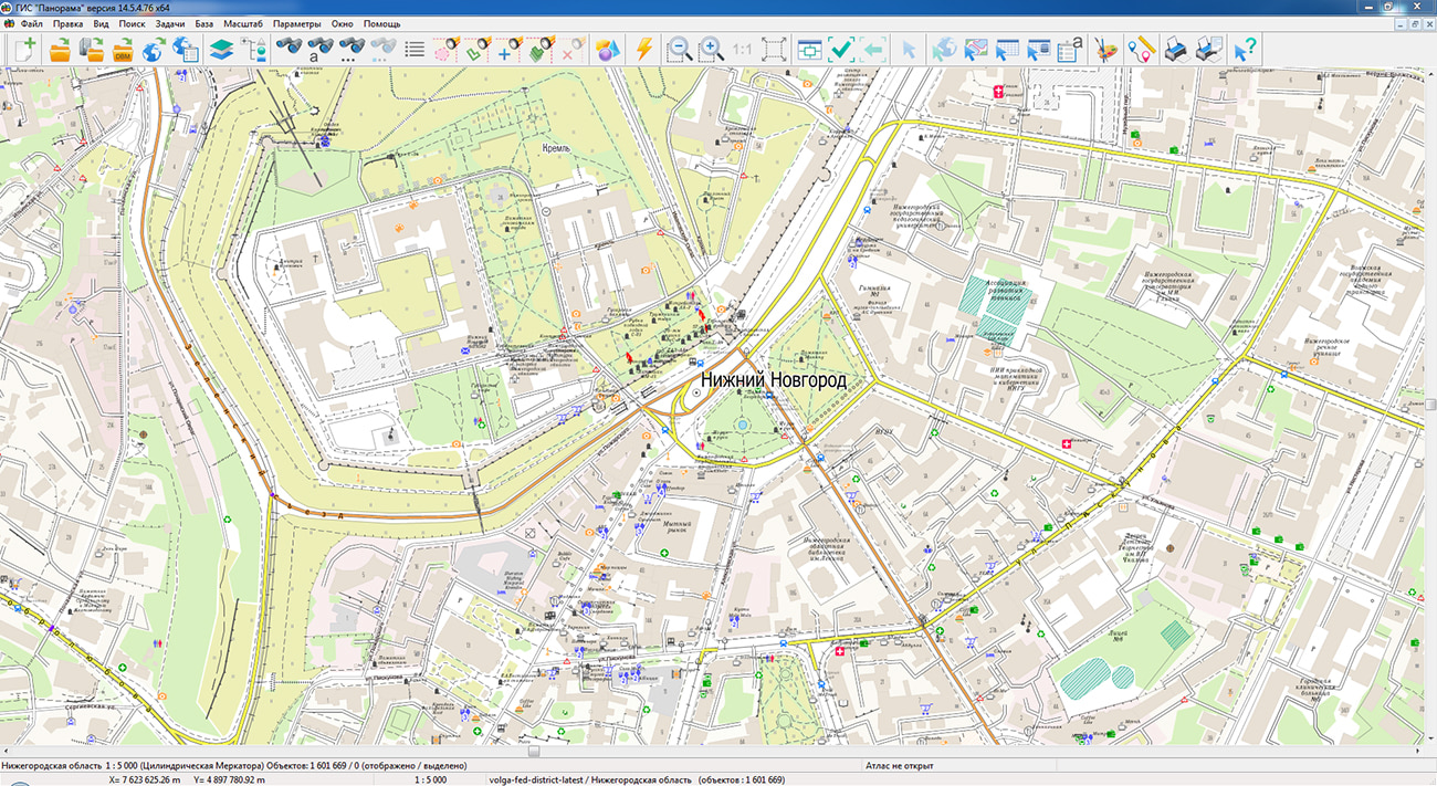
Specialists of KB "Panorama" have prepared and placed the map of the Nizhny Novgorod region on the geoportal . The map was formed using OpenStreetMap data. To work with the map, you can use the program or other software products of KB "Panorama".
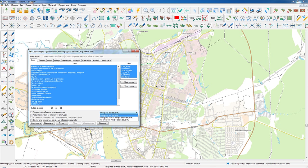
The map was led to the modernised classifier of large-scale plans of scale 1: 5 000 (map5000m) and was saved into a packed project (MPTZ). The MPTZ format project includes a digital map of the region's territory (country, subject of the federation, administrative region), a map of the administrative-territorial division of the region and a digital classifier. Publishing of updates in bank of spatial data is made by using the program of . Publishing contents of bank of spatial data on the geoportal and data access for downloading are implemented by means of .
Free maps on the basis of OpenStreetMap data are available for download on the page "Digital maps".


In KB "Panorama" the version 8.3 has been developed. In the new version the tools of control of presence of data in file storehouse have been added. Presence of files for the selected records is checked, a protocol is formed by results. This information can be used for data recovery, analysis and creation of reporting documents. Moving of files from storehouse into archive occurs only when the deletion is approved. Control over the filling of required metadata fields has been added when approving editing operations. When loading analog maps and analog images, control for data duplication has been added.
Tools of search for vector and raster data, analogue maps and images, geodetic materials and documents have been optimised. Search can be carried out at once on several values, their presence or absence. Search by metadata with filter imposing on a map (rectangular area, circle, polygon, map object borders) is supported. All selected data are displayed on a map-scheme and are automatically scaled to obtain a clear picture.
Visualization of displaying geodetic points on a map-scheme has been increased at data clustering. Small objects unite into groups (clusters). Separate maps-schemes of division of nomenclature sheets by scale have been added. Separately for each scale - 1 000 000, 500 000, 200 000, 100 000.
Safety of the data is provided with differentiation of access rights on the basis of the means of safety which are a part of an operating system. Usual check of authenticity, the digest-authentication, system check of authenticity (web server means) and domain (Kerberos or ActiveDirectory) is supported. Additional safety is provided with use of a through authentication at work with a database. Connection to base occurs to the rights of the user working with system. The complex is adapted for work on a wide spectrum of operating systems (Astra Linux SE, ALT Linux, Elbrus, Ubuntu, CentOS, MS Windows and others) and architecture (Intel, Elbrus, Baikal). The program is registered in the register domestic ON at number 1862.
Data security is ensured by the differentiation of access rights based on the security tools that are part of the operating system. Basic authentication, digest authentication, system authentication (web server tools), and domain authentication (Kerberos or ActiveDirectory) are supported. Additional security is provided by the use of pass-through authentication when working with the database. Connection to the database occurs with the rights of the user working with the system. The complex is adapted to work on a wide range of operating systems (Astra Linux SE, ALT Linux, Elbrus, Ubuntu, CentOS, MS Windows and others) and architectures (Intel, Elbrus, Baikal). The program is registered in the register of domestic software under the number 1862.
The databank of digital maps and remote sensing data is the basis for building infrastructure of spatial data of federal, regional and municipal levels, in corporate information systems. Within the framework of a single geoinformation space, the Data Bank of digital maps and remote sensing data realises gathering, storage, quality control, search and delivery of the spatial data in exchange formats. The spatial data selected by means of the program can be placed for the multiuser access on the and be published according to the international standards OGC WFS, WFS-T, WMS, WMTS, WCS on application server the . Users can access data from both a thin client (by means of ) and from desktop applications (, ). The databank of digital maps and remote sensing data provides construction of cloud warehouse of spatial data, provision of access to these data, the automated formation and updating of geocovers.
The current state of spatial data is displayed by means of maps-schemes that are maintained for each type of stored data: vector maps, remote sensing data, elevation matrixes and terrain models. It provides remote placing the sets of spatial data into file warehouse, keeping versions of stored sets, updating maps-schemes of data availability, the automated collection and formation of metadata, and the formation and updating of geocovers. Automated collection and formation of metadata is performed according to the standards of ISO 19115: 2003, Geographic information - Metadata and ISO/TS 19139, Geographic information - Metadata - XML schema implementation. The reduced copies of data images are automatically formed, checksum of files and completeness of data sets are checked. Placement of spatial data into file storage is performed with integrity check, control of data structure and content. The results of the work are recorded and are entered into the metadata base. Automatic backup of metadata and spatial data storage with integrity control and data recovery has been provided. Multilingual interface is supported.
The portal demonstrates the possibilities of organizing storage, accounting and and issuance of vector maps, remote sensing data, matrixes of heights and the terrain models. The portal contains vector maps in SXF format, generated on the basis of data from open sources (OpenStreetMap, VMap0). The spatial data includes maps of: subjects of the Russian Federation, countries and cities of the near and far abroad. In total, over 350 vector maps and 6700 matrix data with a total volume of 80 GB. Specialists of KB "Panorama" weekly update and refresh the content of the information on the portal. All published data is distributed free of charge under a free license.
The new version of the program is available for download on the page.


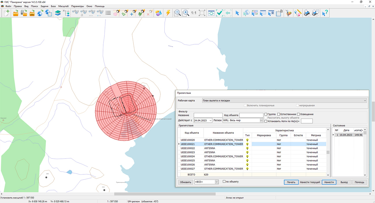
In KB "Panorama" the version 8.1 under control of has been developed. The dialog "Import from format ARINC to database" has been improved in the new version. The mode of creating obstacles by point objects has been added. One point object is created for each coordinate from the ARINC source file. When importing obstacles, information about the presence in the source file of the name and unique identifier of the obstacle is analyzed. If there is no name, the value of the text identifier in the "Own name" field is written into the database and into the semantics of the object.
In the "Admin panel" dialog, a new "Clear tables" tab has been added, designed to remove obsolete records of the table of obstacles and its subordinate tables of PostgreSQL format.
The interface of the "Task settings" dialog has been updated. A new parameter "Round semantic values when placing obstacles on the map" has been added. When creating obstacles using the "Output of obstacles", "Output of aerodrome infrastructure" dialogs, it is now possible to fill in the "Absolute height", "Relative height" semantics with a rounding to the nearest (upward) meter or foot (according to ICAO Doc 8697 "Manual on Air Navigation Charts").
In dialog "Input of aerodrome radio equipment" there is added a mode for maintaining the list of radio technical and radio navigation aids of the aerodrome. The list is automatically generated based on the data entered using the "Input significant points to database" dialog for the selected aerodrome and types of points VOR, DME, VOR/DME.
The complex for preparing documents of aeronautical information is a set of tools for maintaining an aeronautical data base, a modeling and analyzing the aeronautical situation, generating aeronautical maps and exchanging data with other information systems through export and import in the ARINC 424-19 exchange format and export in the AIXM 5.1 format. The task "Flight procedures design" is used to design the routes of departure, approach and landing and to analyze the safety of flights on them. The task "Assessment of compliance for aerodromes with the requirements FAR" is intended for the analysis of the aerodrome and the aerodrome environs for the suitability for operation and aircraft flights in accordance with the Federal Aviation Regulations.
The new version of the program, examples of aeronautical information documents, operational , and are available for download on the page.


In KB "Panorama" the for Qt Designer SE version 14.2.4 has been developed. In the new version the saving of digital maps in vector PDF format has been implemented, a type of programmable signs has been added to display bar charts. The list of scripts in the Python language has been expanded, the efficiency of searching and displaying data has been increased by optimizing the allocation of RAM.
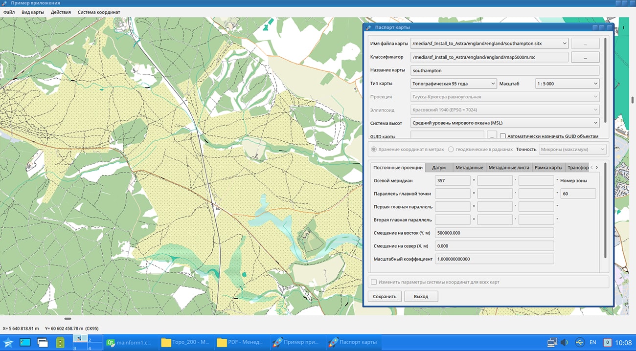
In the program a saving of digital data to a file of vector format PDF has been added. The user can combine a set of open maps, save them in vector PDF format and transfer the resulting file for viewing in original quality at any scale using standard operating system tools. Individual layers can be excluded from the export by means of displaying layers of a map with use of standard functions of MAPAPI interface. Thus, the data of vector maps is saved to a PDF file along with rasters and matrixes of heights loaded into them. Data export can be performed at an arbitrary scale and for an arbitrary map fragment. For example, the user can select a map fragment on a small scale, and output it to a file on a larger scale, and save the image not of the entire work region, but only of its fragment, limited by a rectangular area, a map object, or the size of the current window. The resulting file in vector PDF format preserves the quality of the map image when viewed at any scale, which allows it to be used, for example, when preparing reporting documents.
New type of programmable signs has been added for displaying bar charts according to the semantics of objects with display in a legend of semantics values (in addition to a sign displaying values in percentage). The description of charts includes a list of codes of semantics corresponding to sectors of the chart. For each semantics the own parameters of displaying a sector are set. For all chart the maximum width and the maximum height of the chart are set. To the right of the diagram its legend is displayed. Texts of lines for signing of sectors are taken from semantics names, excepting repeating part of names. For example, if the semantics are called "Number of inhabitants under 20 years old", "Number of inhabitants from 20 to 40 years old", then the legend will contain the following lines: "up to 20 years old", "from 20 to 40 years old", and so on. The conventional symbol the "Bar chart" is shown in the data example on the map \Data\shape.
A script has been added into the list of basic python scripts that calculates the distance from the selected object up to several selected objects with recording into the semantics of the calculated value. RAM distribution has been improved when processing large data sets (tens of gigabytes and more than a hundred million objects). The speed of searching and displaying data has been raised.
GIS Constructor is a set of geoinformation components for use in the visual programming environment of Qt Designer, which allows you to develop your own GIS applications. The visualization of the contents of digital maps is made in conventional symbols adopted for topographic, geographical and various special maps. Geoinformation system has ample opportunities for performing calculations, for providing display of spatial data on various graphic devices in standard and user systems of conventional symbols. The main functions can be executed in multithreaded mode. It supports automatic optimization of used memory for processing large amounts of data (tens of gigabytes) on limited resources (hundreds of megabytes).
The toolkit is adapted for work on a wide range of operating systems (Astra Linux SE, ALT Linux, Elbrus, Ubuntu, CentOS, QNX) and architectures (Intel, Elbrus, PowerPC, SPARC, ARM). The toolkit includes components of visual designing the GIS applications and library of a multiplatform multithreaded GIS core. GIS Constructor provides a cross-platform MAPAPI interface that allows a programmer to implement development in an operating system convenient for it. The developer can release GIS applications for a set of operating systems by simple assembly with minimal changes to the program source code.
The new version of the program is available for download in the section.


Specialists of KB "Panorama" have prepared a video lesson on using the mode . Users can use this mode in programs the and .
The considered problem is intended for splitting objects with a complex metric (multipolygons, multilines, multipoint objects) into simple objects of the appropriate localization - areal, linear or point. To process several objects, you must first select objects using the dialog, or using interactive modes - by area, by type of selected object, and others.
You can get acquainted with the training materials in the "Video lessons" section.


Ph.: +7 (495) 739-0245, +7 (925) 221-1603
www.gisinfo.ru | panorama@gisinfo.ru
105005, Russia, Moscow, Baumanskaya Street 7, building 1, office 229 (m. Baumanskaya)
Copyright © Panorama Group 1991 - 2024


 Mobile version
 Full version