Copyright © Panorama Group 1991 - 2024

In KB "Panorama" the GIS Panorama Mini version 14.5.5 has been developed. In the new version the possibility of requesting the information from databases of external information systems via web protocols has been implemented. Connection of bases of spatial data was simplified. Import and export of DXF format and import of DGN format has been improved. The tools for managing the display of sea maps of the S52 standard have been implemented, taking into account the characteristics of a vessel with a navigation system, the possibilities of using TrueType fonts as the signs for filling polygons or designing linear objects have been expanded. The task, which controls the logical structure and classification system of vector map data, has been completely updated. Tools for displaying rasters and matrixes with compression, formations of file PostScript CMYK have been refined. Display of graphics by adding the ability to directly open graphic files has been accelerated.
The possibility of requesting information from databases of external information systems via web-protocols has been implemented. ("1С: Enterprise" and others) allows to use the data from these systems as the additional attributive information for displayed territory. For example, the information base "1C: Enterprise" contains information on accounting objects - land plots and buildings, their lease payments, lease terms, types of permitted use and other indicators that can be displayed in the GIS in logical connection with vector map objects and/or spatial database.
Access to external information systems is carried out using the HTTP protocol. The response from the system is a data set in XML format, which is provided to the GIS user in the form of a table in a separate dialog box.
The dialog provides various interactive modes of operation: search on the map for an object corresponding to the current record, and vice versa - search for a record in the table for the current map object; setting filters for displaying data in the table with the ability to select objects on the map that meet the filter conditions; filtering records in the table by selected map objects; viewing the selected table record in a separate dialog box; export of the table to *.csv file and others.
Link of records of a data set from an external source with map objects is carried out according to the value of the key field and the predefined semantics of the object, which is specified in the settings. For example, information on real estate objects in the 1C database can be associated with map objects by cadastral number.
A map of land plots and buildings and the configuration of the "1C:Enterprise" information base containing information on these land plots and buildings have been added into the demo data included in the GIS installation. In the configuration of information base a publication has been prepared using the OData protocol for directories and contains an example of program formation of the XML-response to a request to an HTTP service.
When (DBM-projects) from one spatial database the repeated requests for user authorization are excluded. The diagnostic protocol of connection to a spatial database for the analysis of errors in the data has been refined.
In the main menu "View" the item has been added, taking into account the features of the vessel on which the navigation system is installed. When this menu item is selected, a dialog is called up in which you can change the parameters for displaying sea maps: safe depth, safety contour, shoal contour, depth contour, depth gradation, shallow filling, isolated dangers in shallow water, language of displayed titles.
When importing S57 sea maps, support has been added for datasets with sea map updates (ER profile), which are located in files with extensions 001, 002, 003, and so on.
Files of updatings should take place together with an initial data set with expansion 000 in one folder or according to structure of folders under standards . The update files must be placed together with the source data set with extension 000 in the same folder or in accordance with the structure of folders according to the IHO S57/S63 standards. The names of the source dataset and update files must match.
In the tasks of and of data in the DXF format, a saving and reading of colors of conventional symbols of objects in RGB format has been implemented. The RGB color model covers a wider range of colors and provides the highest color rendering compared to the previously used AutoCAD indexed color palette. Into dialog "Export a map to DXF file" the possibility has been added for customizing a processing of all open maps at enabling the option "Process all maps" that allows you automatically to export the data of each map to a separate DXF file.
There is added a recalculation of coordinates and sizes of characters from storage units specified in DXF: inches, feet, miles, millimeters, centimeters, meters, and so on. The formation of graphic primitives from the parameters of conventional symbols specified in DXF has been improved, which allows you to reproduce the view of the original drawing without setting the symbols.
In dialog the mode "Create a set of maps" has been added which is intended for automatic processing a large number of selected data and creating a separate user map for each DXF file. As a result of the task execution, the list of the generated maps is saved in project MPT.
In the task the possibility has been implemented for creating objects which are described in the source file as a complex chain. As a result, the elements of each chain are transformed into a single object. The dialog interface has been updated to automatically process a lot of selected data and create a separate user map for each DGN file.
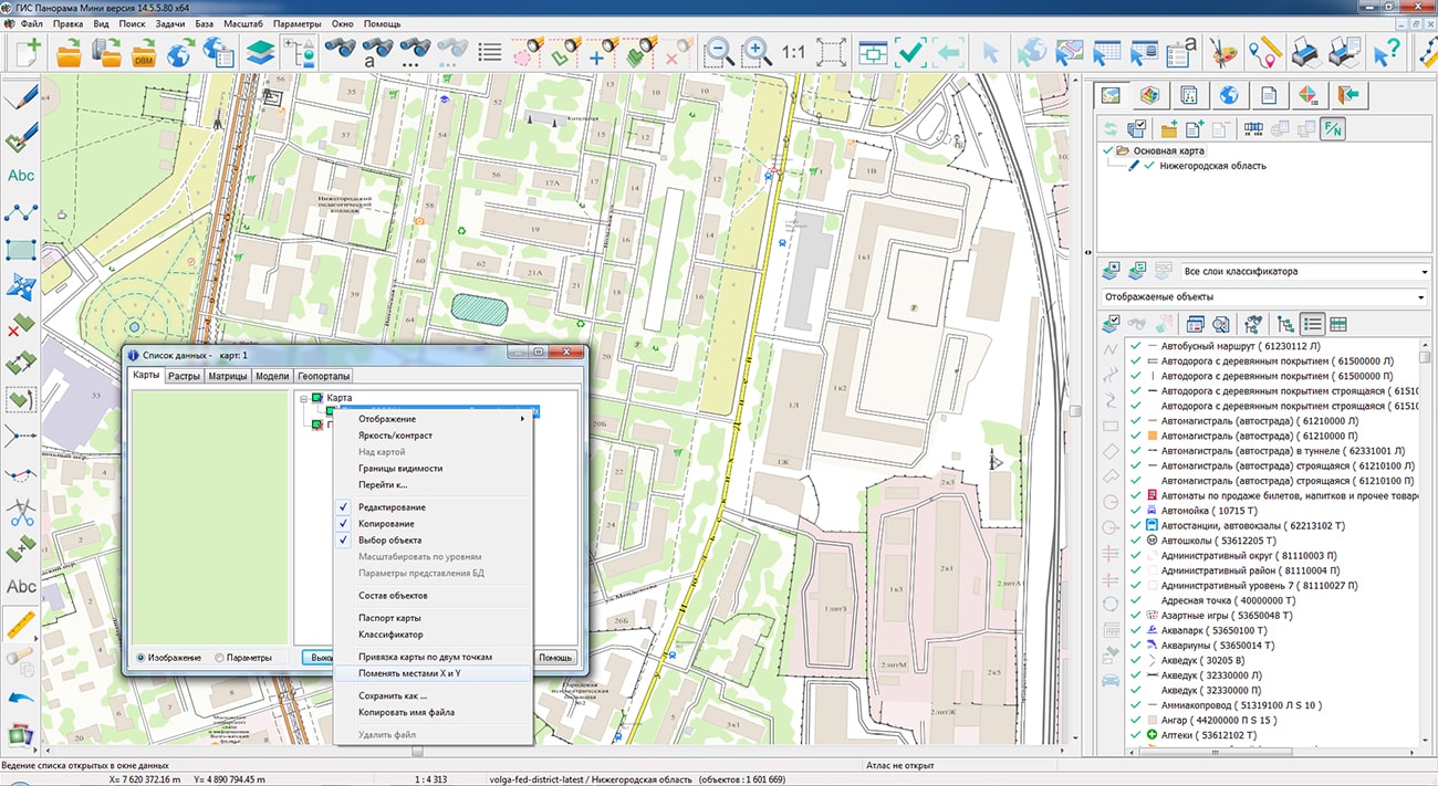
A new version of the "Classifier Editor" task has been developed. In the tab, information about the composition of the classifier is supplemented by the number of connected libraries with user symbols. There is added the tool for translating the names of layers, objects and semantics of the classifier into other languages. Working with color palettes of the classifier is placed on a separate tab "Palette". There is a convenient opportunity to simultaneously view and work with the colors of RGB and CMYK palettes. In the tab there are added the tools of search for objects by name, code, symbolical code, a key and other properties through the "Objects Content". In the tab in the tree of user functions for displaying objects, next to the name of the function, the number of types of objects in which it is used has been added. In the tab, the display of the full set of characters of the selected font has been added.
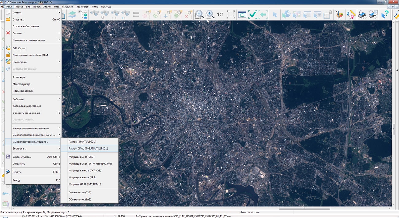
Possibility of direct opening of graphic files has been implemented without the dialog for converting to RSW through the File-Open menu, for quick access to various terrain images. When graphic files are opened for the first time, a service RSW file is automatically created without copying the image and a TAF file with a pyramid of thumbnails, if they were not in the source file. To work with large images, it is recommended to open files with the image converted to RSW format via menu the File - Import rasters or matrix. This will speed up the display of graphics, allow you to process a large number of files of arbitrary sizes with a limited memory area, and speed up the conversion of image projections on the fly.
has been added. At increase in the image of a raster more than in 2 times from the initial size in pixels a smoothing is carried out. The new display algorithm allows you to get rid of the "pixelation" effect when you increase the rasters. Management of smoothing is carried out via the main menu: View - Enlarged raster with smoothing.
has been refined: accounting for the colors of the palettes of all open maps has been added, processing of gradient fills has been added. PostScript files are created in the map printing dialog, which is called via the main menu: File - Print. To print the map in PostScript, you must select a PostScript-compatible printing device and output type: PostScript RGB or PostScript CMYK.
The task of has been improved. For the geoportal of Rosreestr "Land plots", the range of data display scales has been expanded to 1:1 - 1:50 000. To be able to view an overview view, data from larger scales with image compression is requested.
The algorithm of compression of the data of a matrix of heights has been improved. Functions have been refined: compression of 16-bit data has been added. This algorithm is used when loading a matrix of heights in the following modes: File - Import of rasters or matrix from ... - Matrix of heights (SRTM, GeoTIFF, IMG), GDAL matrix (IMG, DEM ...). To compress previously loaded 16-bit matrixes, select the matrix in the data list and select the "Optimize" item in the context menu (select the "Optimize compressed matrix" mode in the dialog). Usually compressed matrix occupies volume in 5-7 times less than initial volume. Reduction of volume and application of the mechanism of overview images repeatedly accelerates matrix visualisation.
The task has been improved. There is added the ability to import matrixes of heights or images from TIFF(GeoTIFF), IMG, KMZ files contained in the selected folder. When the element "Import heights from TIFF, IMG files" is enabled on the form, the control of the program is transferred to the dialog .
The digital classifier forestry.v2.rsc, intended for the state inventory of forests, planning economic activities, organizing the protection of forests from fires and forest violations, and other tasks in the field of forestry, has been improved. Changes have been made to generate the XML file of the forest declaration, approved by order of the Ministry of Natural Resources and Ecology of the Russian Federation dated April 29, 2021 N 303. In the classifier are added new semantics for object a forest plot, used at filling of appendices to the wood declaration.
New semantics have been added into the classifier for the object a forest plot, used when filling out applications to the forest declaration.
The classifier for maintaining a unified digital cartographic basis (EEKO) for federal, regional, municipal purposes map5000m.rsc has been improved.
The new version of the program is available for download in the section.


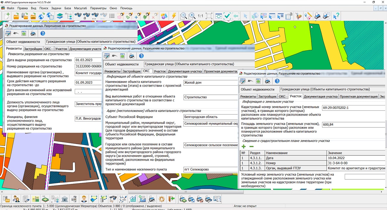
In KB "Panorama" the version 14.5.5 has been developed. The new version implements the filling of the document in accordance with the requirements of the order of the Ministry of Construction and Housing and Communal Services of the Russian Federation dated 03.06.2022 No. 446/pr "On approval of the form of a building permit and permission to put an object into operation." The document is generated for capital construction objects according to the information stored in the database.
The new form of a building permit includes 8 sections: details of a building permit, information about the developer, information about the capital construction object, information about the land plot, information about project documentation, a typical architectural solution, information about the results of the examination of project documentation and state environmental impact assessment , design characteristics of a capital construction facility, design characteristics of a linear object. For the new form of a building permit, additional attributes for capital construction objects have been added to the urban planning database, and the attributive information of a building permit has been loaded into electronic map objects.
Saving the created document "Building permit" in the urban planning database has been implemented. To store information about the building permit in the database, standard document attributes are used, and the directory "Subject of the Russian Federation (Region, Republic)" has been added. The document's attributive information is filled in the new dialog "Building permit", which is called from the register of accounting objects or by clicking the "Reporting" button located on the main panel of the complex. The dialog tabs correspond to the sections of the new document form. After filling in the attributive information, you can generate a document in the office suite. Completely blank sections of the form are not included in the document.
The form of the document is formed on the basis of prepared templates of the dot format. Templates contain a descriptive part and named markers that tell the program where to insert data. The document generation procedure is customizable. The user can modify the template according to different regional and departmental requirements. Between attributes of the building permit and markers in a template there is set the interrelation which is customized in the directory the "List of attributes for type of accounting object". To exchange data with an electronic map in the same directory, each attribute can be assigned any semantic characteristic of the object according to the survey classifier.
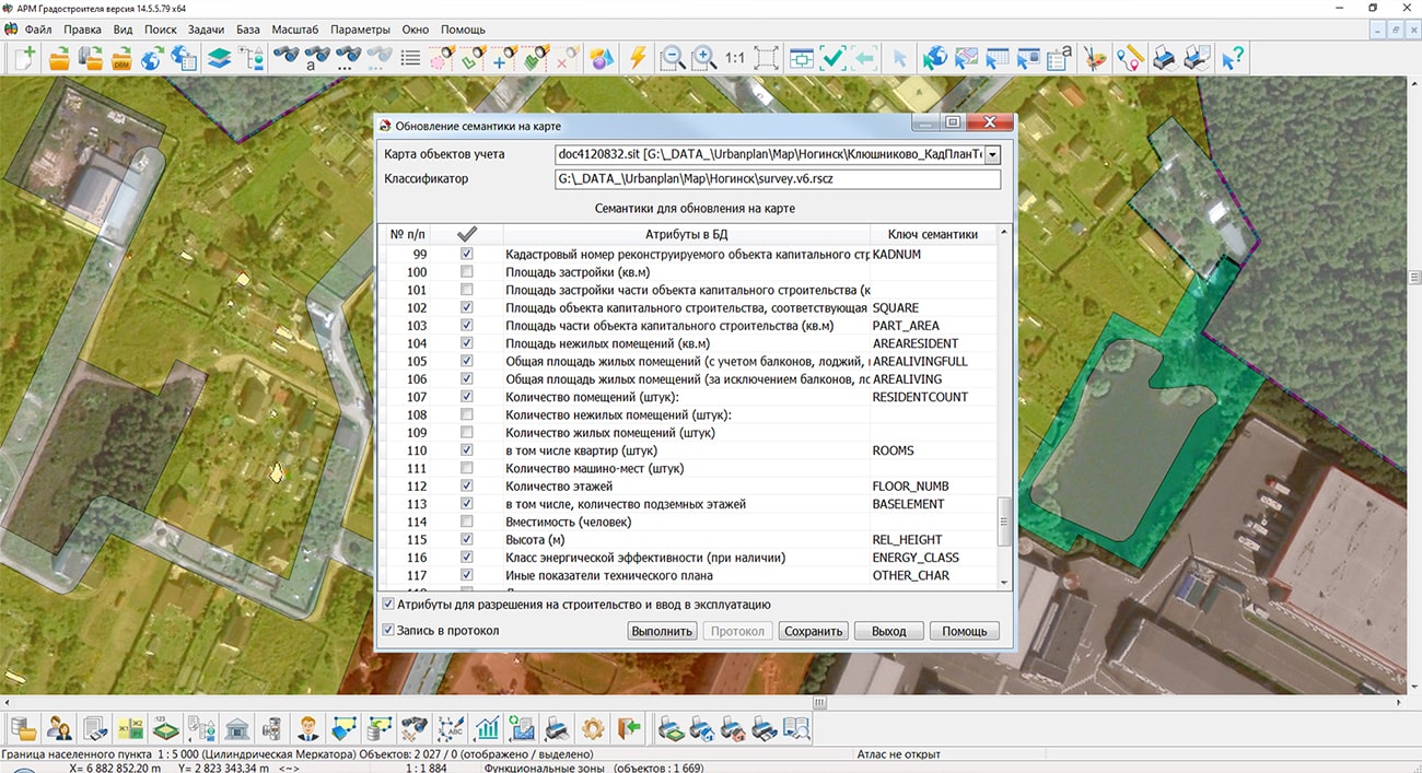
The generated building permit can be saved on disk in doc, docx, pdf formats. If necessary, an electronic copy of the document is loaded into the file storage of the complex's database. In this case, the document file is attached to the list of files of the capital construction object. By means of the "Update semantics on the map" mode, you can load the attributive information of a building permit into an electronic map object. A necessary condition for updating semantics is the existence of a connection between a record in the database and an object on the map. The update procedure can work both with one or several records, and with the entire list of capital construction objects.
The new version of the program is available for download in the section.


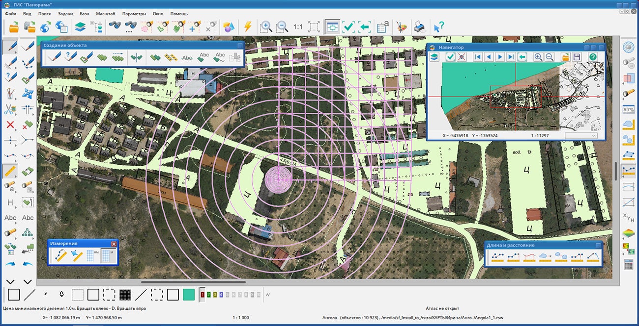
In KB "Panorama" the and of versions 14.2.6 have been developed for domestic operating system Astra Linux SE (Release "Leningrad") version 8.1 used on servers with processor architecture "Elbrus". In the new version the possibilities have been expanded for creation, updating and analysis of digital terrain models due to inclusion of scripts in Python language into software. The task "Map comparing" has been added, providing scheduling of updating of the digital information about the terrain in offline mode in the absence of access to the server of spatial data. The ability to save spatial data into pyramids of tiles in the Mbtiles format has been implemented, tools have been added to save digital maps in vector PDF format for reporting documents. New modes of the "Map Editor" task have been developed, the tools for editing the classifier of conventional symbols have been improved. A type of programmable signs for displaying bar graphs has been added, tools for displaying maps and terrain images, tools for importing files of exchange formats SHP, MIF, KML, GML, DXF have been improved. The quality of displaying graphic symbols on the map has been improved, the efficiency of searching and displaying data has been increased by optimizing the allocation of RAM.
is the universal geographic information system that has tools for creating and editing digital maps and city plans, processing remote sensing data, performing various measurements and calculations, overlay operations, building 3D models, processing raster data, tools of preparing graphic documents in digital and printed form, as well as tools for working with databases. GIS is used for mapping, land management and cadastre, geodetic surveys, and the creation of geoportals. The GIS is included into the Unified register of Russian programs for electronic computers and databases (registry entry No.4227 dated March 29, 2018).
is a universal domestic geoinformation system for law enforcement agencies. The program is designed for accumulation, storage, automated processing and display of data, calculation results and forecasts with geospatial reference. GIS "Operator" SE contains means of displaying and processing vector, raster and matrix maps. The application provides users with tools for solving specialized tasks of modeling the movement of special objects against the background of a 3D model, predicting the consequences of emergencies at hazardous facilities, monitoring aircraft movement, conducting geodetic and topographic work, processing data from GPS/GLONASS navigation devices, printing displayed spatial data to various output devices and many others. GIS "Operator" SE is certified according to the 2nd level of control of the absence of undeclared capabilities in the Ministry of Defense of the Russian Federation, it is included in the Unified Register of Russian Programs for Electronic Computers and Databases (registry entry No. 10628 of 05/27/2021).
New versions of the programs are available for download in the section.


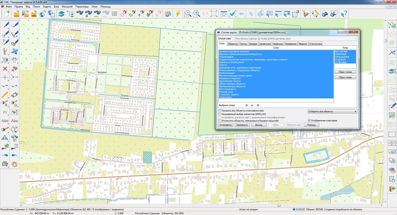
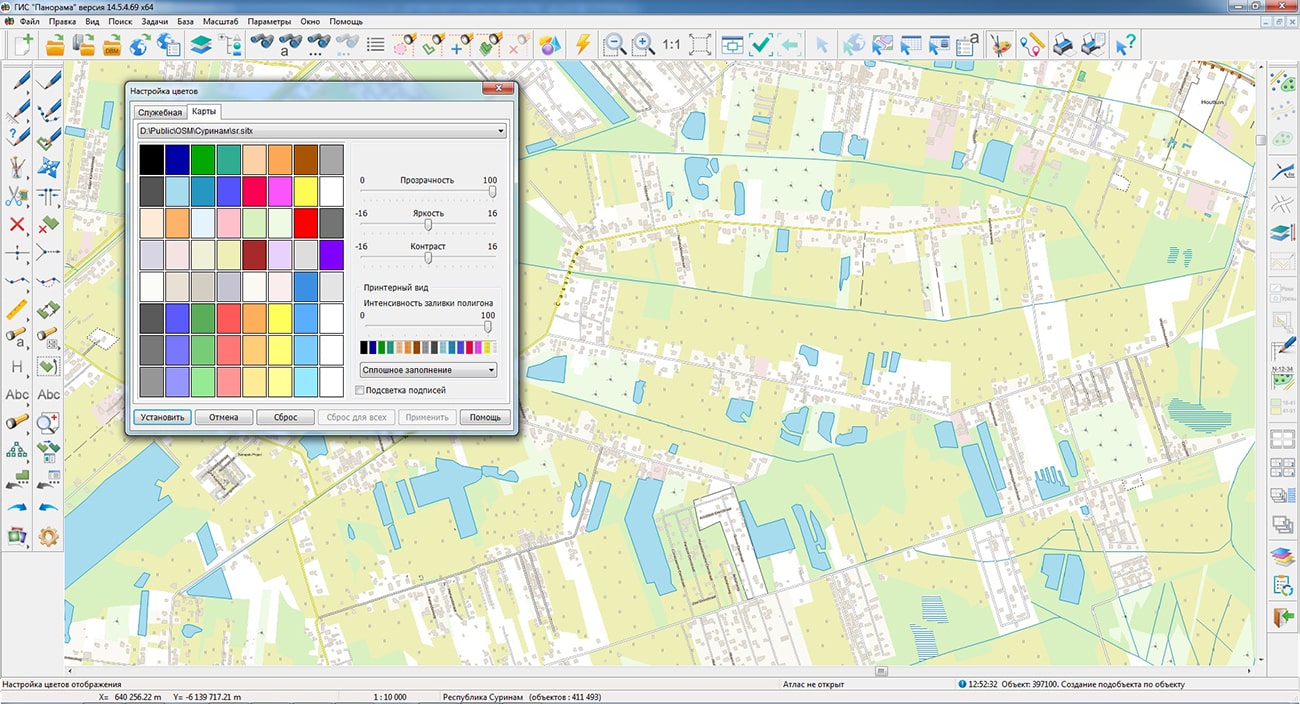
Geoportal has been supplemented with a map of the Republic of Suriname, formed according to OpenStreetMap data. To work with the map, you can use the program or other software products of KB
The map was led to the modernised classifier of large-scale plans of scale 1: 5 000 (map5000m). Publishing of updates in bank of spatial data is made by using the program of.
Publishing contents of bank of spatial data on the geoportal and data access for downloading are implemented by means of .
Free maps on the basis of OpenStreetMap data are available for download on the page "Digital maps".


In KB "Panorama" the has been developed. In the new version, tools for working with the layer tree of vector map objects have been expanded, the list of operations for formula-type semantics has been expanded, modes have been added for processing multipolygons, multilines and multipoint objects. New tasks "Calculation of reserves of solid minerals", have been implemented, controls for displaying sea charts of the S52 standard have been added, taking into account the features of a vessel with a navigation system, and a block of geodetic and cadastral tasks has been refined. The possibilities of using TrueType fonts as the signs for filling polygons or designing linear objects have been expanded.
In the task, the mode has been added. The mode is intended for splitting objects with complex metric (multipolygons, multilines, multipoint objects) into simple objects of appropriate localization. To process several objects, you must first select objects using the search and selection dialog, or using interactive modes: by area, by type of selected object, and others.
The mode has been improved. The ability to process multipolygons has been added, the points of the template (cutter) have been matched with the points of new objects created as a result of processing. The list of operations for semantics of the "numerical formula" type and for the mode "Calculations on semantics of selected objects" in the Map editor task has been expanded. There is added the operation "%" - Modulo division. The operation can be used, for example, when you need to get the last few numbers of some identifier for different semantics and signature text: 73025679 % 10000 = 5679.
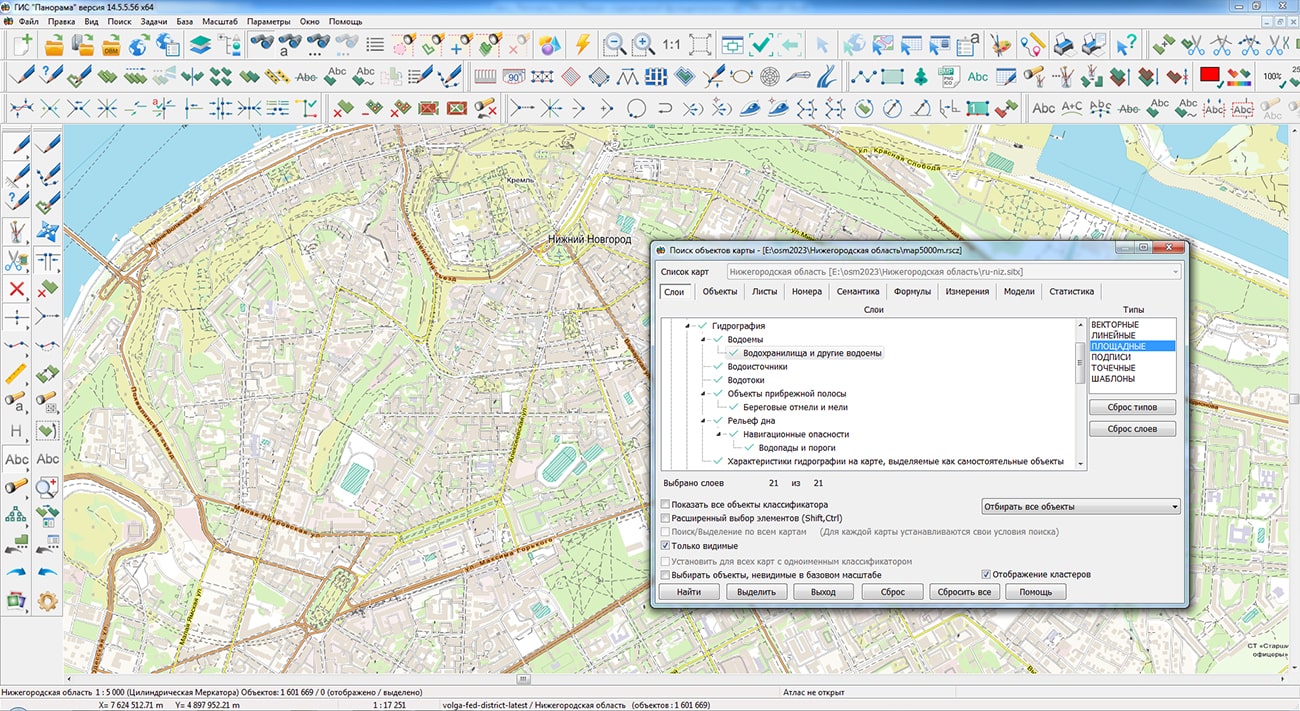
The dialogs "Map contents" and "Map object search" have been improved. On the "Layers" tab, the has been added. Classes are layers of lower level which together with base layers form a multilevel tree of layers. The division of objects into layers and classes makes it possible to describe the classification of objects of any hierarchy. For change of availability of a layer or a class it is necessary to press the left mouse button on the status icon of the chosen element or press the space bar. For the convenience of a finding the necessary layer/class, a search by partial coincidence of the name has been added. To move to the next or previous search result, you can use the "arrow up" and "arrow down" keys, as well as the corresponding modes next to the search line. The search line is activated using the key combination "Ctrl+F".
Into the list of applications, the task "Drawing of image on raster" has been added, which is intended for updating a part of an image of a raster tablet. During the execution of the task, a raster is created by copying the source file with the subsequent updating the selected area with an image of another raster that is part of the document. The characteristics of the output raster with the updated image (geospatial binding, element size in meters on the ground) will fully correspond to the parameters of the source raster. The task is intended for use in the technology of updating raster tablets in spatial data collections. The task is run from the "Run Applications" dialog in the "Transforming rasters" group.
In the main menu "View" the item has been added, taking into account the features of the vessel on which the navigation system is installed. When you select this menu item, a dialog opens in which you can change the parameters for displaying sea maps: safe depth, safety contour, shoal contour, depth contour, depth gradation, shoal filling, isolated hazards in shallow water, the language of the displayed titles. The made changes are saved in the main ini-file of the application and are automatically applied to a current session of the user.
has been improved, designed to create surface models and solve problems of spatial analysis using the constructed models. The task has been added into the "Prognosis" panel. The task is designed to assess the reserves of minerals in a warehouse, or mineral resources in the development of deposits by open pit. The task calculates the volume and weight of a mineral within the selected area of calculation using the matrix of heights of the surface of the selected area of the warehouse or deposit on the ground.
The type of mineral for calculation is specified in the "Minerals" list. There is a possibility of changing the volumetric weight of the selected mineral, and also possibility of addition and deleting of the list elements.
The matrix of absolute heights determines the surface's configuration of the calculation area. The resulting volume is calculated within the specified calculation area using the surface's heights of the selected area and the heights of the bottom level of the mineral. The height of the lower level can be set in the corresponding field or using the "Select point on map" button. By default the value of a step is equal to the size of an element of elevations matrix of a surface of the selected area. If necessary, the calculation step can be changed. The calculation area is set using the buttons in the "Calculation area" group. As the calculation area, you can select: all region, a rectangular area, a contour of an object, and an arbitrary contour.
has been improved. In the "Fonts" tab, the display of the full set of characters of the selected font has been added. This feature allows you to evaluate the style and completeness of the font - the presence of digital characters, characters of Latin, Cyrillic and other language groups, as well as signs of symbolic fonts. The dialog for editing a vector symbol has been improved. When entering text elements of a symbol, the ability to select font characters that are not available on the keyboard has been added. Symbolic font characters are selected using the "Symbol from TrueType Font" dialog. To increase the information content of the table of elements of the symbol, the display of the font name of the text element has been added. Vector symbols can be used as independent elements for displaying conventional map symbols or as design elements: when filling areal one with symbols regularly and in a checkerboard pattern, when displaying vector symbols by points of contours metrics, vector symbols along contours or set of elements from various alternating vector symbols.
Module has been improved. The procedure for calling interactive help on using the program has been changed, the help system sections have been updated. For the group of modes "Well calculations", a demo example of data has been updated, providing the constructing a 3D view of a bush of wells. Using the "Building a three-dimensional map" mode allows you to visually analyze the intersection of the boreholes of one or more bushes.
Module has been improved. In the dialog of the mode "Correction of registry errors", on the page "General information", as well as in section 2.1 of the report, the "Name of the federal state budgetary institution subordinate to the registration authority" has been replaced with the PPK "Roskadastr". The change was made in connection with the reorganization of the Federal State Budgetary Institution "FKP Rosreestr" into the public law company "Roskadastr". Changes have been made in the report template in section 2.1, instead of "Name of the federal state budgetary institution subordinate to the registration authority" is indicated "Name of the branch the PPK "Roskadastr". The mode has been improved. Record into the xml document of the value "w\n" has been corrected. An extra column has been removed from the "Appendix 2 (stuff)" table, which is not used either when exporting to xml or to docx. In the "Lands survey plan version 6" mode, to write the information of the attached image of the document about the category of land in pdf format into the XML document, the recording of the AppliedFilePDF element is implemented instead of AppliedFile. When specifying the boundaries of land plots, there is corrected an error of search and an insert of number (name) of a point and recording the coordinates with the OldOrdinate and NewOrdinate pairs, if position of a characteristic point is specified.
The new version of the program is available for download on the page.


Ph.: +7 (495) 739-0245, +7 (925) 221-1603
www.gisinfo.ru | panorama@gisinfo.ru
105005, Russia, Moscow, Baumanskaya Street 7, building 1, office 229 (m. Baumanskaya)
Copyright © Panorama Group 1991 - 2024


 Mobile version
 Full version