Copyright © Panorama Group 1991 - 2024

In KB "Panorama" the version 14.2.5 has been developed. In the new version a search and display of spatial data is accelerated. Information systems of various levels and purposes use large volumes of geodata. For fast display of spatial data and search in them the modern methods of processing are required. GIS WebService SE includes most of the automated technologies for working with Big Data. Using intelligent technologies, the service allows in the shortest possible time to process and provide access to databases, the speed of information change in which reaches hundreds of thousands of transactions per second.
In the program the list of supported requests for working with spatial data has been expanded. Applications using GIS WebService SE, such as GIS WebServer SE, , and others, have received a number of new possibilities for processing Big Data. A new request to clear empty tiles or tiles of a certain size has been added. This request is necessary if third-party geoportals (when republishing data through the service) give empty pictures instead of error messages. The service can automatically understand that the received tile is empty and not save it in the cache or give an error. The request of building a route with a stop at several points has been added. On request it is possible to receive the description of a route with all points of turn and movement time on sections. A request of crossing of a point object with other objects was implemented. The request of loading a file from document repository on the has been added. Some of the requests have been moved to the class that are executed in time. New requests have been added to get information about the percentage of completion of the operation. A request for converting point coordinates from one system into another one and a request for converting a set of points by a JSON file have been implemented. Request - an attachment of an arbitrary file to the object was added. Pictures for the gallery, video files, documents and other data can be used as information. They can be loaded both locally and on the GIS Server. Function of building a profile of a relief by object from a map or by an arbitrary object in request has been added.
The service administrator has been improved. Ability has been added to update the cache of several layers simultaneously. The reliability of work with data located remotely on the GIS Server, in a database or in the Databank is increased.
Search of objects in a point is improved - the data is returned faster and the answer does not capture objects which are not visible or are close to poll point. There is improved end-to-end search in complex queries when limiting the output of the number of objects. The request of a file from semantics of object automatically determines the location of the data locally or on the GIS Server and returns the data. When searching, the ability to display semantics codes and display the semantics of type the link to a file has been added.
A new protocol on interacting with the service in JSON format has been added. Almost all requests and data for a service can be sent in JSON or XML-RPC format. Support for transactions in the GeoJSON format has been implemented.
Output of messages into a file of service's errors is improved. There are added messages describing the error and messages with the output of the request, responsible for this error. Diagnostic messages are expanded at loading data into the Databank. The file of statistics of service's work is created for each start of service, allowing to accumulate the information for the further analysis.
Possibilities have been expanded when working with the Databank. There are added the requests for exporting geo-covers from the Databank, requests for control of input datasets by a requirements template, requests for summarizing map sheets. Work with databases and processing of their information are accelerated.
GIS WebService SE supports all international standards (OGC WFS, WFS-T, WMS, WMTS, WCS), which are used to transfer and display spatial data. The program implements the ability to issue tiles for any user or local coordinate system. The application is implemented on Windows and Linux platforms, and is compatible with Apache, IIS and nginx web servers.
The new version of the program and the documentation are posted on the website in the section.


In KB "Panorama" the version 14.0.0 for OS Astra Linux SE (Releases "Smolensk" and "Oryol") has been developed. In the new version the user interface of the program used in operating systems with customizing high density of displaying the image on the screen has been improved. It expands a range of application of software product on devices with screens of the reduced size - portable laptops, specialised tablets and other similar devices. In the program interface of dialogs the possibilities provided by the layout system of the elements of the visual design environment are as much as possible used, which allows you to get a dialog design adapted to the display parameters in accordance with the settings of the operating system. The new version of the program is compatible with OS Astra Linux SE (release "Smolensk") versions 1.6 and 1.7.
The initial opening and display of large sets of vector maps and spatial databases containing several million objects and more, has been accelerated. Construction of the objects tree when opening the datasets has been accelerated.
Possibilities of work with text and hypertext documents have been expanded due to addition of support of documents in PDF format. The user can add a set of PDF documents to the map, for example, to use them as an auxiliary material during work. When the size of the window of the added document is changed, its scale will change depending on the current scale of the map. You can customize the display of the desired page of the PDF document on a user document. For the convenience of customization, there is a preview window for the added documents.
Display of clusters used for grouping point conventional symbols on a map has been improved. Into the cluster description the property "Display the first character in the cluster" has been added. When it is set, in the position of the cluster sign the first object in the cluster will be displayed first, and then the cluster sign. In this case, the cluster sign can contain only the number of objects or other complementary elements of the conventional symbol. When drawing an object, various semantics can be taken into account, including links to graphic files, which makes the generalized sign more complex and informative.
Algorithms of data storage of type "a cloud of points" in data sets of format MTD have been improved. Packing of the data, taking into account the area of processed territory and the specified accuracy of storage, allows to reduce to 4 times the size of created MTD files which can be from several tens of Gigabytes to Terabytes. New algorithms allow to raise accuracy of terrain descriptions over a wider area and accelerate the construction of 3D terrain models.
Display of raster data limited by a framework has been improved. The image of such rasters is cut out by a contour of a frame of any complexity. The frame can be set by any closed contour, or by a selected object. The frame can contain thousands of points and thousands of contours, as well as many times exceeds the raster by the area. A large number of frame points decreases the speed of displaying the raster. To speed up the display of rasters, an optimization of the raster frame during recording has been added - all frame contours are cut out by the sizes of each raster. When setting a region frame to all rasters of a region's coverage an optimized frame is written to each coverage raster. When opening the rasters and matrixes of heights created earlier, frame optimization is performed automatically (the sign of frame optimization is entered into the file). This approach allows you to speed up the display of both new raster data and previously created ones.
Displaying sea maps of S57/S52 standards has been improved. In the s57navy.rsc classifier for attributes that have a list of classified values (Attribute type: L - CATAIR, CATACH, ... TECSOU), property the "Repeat allowed" is set. When exporting and importing data, lists of attribute values (1,7,, 30) are written and read. For display of lists of values, into the combined title the new operating symbol ' r ' (#113.r) has been added, which allows to form a line from the list of attribute values, separating them with a space. There is refined a display of depth marks taking into account safety contours and taking into account depths on drying surfaces.
Dialog of creating a matrix of heights according to data of a digital map has been improved. In dialog the possibility has been added for a choice of nomenclature sheets of a map and the user layers by which building a matrix of heights will be carried out. This possibility provides the user with additional flexibility in setting the parameters for creating matrixes of heights for regions of work, consisting of a large number of nomenclature maps sheets. The choice of sheets is performed by selection directly in the list of names of nomenclature sheets which will participate in processing. By means of special control buttons it is possible to select all sheets in the list at once, reset selection of all sheets, or invert the selection of sheets.
The interface of the dialog for importing graphic files into RSW format has been modernized at using files of a binding. The user selects the possibility of using data from the binding's file by setting the appropriate checkbox in the dialog. The program carries out search of a binding's file by coincidence of its name with raster file name. If a single file of binding is found in a search result, data from this file is automatically loaded. If there are several binding files of the same name in different formats, then the choice of the file used when loading graphic data is provided to the user.
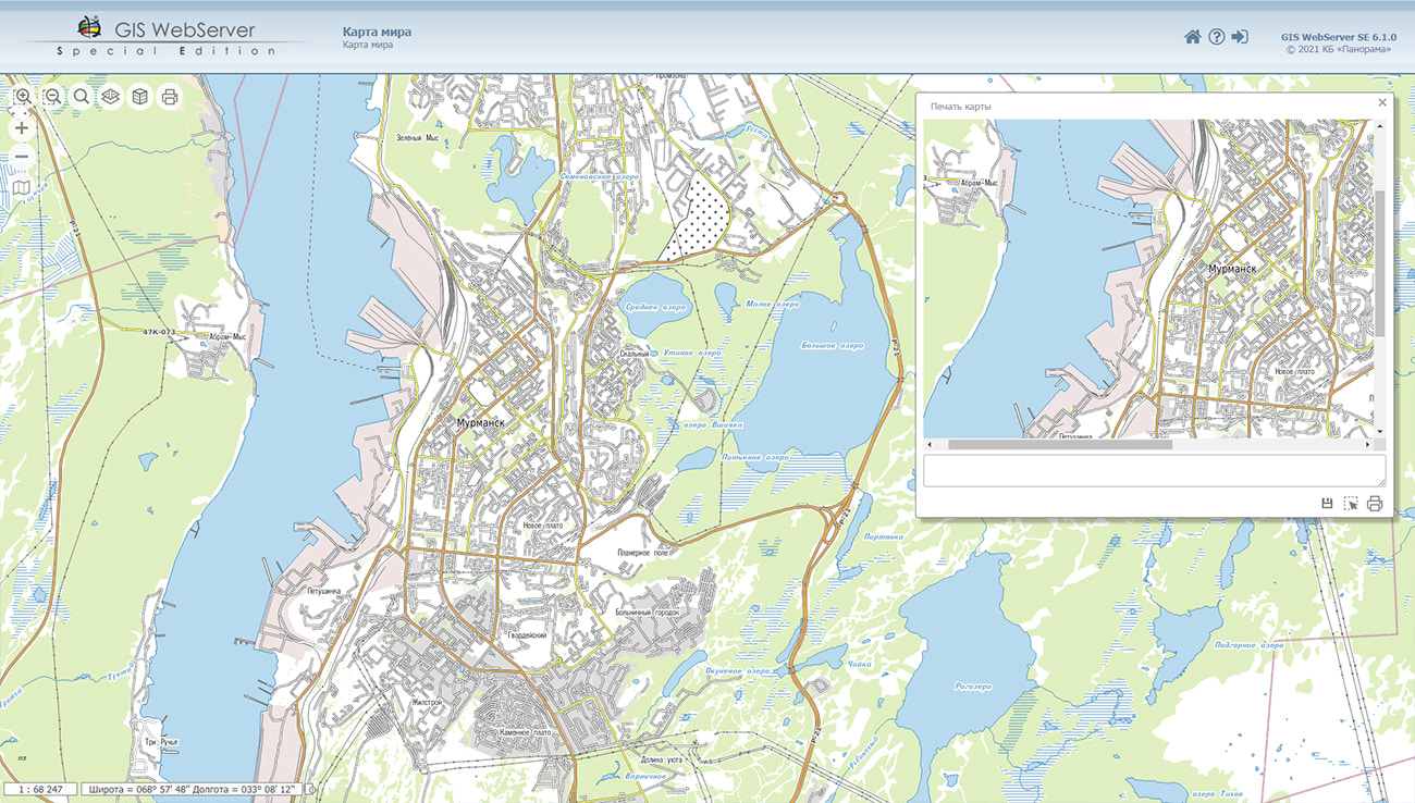
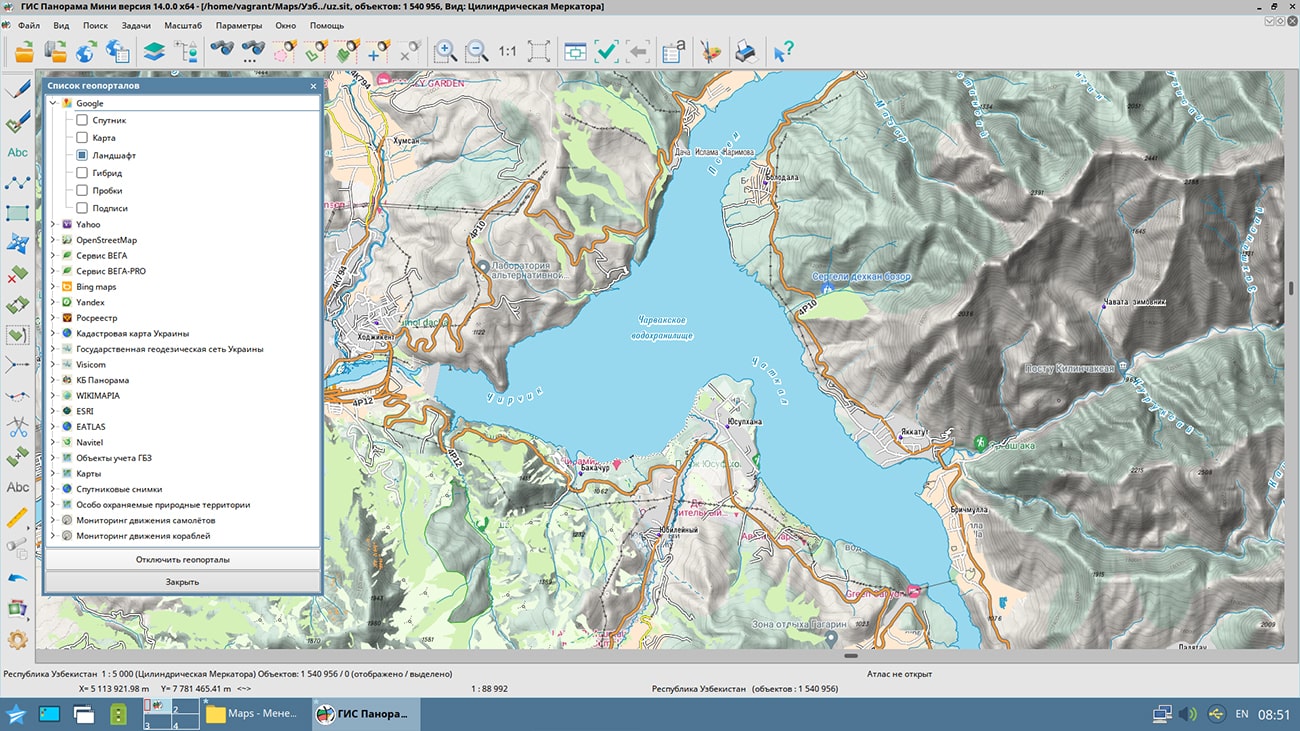
GIS Panorama Mini is the universal geoinformation system intended for a collecting the spatial data, a conducting the spatial database, creation and updating of digital maps and plans, creation of information systems of various purposes. The program implements the following main functions: import and viewing of vector maps, raster data, matrixes of heights, matrixes of qualities, geological matrixes of layers, TIN-models, laser scanning data, user maps and work regions; creation of new maps with automatic filling of parameters using the EPSG code or from the list of parameters in XML format; export of maps to SXF, DXF, OGC GML formats; multi-user work with data with access control through a connection to the ; combining and editing vector maps of different projections in one document; support for popular geoportals, which allows displaying user maps over images received from sites; printing to various output devices with customization of print parameters.
The new version of the program is available for download in the section.


The development of railway transport is carried out in accordance with the , approved by the order of the Government of the Russian Federation dated November, 27th, 2021 №3363-r. The insufficient level of digitalization and the introduction of new technologies in transport limits the long-term innovative development of the transport complex in Russia.
The joint-stock company (JSC "IERT") is a subsidiary of JSC "Russian Railways", authorized to conduct research and development in the field of economics and strategic development of railway transport. The consistent implementation of digital technologies for paperless document flow and the use of modern geoinformation solutions ensure the formation of a single information space in the digital environment in JSC "IERT" with using the domestic software.
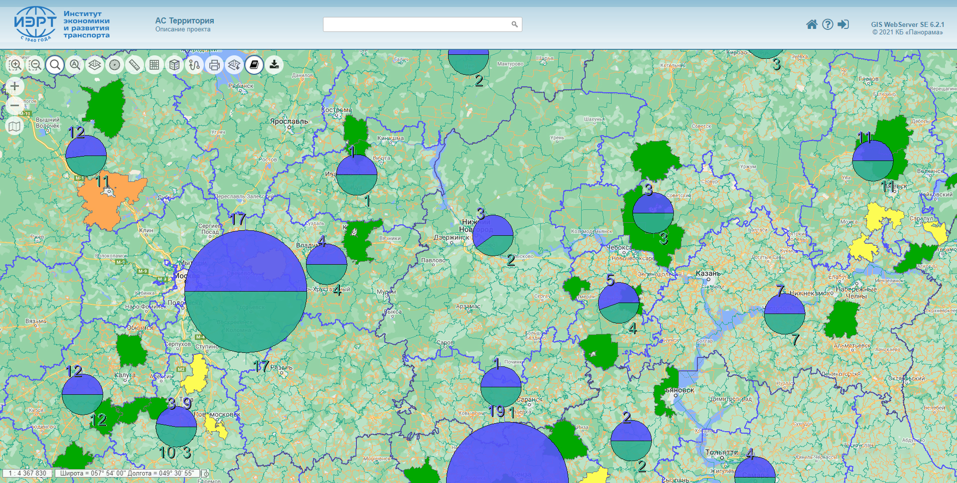
With the help of software products the and , a bank of spatial data of the organization was formed, including a single digital base, a map of administrative-territorial division, schemes of railway lines, thematic cartograms and graphical reports. A web application based on GIS WebServer SE has been created for employees of structural divisions to access layers of spatial data integrated with industry databases of technical and economic information. The set of server programs operates under the control of the domestic operating system Astra Linux Special Edition and implements in JSC "IERT" a unified environment for viewing and analyzing georeferenced data.
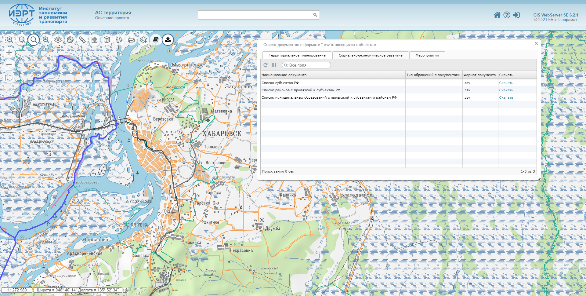
In 2021, JSC "IERT", together with JSC "KB Panorama", completed the stages of automating the process of working with requests for the examination of documents of territorial planning, socio-economic development in conjunction with information on promising and implemented measures for the development of railway transport infrastructure with a breakdown for the constituent entities of the Russian Federation. For the preparation of basic industry information, a library of conventional symbols and a digital classifier of the map have been developed, which provides a visual displaying the facilities of infrastructure of railway transport and the unification of schematic maps. The creation of thematic cartograms of measures for the development of existing and planned infrastructure facilities of railway transport is carried out on the diagram of the railway network, with reference to the CNSI and OKTMO.
In JSC "IERT" a large number of databases and information systems have been created and are used. The best way to integrate them into a single information space is a digital map, which allows you to quickly find and visually display any georeferenced data. Work on the preparation of data for loading into a single bank of spatial data is carried out by employees of the department of geoinformation and technical support using the . The mode gives them the ability to create complex graphic documents that combine a map, tables, photos and text information.


In KB "Panorama" the version 7 has been developed. The new version supports storage of digital vector maps, city plans, remote sensing data, terrain models, geodetic points, geodetic networks for special purposes (GNSP) and lines of state leveling networks (SLN), technical documents and their metadata. Conducting of metadata of analog maps and analog images and the accounting of their movement is carried out.
The Databank implements an algorithm for creating, updating and deleting datasets and metadata in two hands. All metadata state changes require approval if made by a user who does not have metadata approval rights. After approval of the changes, the old record is transferred into the archive status, with the possibility of later viewing. The manager always has access to information about the user who performed the operation, the date and time of the operation, and the previous state of the data.
A system of remote notifications of managers about the changes made in the data bank has appeared. You can customize what data you want to track and receive information about all changes by e-mail.
The list of metadata for integration with systems of planning and the organisation of works for digital mapping of territories has been significantly expanded. Conducting coordinates and heights of geodetic points in different systems has been added. Toolls of recalculation of coordinates from SCS to LCS were added. Import and export of metadata and directories in office suite formats have been added. For analog maps and images, material flow accounting has been implemented. The type of operation (issue, replenishment), document-basis, date and time are recorded.
Tools for work with directories of the metadata are added, allowing to expand the list of the metadata and to support various versions of metadata. Directories can be grouped by themes. All changes in directories require approval if they were made by a user who does not have the right to approve metadata. Viewing of archival directories allows you to control all made editing. Possibility of search of duplicated values has been added.
Data security is ensured by the differentiation of access rights based on security tools included in the operating system. Basic authentication, digest authentication, system authentication (via web server), and domain authentication (Kerberos or ActiveDirectory) are supported. The complex is adapted to work on a wide range of operating systems (Astra Linux SE, ALT Linux, Elbrus, Ubuntu, CentOS, MS Windows and others) and architectures (Intel, Elbrus, Baikal). The program is registered in the register of domestic software under the number 1862.
The databank of digital maps and remote sensing data is the basis for building infrastructure of spatial data of federal, regional and municipal levels, in corporate information systems. Within the framework of a single geoinformation space, the Data Bank of digital maps and remote sensing data realises gathering, storage, quality control, search and delivery of the spatial data in exchange formats. The spatial data selected by means of the program can be placed for the multiuser access on the and be published according to the international standards OGC WFS, WFS-T, WMS, WMTS, WCS on application server the . Users can access data from both a thin client (by means of GIS WebServer SE) and from desktop applications (, GIS "Operator"). The databank of digital maps and remote sensing data provides construction of cloud warehouse of spatial data, provision of access to these data, the automated formation and updating of geocovers.
The current state of spatial data is displayed by means of maps-schemes that are maintained for each type of stored data: vector maps, remote sensing data, elevation matrixes and terrain models. It provides remote placing the sets of spatial data into file warehouse, keeping versions of stored sets, updating maps-schemes of data availability, the automated collection and formation of metadata, and the formation and updating of geocovers. Automated collection and formation of metadata is performed according to the standards of ISO 19115: 2003, Geographic information - Metadata and ISO/TS 19139, Geographic information - Metadata - XML schema implementation. The reduced copies of data images are automatically formed, checksum of files and completeness of data sets are checked. Placement of spatial data into file storage is performed with integrity check, control of data structure and content. The results of the work are recorded and are entered into the metadata base. Automatic backup of metadata and spatial data storage with integrity control and data recovery has been provided. Multilingual interface is supported.
The portal presents the possibilities of organizing storage, accounting and and issuance of vector maps, remote sensing data, matrixes of heights and the terrain models. The portal contains vector maps in SXF format, generated on the basis of data from open sources (OpenStreetMap, VMap0). The spatial data includes maps of: subjects of the Russian Federation, countries and cities of the near and far abroad. In total, over 240 vector maps and 6700 matrix data with a total volume of 56 GB. Specialists of KB "Panorama" weekly update and refresh the content of the information on the portal. All published data is distributed free of charge under a free license.
The new version of the program is available for download on the page.


To use smartphones as an effective means of displaying and analyzing spatial data, KB "Panorama" has developed a mobile application (for and ) and modernized GIS WebServer SE to support the operation of the mobile application by means of cloud storage and data processing. The mobile application provides access to public data of the geoportal operating under the control of GIS WebServer SE and allows you to search and filter objects in the system, to view information about found objects, to build traffic routes and geolocation.
The mobile application is adapted for use as part of the state information system (RGIS RO). In 2021, in order to inform an unlimited number of users of RGIS RO about objects of social, transport, telecommunications infrastructure, financial organizations, investment sites in the Ryazan Region, the system was supplemented with a mobile application and a mobile version of the RGIS RO website.
The mobile application as part of the RGIS RO is intended for viewing and analyzing public data sorted by categories, information about the state and dynamics of development of objects and territories. The mobile application expands the range of users of the system and makes it available not only to government officials, but also to a wide range of users - for citizens, organizations, including potential investors and companies that participate in urban planning activities. The development of RGIS RO is one of the important tasks that the government of the Ryazan Region is implementing as part of the digital transformation of the region.
The client part of RGIS RO is implemented in the form of a single geoportal on the Internet and a mobile application. The server part runs under the control of the domestic operating system Astra Linux Special Edition and consists of , and . Preparation of data for publication is carried out in the . All software products are included in the register of domestic software and comply with information security requirements for level 2 of control over the absence of undeclared possibilities.


Ph.: +7 (495) 739-0245, +7 (925) 221-1603
www.gisinfo.ru | panorama@gisinfo.ru
105005, Russia, Moscow, Baumanskaya Street 7, building 1, office 229 (m. Baumanskaya)
Copyright © Panorama Group 1991 - 2024


 Mobile version
 Full version