Copyright © Panorama Group 1991 - 2024

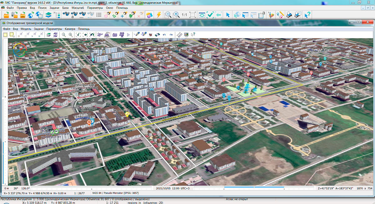
Specialists of KB "Panorama" prepared and placed the map of the Republic of Ingushetia on the geoportal . The map was formed using OpenStreetMap data, source data was obtained from website. To work with the map, you can use the program or other software products of KB "Panorama".
The map was led to the modernised classifier of large-scale plans of scale 1: 5 000 (map5000m) and was saved into a packed project (MPTZ). The MPTZ format project includes a digital map of the region's territory (country, subject of the federation, administrative region), a map of the administrative-territorial division of the region and a digital classifier. Publishing of updates in bank of spatial data is made by using the program of . Publishing contents of bank of spatial data on the geoportal and data access for downloading are implemented by means of .
Free maps on the basis of OpenStreetMap data are available for download on the page "Digital maps".


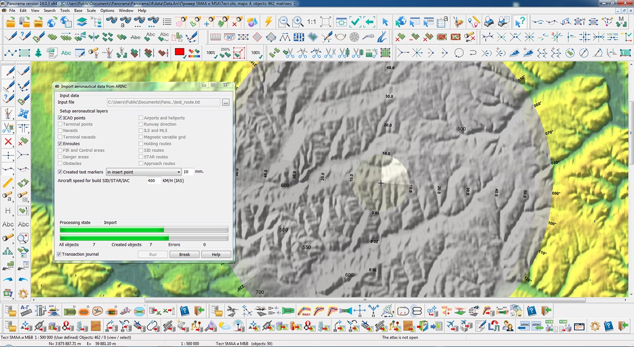
KB "Panorama" has developed a version 7.7.7 under the control of the 14. In the new version in the task the tools of maintaining the database of airdrome infrastructure have been improved, the operations of reading and writing data from the DBMS PostgreSQL have been optimized. In the task , a preparation of schemes the "turn" and ""NAVAIDS guidance" has been improved. In the task , the schemes of the ICAO regions were refined. The converter from the ARINC format has been improved for the correct transfer and rounding of the heights of objects when writing into semantics. Support for English localization of dialogs of maintaining a database of the aeronautical information has been added.
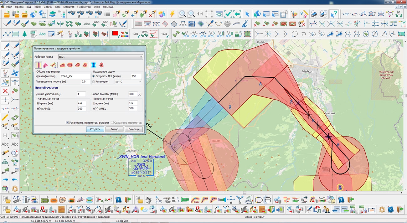
The task of preparing documents of aeronautical information is a set of tools for maintaining an aeronautical data base, a modeling and analyzing the aeronautical situation, generating aeronautical maps and exchanging data with other information systems through export and import in the ARINC 424-19 exchange format and export in the AIXM 5.1 format. The task "Flight procedures design" is used to design the routes of departure, approach and landing and to analyze the safety of flights on them. The task "Assessment of compliance for aerodromes with the requirements FAR" is intended for the analysis of the aerodrome and the aerodrome environs for the suitability for operation and aircraft flights in accordance with the Federal Aviation Regulations.
The new version of the program, examples of aeronautical information documents, operational documentation, video lessons and presentations are available for download on the page.


Specialists of KB "Panorama" have prepared a video lesson of filling the information in dialog "Base of cadastral works". Users of "Workstation of cadastral engineer", or can add, edit, delete information in the base of cadastral works using the complex of geodesy calculations.
The subsystem "Base of cadastral works" is intended for maintaining information about cadastral engineers, customers, measuring instruments and contracts for the performance of cadastral works. The subsystem is integrated into all modes of preparation of cadastral documents, including the land survey plan, the technical plan, a map (plan) of object of land management. The information specified in the subsystem's dialogs is used to speed up data input in various modes of forming cadastral documents.
The base of cadastral works is stored in SQLite format and contains information about contracts for the performance of works, cadastral engineers, customers of cadastral works and other information.
You can get acquainted with the training materials in the "Video lessons" section.


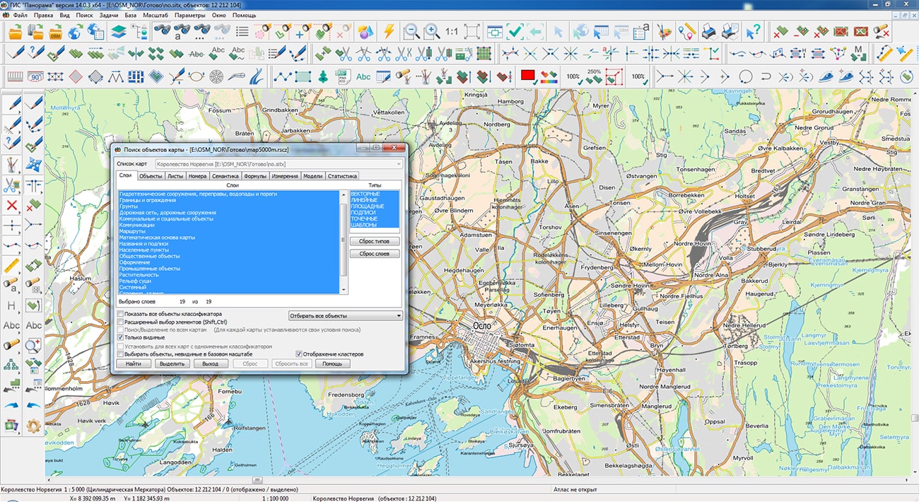
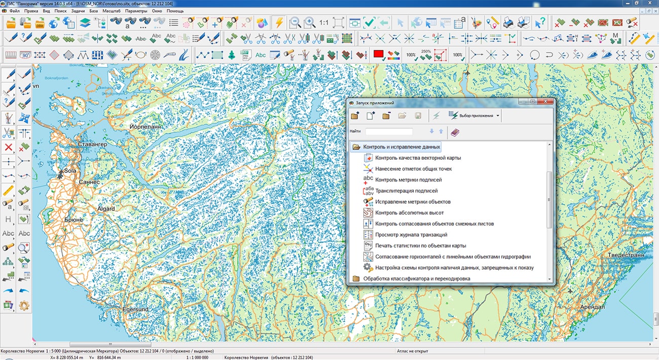
Specialists of KB "Panorama" prepared and placed the map of the Kingdom of Norway on the geoportal . The map was formed using OpenStreetMap data, source data was obtained from website. To work with the map, you can use the program or other software products of KB "Panorama".
The map was led to the modernised classifier of large-scale plans of scale 1: 5 000 (map5000m) and was saved into a packed project (MPTZ). The MPTZ format project includes a digital map of the region's territory (country, subject of the federation, administrative region), a map of the administrative-territorial division of the region and a digital classifier. Publishing of updates in bank of spatial data is made by using the program of . Publishing contents of bank of spatial data on the geoportal and data access for downloading are implemented by means of .
Free maps on the basis of OpenStreetMap data are available for download on the page "Digital maps".


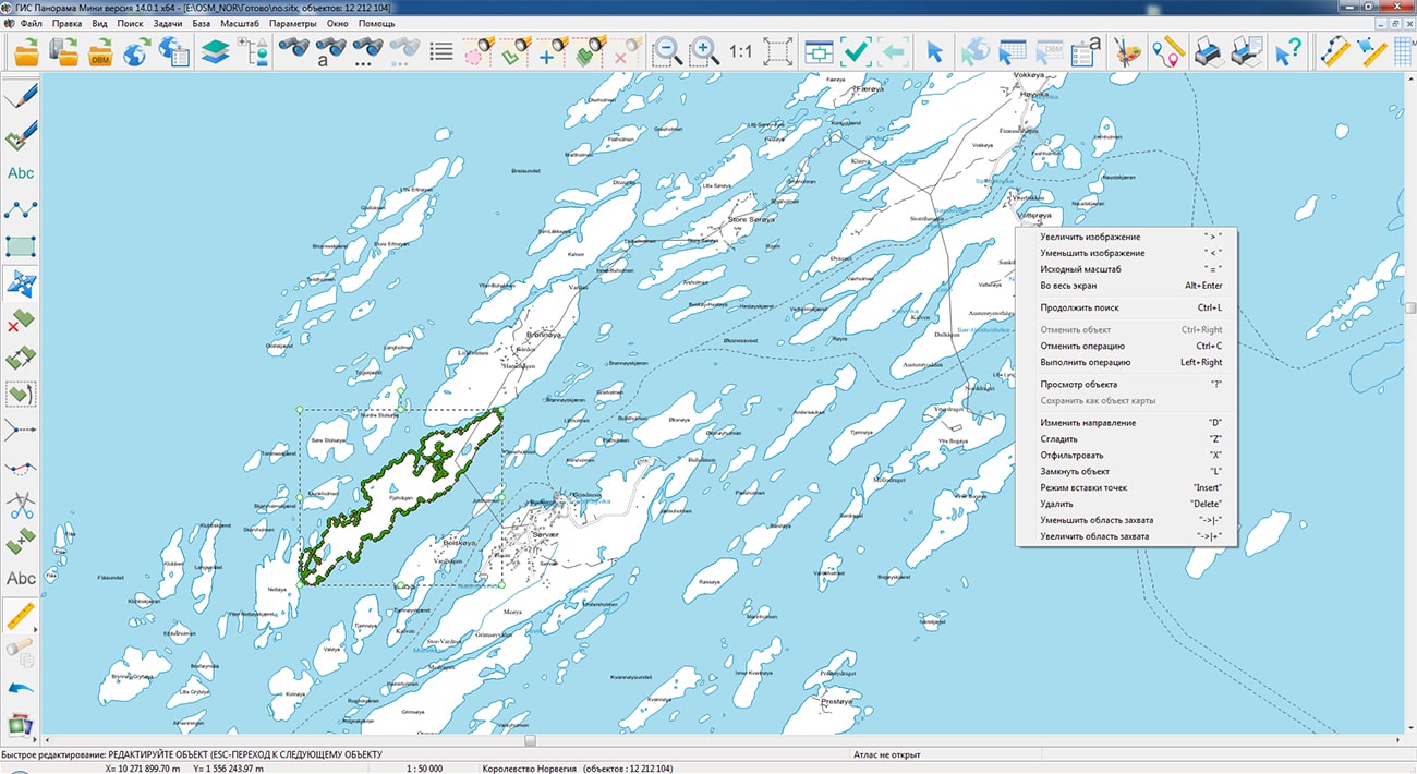


Specialists of KB "Panorama" have prepared a video lesson on using the mode. This task is intended to check the structural integrity of digital data, the completeness and quality of the metric and semantic description of objects, and to perform automatic correction of detected errors.
The task "Check of vector map quality" can work in two modes: control of the data and editing of the data. In dialog "Checking type" the following groups of check are specified:
- structural control, which is performed always and for all map objects and can never be disabled;
- control of the map passport;
- control of the objects metrics;
- control of the objects semantics;
- topological control (coordination control) of data.
In each group of checking types, except for structural control, it is possible to set or deactivate the checking types specified in the corresponding list. You can disable/enable each specific type of check. The list of specified types of checking and their parameters forms a temporary file of the scheme of control which is relevant during the current session of the program of control.
When the control program is called for the first time, the types of checking and their parameters are set in accordance with the Default.cxml schema from the program directory. This schema contains the types of control and their parameters that are set by default. Error messages for each map are recorded into the log and into the report on execution of the map quality control. Errors can be viewed in the control log and printed as a report document. The HTML report document is saved in the map directory. Viewing the results of control is carried out in the mode "View map control log" in the . You can switch to viewing the results of control by means of the "Protocol" key.
You can get acquainted with the training materials in the "Video lessons" section.


Ph.: +7 (495) 739-0245, +7 (925) 221-1603
www.gisinfo.ru | panorama@gisinfo.ru
105005, Russia, Moscow, Baumanskaya Street 7, building 1, office 229 (m. Baumanskaya)
Copyright © Panorama Group 1991 - 2024


 Mobile version
 Full version