Copyright © Panorama Group 1991 - 2024

In KB "Panorama" a digital geographic map of scale 1: 1 000 000 in format SXF onto territory of Republic of Poland has been prepared. As a source for preparation of the map the obtained from the information from the site has served. The map contains information on the number of inhabitants for cities and the name of settlements in Russian. As additional materials the World map of scale 1: 5 000 000 and data were used.
The map was led to the classifier of geographic maps of scale 1: 1 000 000 (). It can be used for a general assessment of the area and the study of natural conditions, to ensure the educational process, as a basis for the creation of geographic maps of a smaller scale, thematic and special maps, and solving other tasks. The map is distributed free of charge under a free .
Digital geographic map of scale 1: 1 000 000 in SXF format is available for download on the page "Digital maps".


In KB "Panorama" the version 6.4.0 has been developed. The new version adds a set of tools for quality control of digital vector maps: Quality control of digital maps and plans, Control of report of nomenclature sheets of digital maps, Control of the absence of classified information on digital topographic maps of open use. To perform control, it is necessary to select the checked data sets by a filter in the metadata table or by spatial request and select the type of control. Detailed control protocols are stored in the Databank of Digital Maps and remote sensing data and are recorded into the metadata table of the checked sets along with the number of found errors. In the future, this information can be used to analyze data quality and generate reporting documents.
Quality control of digital maps provides checking the correctness of filling in passport data (metadata), coordinates and attributes for several dozen parameters, for example: control of self-intersection, entry of subobjects, metric's duplication, the presence of discontinuities of the same type of objects, the presence of nodal points, coordination of adjacent objects, control of the direction of digitization, coordination of water levels and objects of hydrography, control of water courses and others. The control parameters can be changed or supplemented by means of the taking into account the used digital classifiers and the requirements for data quality. You can learn more about the set of data control tools in the .
The view of the control report in html format is controlled using an html-template. Report templates can be changed taking into account the requirements of structural divisions of enterprises of geodesy and cartography, or enterprises that use spatial data in their activities. All operations of the operator of the Data Bank are recorded in the log of user actions.
Checking a coordination of adjacent nomenclature sheets includes: searching for objects going on frames of the adjacent sheets, checking the matching of metrics and attributes of objects of adjacent sheets. Control of presence of data prohibited for display allows you to check digital topographic maps of open use and digital plans of cities for compliance with the requirements of regulatory documents (Decree of the Government of the Russian Federation of 09/04/1995 N 870, as amended on 03/18/2016 N 214). It includes control of the absence of objects prohibited for display and control of the absence of characteristics that are prohibited for display. The list of types of control of the absence of closed information is contained in the control scheme, which can be changed or supplemented by means of the GIS "Panorama".
Data security is ensured by the differentiation of access rights based on security tools that are part of the operating system. Basic authentication, digest authentication, system authentication (via web server), and domain (Kerberos or Active Directory) are supported. The complex is adapted to work on a wide range of operating systems (Astra Linux SE, ALT Linux, Elbrus, Ubuntu, CentOS, MS Windows and others) and architectures (Intel, Elbrus, Baikal).
The complex of conducting a databank of digital maps and remote sensing data of the earth is registered in the register of domestic software under number 1862.
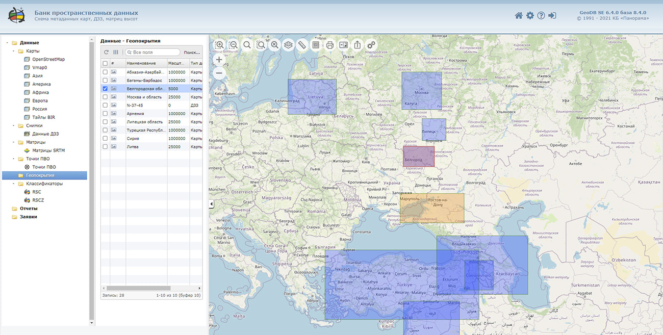
The databank of digital maps and remote sensing data is the basis for building infrastructure of spatial data at the federal, regional and municipal levels, in corporate information systems. Within the framework of a single geoinformation space, the Data Bank of digital maps and remote sensing data realises gathering, storage, quality control, search and delivery of the spatial data in exchange formats. The spatial data selected by means of the program can be placed for the multiuser access on the and be published according to the international standards OGC WFS, WFS-T, WMS, WMTS, WCS on application server the GIS WebService SE. Users can access data from both a thin client (by means of ) and from desktop applications (GIS "Panorama", GIS "Operator"). The databank of digital maps and remote sensing data provides construction of cloud warehouse of spatial data, provision of access to these data, the automated formation and updating of geocovers.
The current state of spatial data is displayed by means of maps-schemes that are maintained for each type of stored data: vector maps, remote sensing data, elevation matrixes and terrain models. It provides remote placing the sets of spatial data into file warehouse, keeping versions of stored sets, updating maps-schemes of data availability, the automated collection and formation of metadata, and the formation and updating of geocovers. Automated collection and formation of metadata is performed according to the standards of ISO 19115: 2003, Geographic information - Metadata and ISO/TS 19139, Geographic information - Metadata - XML schema implementation. The reduced copies of data images are automatically formed, checksum of files and completeness of data sets are checked. Placement of spatial data into file storage is performed with integrity check, control of data structure and content. The results of the work are recorded and entered into the metadata base. Automatic backup of metadata and spatial data storage with integrity control and data recovery has been provided. Multilingual interface is supported.
The portal presents the possibilities of organizing storage, accounting and and issuance of vector maps, remote sensing data, DEMs and terrain models. The portal contains vector maps in SXF format, generated on the basis of data from open sources (OpenStreetMap, VMap0). The spatial data includes maps of: subjects of the Russian Federation, countries and cities of the near and far abroad. In total, over 240 vector maps and 6700 matrix data with a total volume of 56 GB. Specialists of KB "Panorama" weekly update and refresh the content of the information on the portal. All published data is distributed free of charge under a free license.
The new version of the program is available for download on the page.


Specialists of KB "Panorama" have prepared a video lesson of using the mode . The task under consideration is intended for loading vector data from the OSM exchange format. Users of the , when choosing the source map, have access to a choice of OSM, MAP, SIT, SITX files.
The full technological scheme of importing the data fromOSM format is carried out in stages. All modes of the technological scheme are independent. You can select all, one or several modes for processing. The only strict limitation is obligatory execution of "Import" when you select an OSM file as the source map. In other cases it is possible to execute any set of processes (except "Import"). For example, decoding and correction or formation of labels and their generalisation. However, the OSM format does not provide for the storage of label objects, and labels are not generated during the conversion of data.
Formation of labels is carried out by means of the hidden call of procedure the "Automatic labels alignment" of the applications' group . Customizing the file of parameters of drawing labels is carried out by means of the specified procedure (start from the list of applications of GIS "Panorama"). Description of the parameters structure and the order of execution are described in the corresponding documentation and on-line help tools. The rules for drawing labels are written in the .ilb file. At program start by default it is offered to execute import by the map5000m.rscz classifier included into the installation kit and the files of parameters of recoding the map5000m.osm2map and map5000m.rsc.ilb corresponding to it.
You can get acquainted with the training materials in the "Video lessons" section.


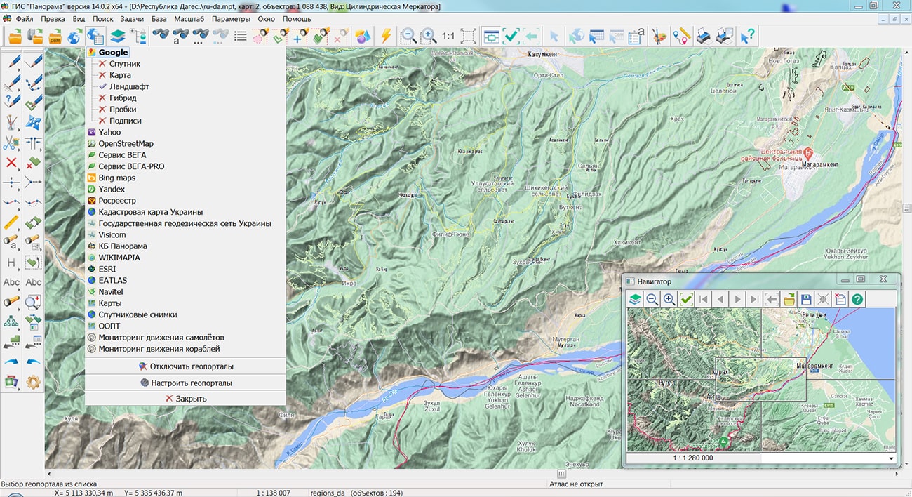
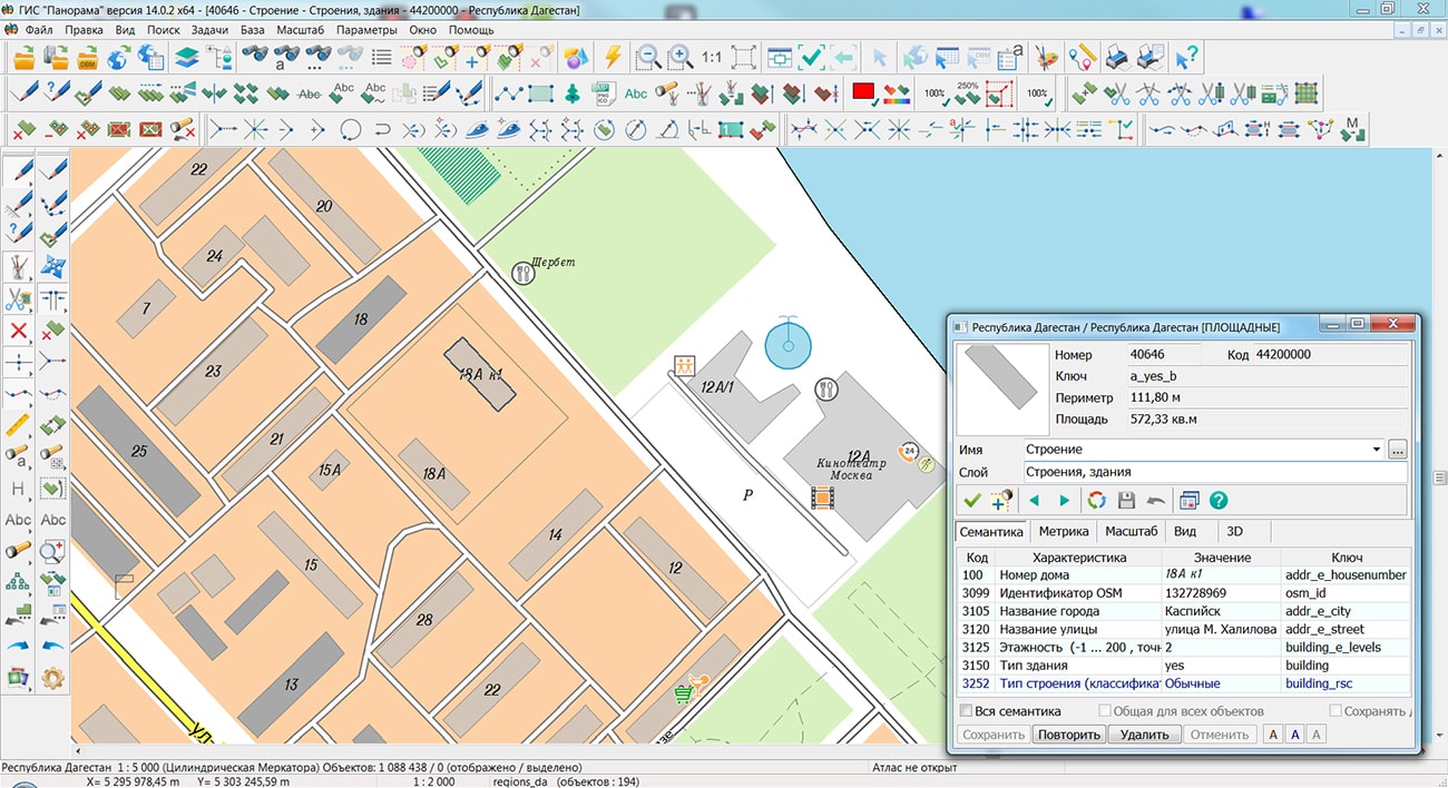
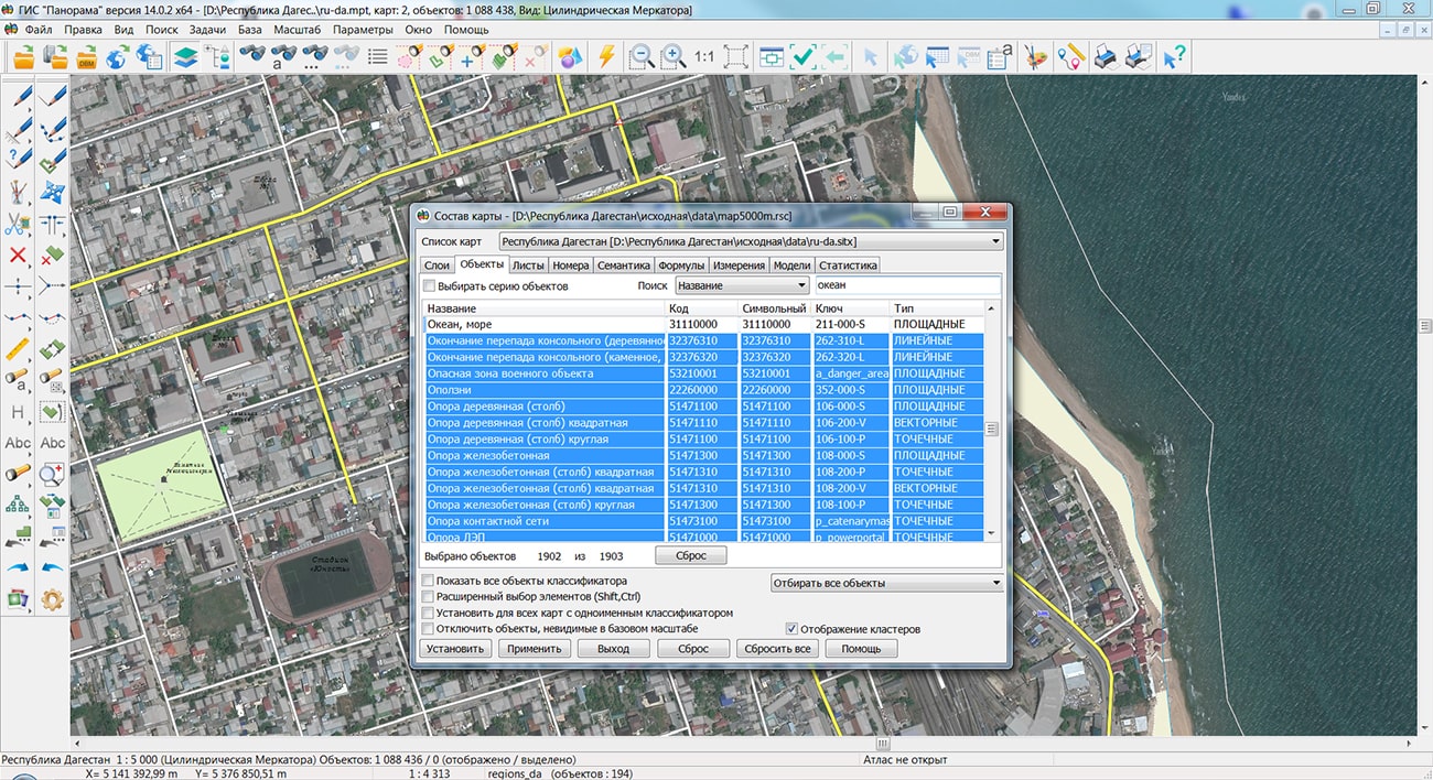
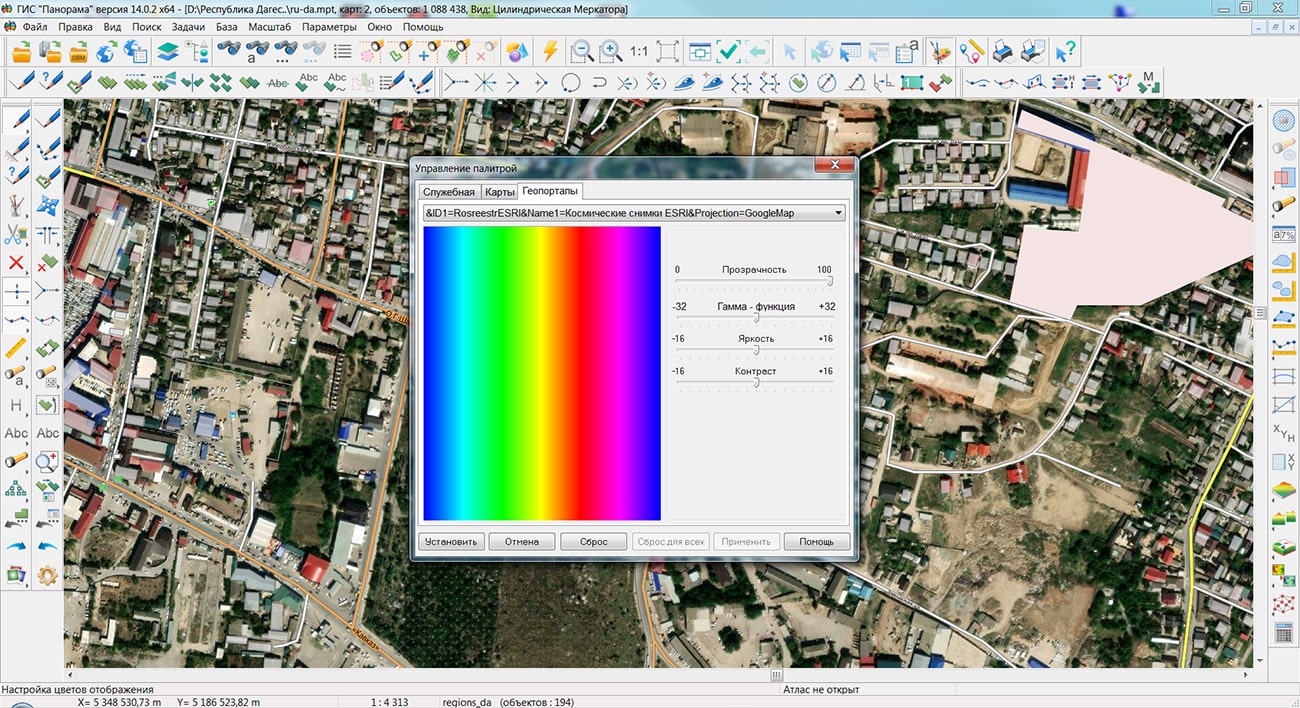
Specialists of KB "Panorama" prepared and placed the map of the Republic of Dagestan on the geoportal . The map was formed using OpenStreetMap data, source data was obtained from website. To work with the map, you can use the program or other software products of KB "Panorama".
The map was led to the modernised classifier of large-scale plans of scale 1: 5 000 (map5000m) and was saved into a packed project (MPTZ). The MPTZ format project includes a digital map of the region's territory (country, subject of the federation, administrative region), a map of the administrative-territorial division of the region and a digital classifier. Publishing of updates in bank of spatial data is made by using the program of . Publishing contents of bank of spatial data on the geoportal and data access for downloading are implemented by means of .
Free maps on the basis of OpenStreetMap data are available for download on the page "Digital maps".

Specialists of KB "Panorama" continue to actively participate in the work on the digital transformation of education. The next lecture and from the course "Geoportals" - "Software of geoportals. Part 1" have been prepared.
The training program for the course "Geoportals", developed for students of the , Faculty of , contains a series of lectures and practical exercises. The course is included in the bachelor's program of the .
The Faculty of "Geoinformatics and Information Security" has combined areas of training (information systems and technologies, applied informatics, information security), which were previously implemented at three different faculties of MIIGAiK. The synergistic effect of this association was achieved by strengthening the interaction of different research groups within the same faculty, as well as by centralizing educational and methodological work in related areas of training.
Highly qualified personnel take part in the preparation and conduct of classes. Students of the course are introduced to modern technologies used in the construction of distributed geoinformation systems and geoportals, including specific software and its practical application. The material is presented in the form of presentations, the lectures themselves are recorded on video and published in the KB "Panorama" knowledge base. Currently available for viewing and downloading lectures on the topics:
- "General characteristic of geoportals" (lecture and );
- "Organization of data in the distributed geoinformation systems" (lecture and );
- "Architecture of distributed GIS" (lecture and );
- "Software of geoportals. Part 1" (lecture and ).
Lecture materials on the topic "Geoportals" are available for review in the sections "Video lessons" and "Presentations".


Ph.: +7 (495) 739-0245, +7 (925) 221-1603
www.gisinfo.ru | panorama@gisinfo.ru
105005, Russia, Moscow, Baumanskaya Street 7, building 1, office 229 (m. Baumanskaya)
Copyright © Panorama Group 1991 - 2024


 Mobile version
 Full version