Copyright © Panorama Group 1991 - 2024

In KB "Panorama" the version 6.1.0 has been developed. In the new version the tools of customizing access to the separate groups of spatial data - to data layers have been added. The ability to save data selections has been implemented, filling the tree of sections of the complex with them. The operator can form data layers on the fly for their further use when generating reports, exporting and issuing spatial data, creating geo-covers, editing metadata, and generating requests.
The selection can contain a filter by the state of the terrain, scale, data format, coordinate system, comment and others. This makes it possible to provide access to data in accordance with the requirements of the enterprises of Roskartography and other organizations. Selecting a specific data layer automatically filters the metadata. The number of such layers is not limited and is configured by the administrator. Each layer has its own icon and can include child layers.
When drawing the contours of objects onto the data availability scheme, the generalization of the metric contour is performed to speed up the search for data over the area and display the scheme. Data security is ensured by the differentiation of access rights based on security tools that are part of the operating system. Basic authentication, digest authentication, system authentication (via web server), and domain (Kerberos or Active Directory) are supported. The complex is adapted to work on a wide range of operating systems (Astra Linux SE, ALT Linux, Elbrus, Ubuntu, CentOS, MS Windows and others) and architectures (Intel, Elbrus).
The complex of conducting a databank of digital maps and remote sensing data of the earth is registered in the register of domestic software under number 1862.
The databank of digital maps and remote sensing data is the basis for building infrastructure of spatial data at the federal, regional and municipal levels, in corporate information systems. Within the framework of a single geoinformation space, the Data Bank of digital maps and remote sensing data realises gathering, storage, search and delivery of the spatial data in exchange formats. The spatial data selected by means of the program can be placed for the multiuser access on the GIS Server and be published according to the international standards OGC WFS, WFS-T, WMS, WMTS, WCS on application server the GIS WebService SE. Users can access data from both a thin client (by means of ) and from desktop applications (, GIS "Operator"). The databank of digital maps and remote sensing data provides construction of cloud warehouse of spatial data, provision of access to these data, the automated formation and updating of geo-covers. The current state of spatial data is displayed by means of maps-schemes that are maintained for each type of stored data: vector maps, remote sensing data, elevation matrixes and terrain models. It provides remote placing the sets of spatial data into file warehouse, keeping versions of stored sets, updating maps-schemes of data availability, the automated collection and formation of metadata, and the formation and updating of geo-covers. Automated collection and formation of metadata is performed according to the standards of ISO 19115: 2003, Geographic information - Metadata and ISO/TS 19139, Geographic information - Metadata - XML schema implementation. The reduced copies of data images are automatically formed, checksum of files and completeness of data sets are checked. Placement of spatial data into file storage is performed with integrity check, control of data structure and content. The results of the work are recorded and entered into the metadata base. Automatic backup of metadata and spatial data storage with integrity control and data recovery has been provided. Multilingual interface is supported.
The portal presents the possibilities of organizing storage, accounting and and issuance of vector maps, remote sensing data, DEMs and terrain models. The portal contains vector maps in SXF format, generated on the basis of data from open sources (OpenStreetMap, VMap0). The spatial data includes maps of: subjects of the Russian Federation, countries and cities of the near and far abroad. In total, over 240 vector maps and 6700 matrix data with a total volume of 56 GB. Specialists of KB "Panorama" weekly update and refresh the content of the information on the portal. All published data is distributed free of charge under a free license.
The new version of the program is available for download on the page.


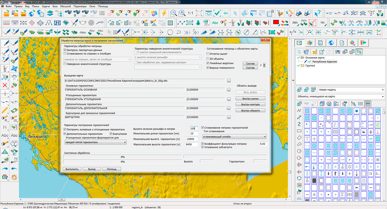
Specialists of KB "Panorama" prepared and placed the map of the Republic of Karelia on the geoportal . The map was formed using OpenStreetMap data, source data was obtained from website. To work with the map, you can use the program or other software products of KB "Panorama".
The map was led to the modernised classifier of large-scale plans of scale 1: 5 000 () and was saved into a packed project (MPTZ). The MPTZ format project includes a digital map of the region's territory (country, subject of the federation, administrative region), a map of the administrative-territorial division of the region and a digital classifier. Publishing of updates in bank of spatial data is made by using the program of . Publishing contents of bank of spatial data on the geoportal and data access for downloading are implemented by means of .
Free maps on the basis of OpenStreetMap data are available for download on the page "Digital maps".


Specialists of KB "Panorama" have prepared a video lesson demonstrating the capabilities of the task . This mode is available to users of the and . The tutorial demonstrates the construction of a map from the data of spatial databases, as well as the procedure for setting up the task. To load layers from a spatial database, a digital topographic map (DTM) of the GIS "Panorama" format is formed. The map is created with the parameters of the coordinate system and projection corresponding to the specified EPSG code. It is recommended that you specify the EPSG code to create the map according to the coordinate system settings used in tables of spatial database. In this case, the transformation of spatial data will not be performed, which will reduce the execution time and reduce the likelihood of recalculation errors.
If the connection to the database is successful, the "DTM Layers" tab displays a list of tables registered as intended for storing spatial data by DTM layers. On this tab, you can select all or individual tables from which data will be loaded into the DTM. If the connection to the database is successful, all the necessary parameters for creating a result map are filled, the "Run" button becomes available. When you click on it, the process of importing the selected DTM layers from the spatial database will start. Tables that were not previously marked are not included in the data import process.
You can get acquainted with the training materials in the "Video lessons" section.


In KB "Panorama" the version 10.1 has been developed. In the new version of the program the initial opening of large vector maps (from several million objects and more) after importing data from exchange formats or databases has been accelerated from tens of seconds to fractions of a second. There is improved a positioning of objects added onto a map in the display sequence chain, as when sorting a map, that improves the quality and ease of editing the map, speeds up the initial construction of the object tree when opening the datasets. Expansion of files of management by order of writing objects SIN has been replaced onto SI2.
The list of supported DBMSs for working with spatial databases has been expanded: PostgreSQL with PostGIS extension (St_Geometry data type), Oracle with Oracle Spatial extension (SDO_GEOMETRY data type), Oracle DBMS with ArcSDE extension (St_Geometry data type), Microsoft SQL Server (geogfaphy data type). For MS SQL Server, a work with a 2-dimensional metric in the WGS84 (EPSG: 4326) coordinate system is supported. To connect databases running MS SQL Server, the user's computer must have Microsoft SQL Server 2012 Native Client installed.
The parameters of connection to databases are configured by the GIS Server Administrator and are stored in a file with the DBM extension, which has an XML structure. The diagnostic protocol of the core libraries is located next to the protocol of the GIS Server operation and has the ".core.log" extension.
When executing queries to the and drawing the contours of objects onto the data availability diagram, the generalization of the metric contour is performed to speed up the search for data in the area and display the diagrams. The composition of the supported metadata of vector maps and remote sensing data has been expanded (a list of types of digital maps and remote sensing data, data on the summary of sheets, information on the contract for the production of data). There is added a processing of MPTZ format files for reading metadata and frames of vector maps for the data availability scheme.
The new version of the program is available for download on the page.


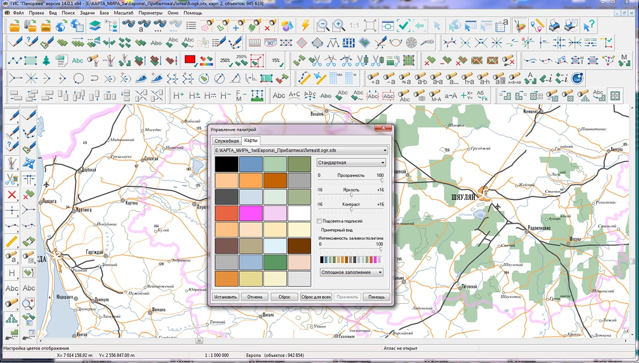
In KB "Panorama" a digital geographic map of scale 1: 1 000 000 in format SXF onto territory of the Republic of Lithuania has been prepared. As a source for preparation of the map the obtained from the information from the site has served. The map contains information on the number of inhabitants for cities and the name of settlements in Russian. As additional materials the World map of scale 1: 5 000 000 and data were used.
The map was led to the classifier of geographic maps of scale 1: 1 000 000 (). It can be used for a general assessment of the area and the study of natural conditions, to ensure the educational process, as a basis for the creation of geographic maps of a smaller scale, thematic and special maps, and solving other tasks. The map is distributed free of charge under a free .
Digital geographic map of scale 1: 1 000 000 in SXF format is available for download on the page "Digital maps".


Ph.: +7 (495) 739-0245, +7 (925) 221-1603
www.gisinfo.ru | panorama@gisinfo.ru
105005, Russia, Moscow, Baumanskaya Street 7, building 1, office 229 (m. Baumanskaya)
Copyright © Panorama Group 1991 - 2024


 Mobile version
 Full version