Copyright © Panorama Group 1991 - 2024

Specialists of KB "Panorama" have prepared a video lesson demonstrating the capabilities of the task . This mode is available to users of the and . The tutorial demonstrates the construction of a map from the data of spatial databases, as well as the procedure for setting up the task. To load layers from a spatial database, a digital topographic map (DTM) of the GIS "Panorama" format is formed. The map is created with the parameters of the coordinate system and projection corresponding to the specified EPSG code. It is recommended that you specify the EPSG code to create the map according to the coordinate system settings used in tables of spatial database. In this case, the transformation of spatial data will not be performed, which will reduce the execution time and reduce the likelihood of recalculation errors.
If the connection to the database is successful, the "DTM Layers" tab displays a list of tables registered as intended for storing spatial data by DTM layers. On this tab, you can select all or individual tables from which data will be loaded into the DTM. If the connection to the database is successful, all the necessary parameters for creating a result map are filled, the "Run" button becomes available. When you click on it, the process of importing the selected DTM layers from the spatial database will start. Tables that were not previously marked are not included in the data import process.
You can get acquainted with the training materials in the "Video lessons" section.


In KB "Panorama" the version 10.1 has been developed. In the new version of the program the initial opening of large vector maps (from several million objects and more) after importing data from exchange formats or databases has been accelerated from tens of seconds to fractions of a second. There is improved a positioning of objects added onto a map in the display sequence chain, as when sorting a map, that improves the quality and ease of editing the map, speeds up the initial construction of the object tree when opening the datasets. Expansion of files of management by order of writing objects SIN has been replaced onto SI2.
The list of supported DBMSs for working with spatial databases has been expanded: PostgreSQL with PostGIS extension (St_Geometry data type), Oracle with Oracle Spatial extension (SDO_GEOMETRY data type), Oracle DBMS with ArcSDE extension (St_Geometry data type), Microsoft SQL Server (geogfaphy data type). For MS SQL Server, a work with a 2-dimensional metric in the WGS84 (EPSG: 4326) coordinate system is supported. To connect databases running MS SQL Server, the user's computer must have Microsoft SQL Server 2012 Native Client installed.
The parameters of connection to databases are configured by the GIS Server Administrator and are stored in a file with the DBM extension, which has an XML structure. The diagnostic protocol of the core libraries is located next to the protocol of the GIS Server operation and has the ".core.log" extension.
When executing queries to the and drawing the contours of objects onto the data availability diagram, the generalization of the metric contour is performed to speed up the search for data in the area and display the diagrams. The composition of the supported metadata of vector maps and remote sensing data has been expanded (a list of types of digital maps and remote sensing data, data on the summary of sheets, information on the contract for the production of data). There is added a processing of MPTZ format files for reading metadata and frames of vector maps for the data availability scheme.
The new version of the program is available for download on the page.


In KB "Panorama" a digital geographic map of scale 1: 1 000 000 in format SXF onto territory of the Republic of Lithuania has been prepared. As a source for preparation of the map the obtained from the information from the site has served. The map contains information on the number of inhabitants for cities and the name of settlements in Russian. As additional materials the World map of scale 1: 5 000 000 and data were used.
The map was led to the classifier of geographic maps of scale 1: 1 000 000 (). It can be used for a general assessment of the area and the study of natural conditions, to ensure the educational process, as a basis for the creation of geographic maps of a smaller scale, thematic and special maps, and solving other tasks. The map is distributed free of charge under a free .
Digital geographic map of scale 1: 1 000 000 in SXF format is available for download on the page "Digital maps".


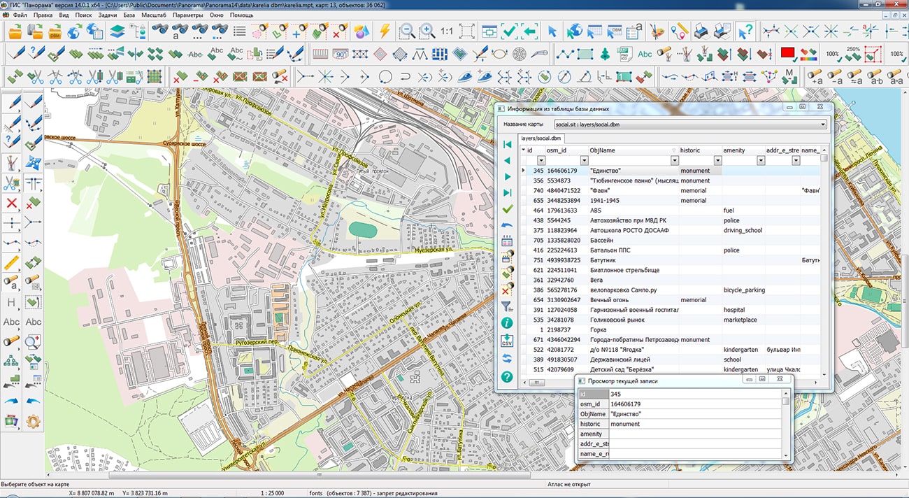
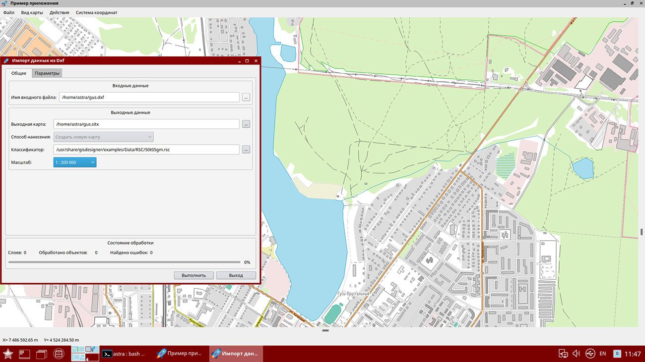
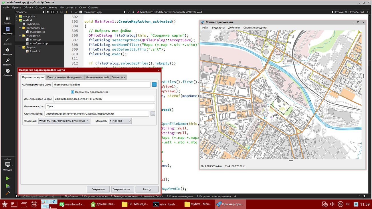
In KB "Panorama" the for Qt Designer SE version 14.0.0 has been developed for operating systems Astra Linux SE (release "Smolensk"), Alt 8 SP, CentOS, Ubuntu. The new version of the toolkit makes it possible to implement direct connection to large (millions of records) in the developed GIS applications using the DBM format support. Information from the database is displayed in the form of vector terrain maps. GIS application will be able to simultaneously edit the contents of databases connected directly and through the , perform an exchange of information between different databases, agree the coordinates and attributes of objects in different databases, jointly display information from different databases in the form of graphic layers, combine data with images , matrixes of heights, vector maps and data from various geoportals and web services. Spatial information from the database is displayed in the form of cartographic conventional symbols, which makes the editing process transparent for the user. The set of displayed and editable objects and their semantic characteristics can be flexibly specified using an SQL query. For convenient customization of the database connection parameters, the database connection administration dialog has been implemented. User-defined settings are saved in a file with a DBM extension, which has a standard XML file structure. The set of dialogs for importing spatial data has been extended with KML and DXF formats. Thanks to the use of optimized and high-performance functions of the GIS core, the speed of import from exchange formats has been increased, which can be critical both for embedded devices that have limitations on processor performance, and for high-performance systems, where it is necessary to use the available processor power as efficiently as possible.
The initial opening of large vector maps, containing several million objects and more has been accelerated after importing data from exchange formats or databases - from tens of seconds to fractions of a second. There is improved a positioning of objects added onto a map in the display sequence chain, as when sorting a map. This improves the quality and ease of editing the map, speeds up the initial construction of the object tree when opening the datasets.
In the new version of the program, the transformation of vector maps into a given coordinate system has been accelerated by 4-6 times. The transformation process is called on the fly when the data of maps and geoportals in different coordinate systems are added into one window. When transforming on the fly, a copy of the input map is created in the map subdirectory with a name containing the name of the passport file and the current date.
used for grouping point conventional signs on a map has been improved. Into the cluster description the property "Display the first character in the cluster" has been added. Placing it in the position of the cluster sign will first display the first object in the cluster and then the cluster icon. In this case, the cluster icon can contain only the number of objects or other complementary elements of the conventional symbol. When drawing an object, various semantics can be taken into account, including links to graphic files, which makes the generalized sign more complex and informative.
Into the graphical component of a support for layers from the Rosreestr geoportal has been added: Cadastral okrug, Cadastral districts, Cadastral quarters, Land plots, Land plots put up for auction, Red lines, Unified real estate complexes. Geoportal provides data in vector tile form in pbf (Protocolbuffer Binary Format) format. The data contains the coordinates of objects, signatures of plots, semantic characteristics.
The parameters of connection to geoportals can be flexibly configured for each user by editing the wmslist_ru.xml file.
When importing a set of maps sheets of and format, specified by the list in the file, the ability has been provided for transfer of sheets by longitude on +/-360 degrees. It allows to duplicate the columns of sheets in the western and/or eastern hemisphere for expansion of dimensions of work region up to -360/+360 degrees. To duplicate sheets, copy the required file with a different name (for example, rename 01-12.sxf to 01-12_west.sxf) and change its nomenclature so that all sheets in the region have a unique designation (for example, rename 01-12 to 01-12_west ). Then, in a text editor, add a line with a new name sxf or txf into the DIR file and press the tab after the file name and enter the direction of transfer (for example, -360 or +360). The recalculation of coordinates and sheet passport will be performed automatically when importing the work region by the DIR file.
GIS Constructor is a set of geoinformation components for use in the visual programming environment of Qt Designer, which allows you to develop your own GIS applications. The visualization of the contents of digital maps is made in conventional symbols adopted for topographic, geographical and various special maps. Geoinformation system has ample opportunities for performing calculations, for providing display of spatial data on various graphic devices in standard and user systems of conventional symbols. The main functions can be executed in multithreaded mode. It supports automatic optimization of used memory for processing large amounts of data (tens of gigabytes) on limited resources (hundreds of megabytes).
The toolkit is adapted for work on a wide range of operating systems (Astra Linux SE, ALT Linux, Elbrus, Ubuntu, CentOS, QNX) and architectures (Intel, Elbrus, PowerPC, SPARC, ARM). The toolkit includes components of visual designing the GIS applications and library of a multiplatform multithreaded GIS core. GIS Constructor provides a cross-platform MAPAPI interface that allows a programmer to implement development in an operating system convenient for it. The developer can release GIS applications for a set of operating systems by simple assembly with minimal changes to the program source code.
The new version of the program is available for download in the section.


In KB "Panorama" the has been developed. In the new version the tools for processing a photo and video data, point cloud data, digital mapping, display of sea maps, preparation of reports and others were updated.
In the task , the dialog "The movement of the track (video)" has been improved. The algorithm for sequential display of video files in the selected folder with automatic transition from file to file has been improved. The program builds a set of tracks based on the metadata of video files. Tracks are formed in the form of linear objects with a four-dimensional metric containing three-dimensional GPS coordinates of the camera and the recording time of key frames of video files. In the new implementation of the program, the smoothness of video data playback has been increased. Synchronization of camera position on the map was improved. An information line has been added containing the name of the current video file, date and time of shooting. This tool allows you to quickly set the position of an object at any time provided by a set of video files.
The task has been improved. Legend and explication maps are created in a conditional coordinate system, which eliminates distortion when added to a map created in a different projection. Maps with tables of legends and explication are created with a coordinate reference to the northeast corner of the designed map, which allows adding maps without additional positioning. In the Legend formation mode, the functions "Divide into blocks", "Split Block", "Combine blocks" have been added.
The number of lines with conventional symbols of objects in a block can be changed. A block on the map is created in the form of a grouping of objects by semantics, which allows further general movement, deletion and other group operations.
In the task, the mode for creating objects the has been improved. There is added the ability to dynamically change the settings of the title, which is created onto the map next to the cursor. By right-clicking on the "Set font parameters" menu item, the font editing dialog is called up, in which you can change the color, height, name and other properties of the font. The new font values are stored in the object semantics the "Coordinate label". In the mode of Creating object by coordinates entered from the keyboard there is added a support for calculating the coordinates of a metric point using the specified initial coordinates of the point, azimuth and distance to the next point. In the Cut lists mode, the algorithm for specified by one list from objects specified by another list has been improved. When processing large amounts of data (hundreds of thousands of processed objects with thousands of internal contours), the operation time was reduced from several hours to minutes. The mode can be used, for example, for cutting islands in water bodies, glades in vegetation and for other objects. Processed objects are checked for self-intersections and automatically corrected. The contours of the cut objects are automatically matched to the processed objects, which significantly reduces the amount of manual work.
In the File menu, the task has been added for to form a work region by the specified dimensions or nomenclatures of topographic map sheets. The task is called using the main menu item "File/New/Work region by coordinates".
In the task of , the ability to apply arbitrary graphic labels not specified in the RSC classifier has been added. The choice of color, font, height, thickness and other parameters of the label is performed in the dialog, which is called by the button "Graphics". The location of the graphic label relative to the object being signed, filling and displaying the semantic characteristics is carried out according to the same algorithm as for the title from the map classifier. In the task "Control of label metrics" the ability has been added of processing the titles on the selected map or on all maps available for editing.
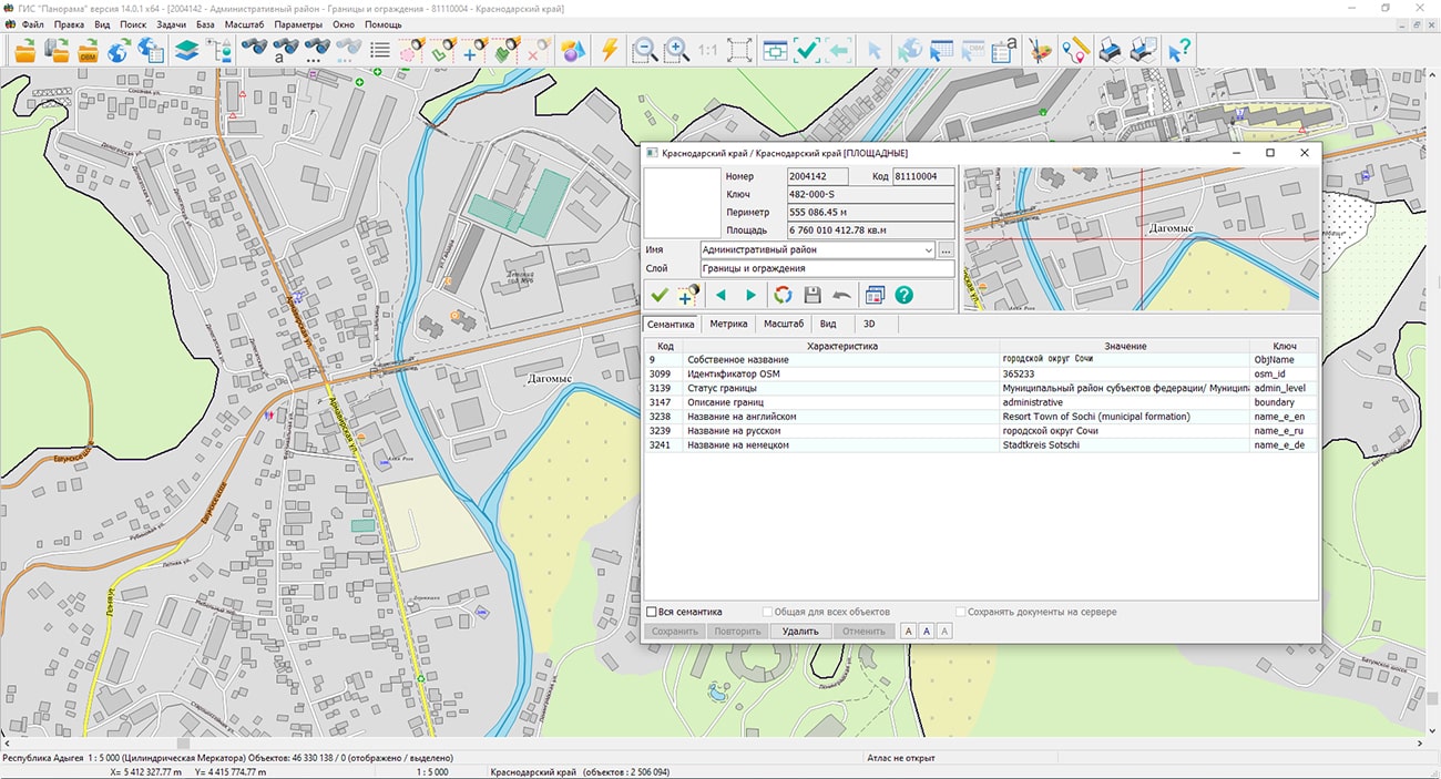
The task has been improved. On the "Sheet Metadata" page there is added the information about execution of summary of the sides of a map sheet with adjacent sheets. The summary of adjacent map sheets is a coordination of areal and linear objects of adjacent sheets, the contours of which go onto the sheet frames. Objects of adjacent sheets are considered coordinated in case of conformity of the points going onto the frame, and absence of contradictions of semantic characteristics. By default, the signs of sheet sides summary have the "Not installed" value. When matching two adjacent sheets for the corresponding side in the passport of the map, the value "Completed" is set. For maps with an arbitrary territory without division into nomenclature sheets, the values "Not required" are entered in the summary fields. On the "Metadata" page, the list of metadata saved in the ".meta.xml" file has been expanded. There is added a recording an information about the restrictions on the use of the dataset: information about the agreement (contract), under which the dataset was created, containing restrictions on the distribution and use of data. Improvements were made in order to ensure the maintenance of federal and regional collections of spatial data and the completeness of the metadata description.
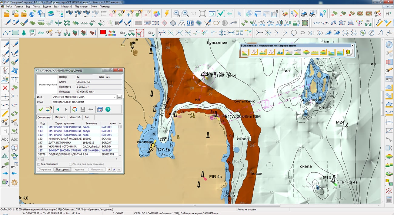
Displaying sea maps of S57/S52 standards has been improved. In the s57navy.rsc classifier for attributes that have a list of classified values (Attribute type: L - CATAIR, CATACH, ... TECSOU), property the "Repeat allowed" is set. When exporting and importing data, lists of attribute values (1,7,, 30) are written and read. For display of lists of values, into the the new operating symbol ' r ' (#113.r) has been added, which allows to form a line from the list of attribute values, separating them with a space. There is refined a display of depth marks taking into account safety contours and taking into account depths on drying surfaces.
Algorithms for storing "point cloud" data in MTD datasets have been improved. Packing data, taking into account the area of the processed area and the specified storage accuracy, allows you to reduce the size of created MTD files by up to 4 times, which can be from several tens of Gigabytes to Terabytes. New algorithms improve the accuracy of terrain description over a larger area and accelerate the construction of 3D terrain models.
The task has been improved. On the "Matrixes" bookmark in the context menu, a call of the new mode "Change of location of a matrix on dx/dy meters" has been added. The mode is intended for changing the binding of matrixes of height, layers and qualities of the document onto a specified value in meters. The processed matrixes must be available for editing. Changing the location is carried out both for one and for all matrixes of the document.
The "Display/Inform window" item has been added into the Options menu to enable or disable a pop-up message that informs the operator about the result of the action performed in the map window.
The new version of the program is available for download in the section.


Ph.: +7 (495) 739-0245, +7 (925) 221-1603
www.gisinfo.ru | panorama@gisinfo.ru
105005, Russia, Moscow, Baumanskaya Street 7, building 1, office 229 (m. Baumanskaya)
Copyright © Panorama Group 1991 - 2024


 Mobile version
 Full version