Copyright © Panorama Group 1991 - 2024

Specialists of KB "Panorama" prepared and placed the map of the Khanty-Mansiysk Autonomous Okrug - Ugra on the geoportal . The map was formed using OpenStreetMap data, source data was obtained from website. To work with the map, you can use the program or other software products of KB "Panorama".
The map was led to the modernised classifier of large-scale plans of scale 1: 5 000 () and was saved into a packed project (mptz). The MPTZ format project includes a digital map of the region's territory (country, subject of the federation, administrative region), a map of the administrative-territorial division of the region and a digital classifier. Publishing of updates in bank of spatial data is made by using the program of . Publishing contents of bank of spatial data on the geoportal and data access for downloading are implemented by means of .
Free maps on the basis of OpenStreetMap data are available for download on the page "Digital maps".


In KB "Panorama" the version 14 has been developed. The new version allows to sort results of requests execution in formats GML/JSON by the value of chosen semantics, the layer name or the object name. Service can filter objects by semantics, using group operations of search for objects. The filter can be set in GML/JSON formats, on the basis of the international standard OGC Filter Encoding 2.0 Encoding Standart 09-026r1 and ISO/DIS 19143. Possibility has been added for an output of statistics by result of the answer: total of objects, quantity of objects on localizations, semantics keys and their number , the objects codes and their number. Support of multilines and multipoints was added when selecting and loading objects in GML/JSON formats.
Service supports the international standards OGC 05-078r4 version 1.1.0 and OGC 02-070 version 1.0.0 - SLD (StyledLayerDescriptor). SLD-styles allow to change dynamically the image for the user, without changing the classifier. Styles and filters of objects can be applied in requests on thematic mapping.
In service the possibility has been implemented for the publication of the same map several times due to the formation of MPT projects. This will allow you to set additional filters on layers, such as localization, semantics, keys, object types, and others. The layer will be displayed to the selected users in accordance with the predefined restrictions. For layers, consisting of MPT project, the ability of editing a specific map has been added.
In service the new format of the answer to all requests in JSON format has been developed, in addition to the already existing XML-RPC standard. Support of antialiasing was added when drawing polygons in Linux systems. Display of rasters by a framework has been accelerated.
The list of supported requests has been expanded. The new request of getting the percentage of data loading in a layer is added. Some of the layers that take large volumes of spatial data, when first opened, take time to prepare them by the service. In the service administrator the possibility has been added of monitoring the loading of a layer, updating a cache by a database or from the removed . Parametres of requests for calculating azimuth, directional angle and distance were expanded. Possibility of calculations by arbitrary EPSG code has been implemented. The new request for building thematic maps using a CSV file has been added.
GIS WebService SE supports all international standards (OGC WFS, WFS-T, WMS, WMTS, WCS), which are used to transfer and display spatial data. The program provides the issuance of tiles for any user or local coordinate system. The application is implemented on Windows and Linux platforms, is compatible with Apache, IIS and nginx web servers.
The new version of the program and the documentation are posted on the website in the section.


Specialists of KB "Panorama" prepared and placed the map of the Republic of Armenia on the geoportal . Source data was obtained from website. To work with the map, you can use the program or other software products of KB "Panorama".
The map was led to the modernised classifier of large-scale plans of scale 1: 5 000 (). Publishing of updates in bank of spatial data is made by using the program of . Publishing contents of bank of spatial data on the geoportal and data access for downloading are implemented by means of .
Free maps on the basis of OpenStreetMap data are available for download on the page .


In KB "Panorama" the version 14 has been developed.In the new version the tools have been updated for collecting and analyzing statistical information and thematic mapping, which can be used for studying the territory, assessment of the combat potential, planning of operations and solving the tasks of topographic and geodetic support.
The task has been improved, which ensures the placement of photographs of the territory and terrain objects on the background of the map. Photos are displayed on the map as icons (thumbnails). When the map is increased, the photo is enlarged, allowing you to see the photo in more detail. The algorithm of automatic clustering has been used to the grouping of photos on a map when scaling. Densely located objects with photos are replaced with the first object in a cluster with indicating the number of photos in the given cell. To load photos, you must select a folder with photos. Upon completion of the selection, a service map containing point objects in the form of photographs will be added to the open document. A link to the photo files will be written into these objects. The service map is saved in the document folder and is included into the document maps list. When you reopen the document, the map with photos opens automatically. If necessary, a list of all open data can be saved into an MPT or MPTZ project.
used for grouping point conventional signs on a map has been improved. Into the cluster description the property "Display the first character in the cluster" has been added. Placing it in the position of the cluster sign will first display the first object in the cluster and then the cluster icon. In this case, the cluster icon can contain only the number of objects or other complementary elements of the conventional symbol. When drawing an object, various semantics can be taken into account, including links to graphic files, which makes the generalized sign more complex and informative.
Display of remote sensing data mosaic has been accelerated. To speed up the display of rasters, an optimization of the raster frame during recording has been added - all frame contours are cut out by the sizes of each raster. The initial opening of large vector maps (from several million objects and more) has been accelerated after importing data from exchange formats or databases from tens of seconds to fractions of a second. There is improved a positioning of objects added onto a map in the display sequence chain, as when sorting a map. This improves the quality and ease of editing the map, speeds up the initial construction of the object tree when opening the datasets.
In the task the ability has been added for creating a project of arbitrary size. When drawing a new inset of the map, it became possible to draw it exactly along the frame of the work area, that is, to create a general background of the document. Controls have been added for the order in which objects are displayed on the document ("Above all", "Below all"). A new "Open Stamp" mode has been added, which allows you to add one or several previously prepared stamp templates (corner stamps, headers and footers, etc.) into the document with the ability to preview the image of the inserted stamp. The new modes complement the task tools that provide fast and high-quality creation and design of graphic documents.
The "Navigator 3D" task provides the construction of a three-dimensional terrain model and its . A three-dimensional model consists of two parts: a relief model (of the earth's surface) and three-dimensional models of terrain objects. The elevation model and three-dimensional models of objects are saved into the database of the DB3D format tile-by-tile at user-specified scale levels. At the maximum level (on a large scale), the most detailed terrain model is created. At the minimum level (on a small scale), a simplified model is built. After saving a three-dimensional terrain model, the resulting database is automatically connected to the project for displaying the model. Saving a terrain model to a database speeds up the display of a three-dimensional terrain model in desktop and Web-applications, makes it possible to work with the model later without the original cartographic data.
In the task an export of an image of an open document into the KMZ format has been added. The formed KMZ archive contains the KML project file and a set of raster tiles pyramid for the saved territory. In the task, it is possible to save the map image by the selected area, by the page format and by the dimensions of the selected objects, for example, by the dimensions of the frames of the nomenclature sheets.
In the task the list of saved file formats has been expanded. Along with TXT and TIFF files,the ability was added to save a digital elevation matrix into a KMZ file. The task is called using the main menu item "File - Export to .. - Matrix (TXT, TIFF, KMZ)".
In the task the mode has been added. At a choice of this mode a coloring of the areal objects with identical value of chosen semantics into one color is carried out. Unlike other modes of construction, this mode allows you to carry out construction for any type of semantics, including for symbolical semantics.
The task provides the construction of thematic maps for the countries of the World and the regions of Russia, Armenia, Azerbaijan, Belarus, Kazakhstan, India, Uzbekistan, Tajikistan and other countries based on the built-in maps of the administrative boundaries of the regions. Statistical data should be presented in the form of a table in CSV format. The table can consist of two or more columns, one of which must contain the names of countries, regions of countries, or municipalities that are part of the selected region. For constructing a thematic map it is necessary to choose a statistics file (a text file of CSV type) and region corresponding to it. The result of construction contains colored territories of administrative units, a scale of ranges of statistical data's values and a list of names of territorial objects with the values of the selected statistical data. The type of the scale depends on the range of statistical data values. The resulting map can be printed, or saved in files of vector (SVG, EMF) and raster (PNG, TIFF) formats.
The task has been improved. The task allows you to plot objects on the map from an Excel file for all lines or for a range of lines specified by the user. The mode of forming a list of correspondences between table fields and object semantics has been updated. The semantics for a list can be found by name, code, or key, which allows you to speed up the process of creating a list. In the modes "Save/Restore settings" the ability has been added to save the list of configured semantics in the ini - user file. "Delete correspondence list" mode has been added, designed to delete the entire list if it is not up-to-date, for example, after restoring parameters from the settings file.
In the task , it is possible to insert data lines with coordinates X and Y, separated by a space, tabulation, comma or semicolon, from the clipboard in one action, into two coordinate fields (New point) at once.
The new version of the program is available for download in the section.


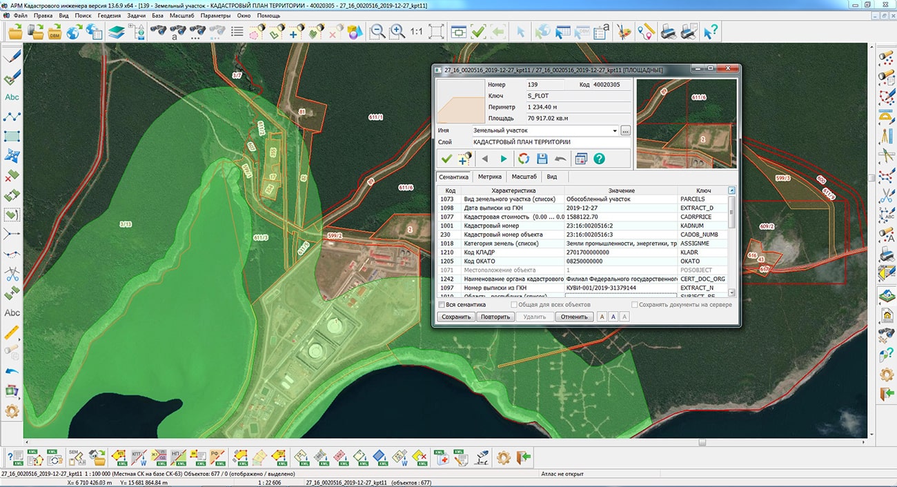
Specialists of KB "Panorama" have prepared a video lesson on the formation of an XML document of the land survey plan of version 06 for the formation of land plot by means of outlining with the preservation of a land plot, the outlining of which is carried out within the changed boundaries. Users of the , or can form XML documents of the land survey plan of version 06 using a complex of geodesy calculations.
In the video lesson the features of preparation of the data, a filling the mandatory characteristics and formation of XML file of the land survey plan of version 06 according to have been shown. On the basis of this order in software products of KB "Panorama" the classifier of conventional symbols has been developed. In the classifier there is implemented a general list of layers, semantic characteristics and objects for display of cadastral data on cadastral maps and other cadastral documents.
can be formed for one or several land plots depending on a variant of a selecting the objects on a cadastral map. Procedures the "Formation of electronic XML document by XML scheme of the land survey plan version 06" and "Formation of land survey plan" provides support of formation of the XML document and the paper report by one of the following options:
- one land survey plan for the object selected on the map;
- one land survey plan for the multi-contour land plot;
- one land survey plan for group of the selected one-contour land plots;
- several land survey plans for a group of selected one-contour land plots;
- one land survey plan for one or several created parts of the selected land plot (one or multi-contour).
You can get acquainted with the training materials in the section.

Ph.: +7 (495) 739-0245, +7 (925) 221-1603
www.gisinfo.ru | panorama@gisinfo.ru
105005, Russia, Moscow, Baumanskaya Street 7, building 1, office 229 (m. Baumanskaya)
Copyright © Panorama Group 1991 - 2024


 Mobile version
 Full version