Copyright © Panorama Group 1991 - 2024

Specialists of KB "Panorama" have prepared and placed a map of Krasnoyarsk Krai on the geoportal . The map has been formed according to OpenStreetMap data, source data were obtained from website. To work with the map, you can use the program or other software products of KB "Panorama".
The map was led to the modernised classifier of large-scale plans of scale 1: 5 000 (map5000m.rsc) and was saved into a packed project (mptz). The MPTZ format project includes a digital map of the region's territory (country, subject of the federation, administrative region), a map of the administrative-territorial division of the region and a digital classifier. Publishing of updates in bank of spatial data is made by using the program of . Publishing contents of bank of spatial data on the geoportal and data access for downloading are implemented by means of .
Free maps on the basis of OpenStreetMap data are available for download on the page "Digital maps".


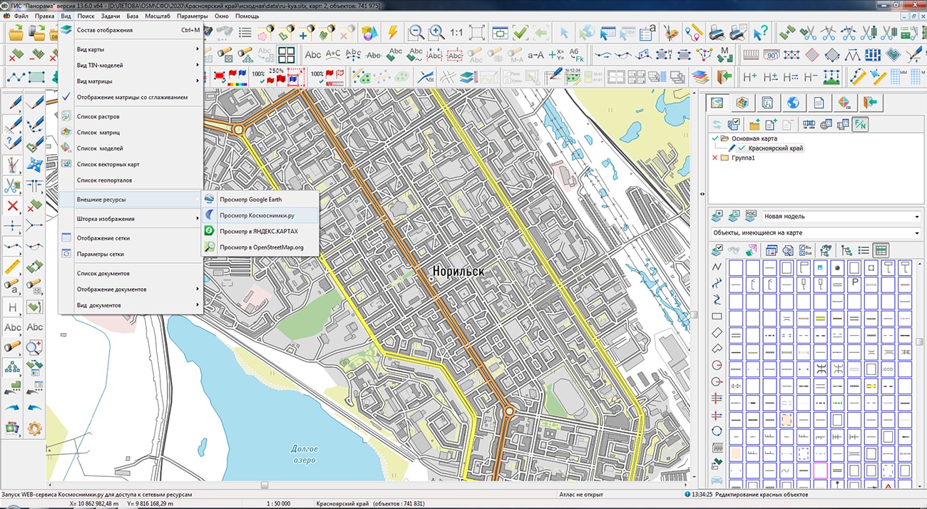


KB "Panorama" has developed the version 13.1.1 for creating GIS applications in the environment of C++ Builder, Delphi Embarcadero. In the new version the possibility has been added for request and display of the data about map objects from geoportals (geoservices) according to the OGC international protocol. The request is executed for a given point of the image. If several layers from different geoportals are open, then the request is made to the current layer specified in the dialog. Information about objects is requested by the geodetic coordinates of a point, transmitted and displayed in the form of an html page.
In this version a new installer of the GIS ToolKit is presented, in which an automatic customization of paths to GIS core libraries, source codes, setting of Windows environment variables have been added. The new installer, through the use of automatic settings, greatly simplifies the process of installing the GIS ToolKit into the palette of development environment components.
The GIS ToolKit consists of a set of visual components (supplied in source code) and API functions of the GIS core for direct access to spatial data. The toolkit is intended for the development of client-server and desktop 32-bit and 64-bit applications that require processing and visualization of spatial data. Spatial data can be located both at the workplace (direct access to data) and in the local network or the Internet (components of access to the or data exchange using international protocols are used).
The new version of the program is available for download on the page.


Specialists of KB "Panorama" have prepared for familiarization with possibilities of the complex for OS Astra Linux SE, Alt 8 SP, Ubuntu and others with support of the platform Elbrus and Intel. Examples include a photorealistic three-dimensional model of the Earth, a system for storing and updating spatial data, a thematic Agro-portal for agricultural management, a geoportal of open data of the Ministry of Emergencies of Russia, a geoinformation system for monitoring vehicles, a reference information system of Ecuador, and also three-dimensional city models.
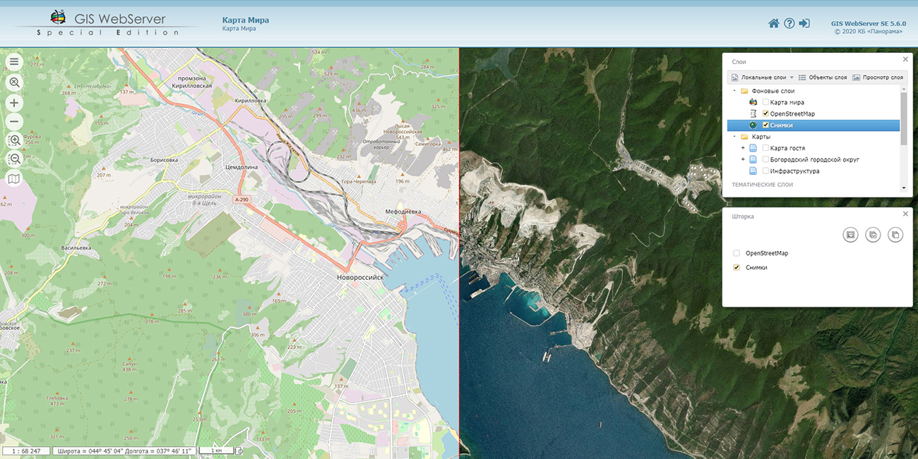
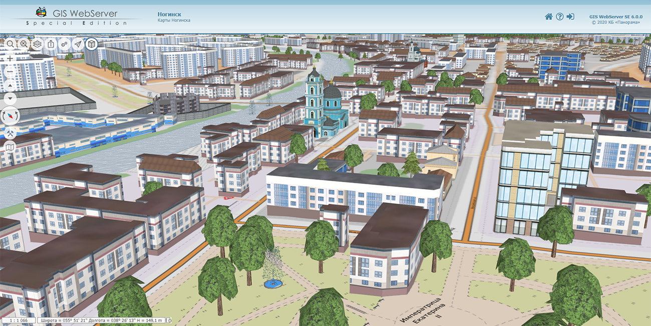
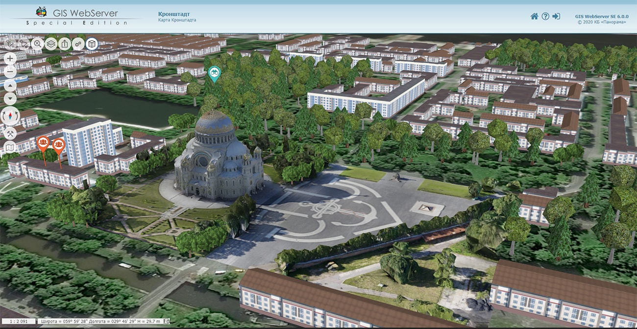
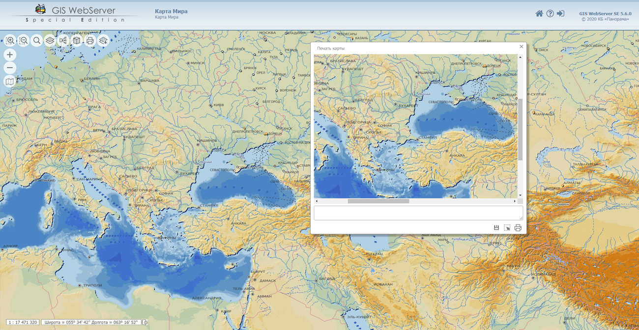
The information geoportal is a tool for accessing the spatial data infrastructure, contains tools for creating and updating digital maps of terrain and city plans based on remote sensing data, a processing materials of space and aerial imagery of the terrain, forming a geospatial database and metadata base, providing collective remote access to data via the web interface.
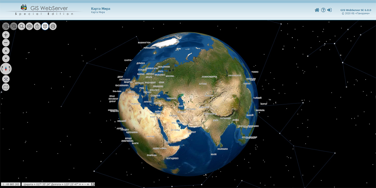
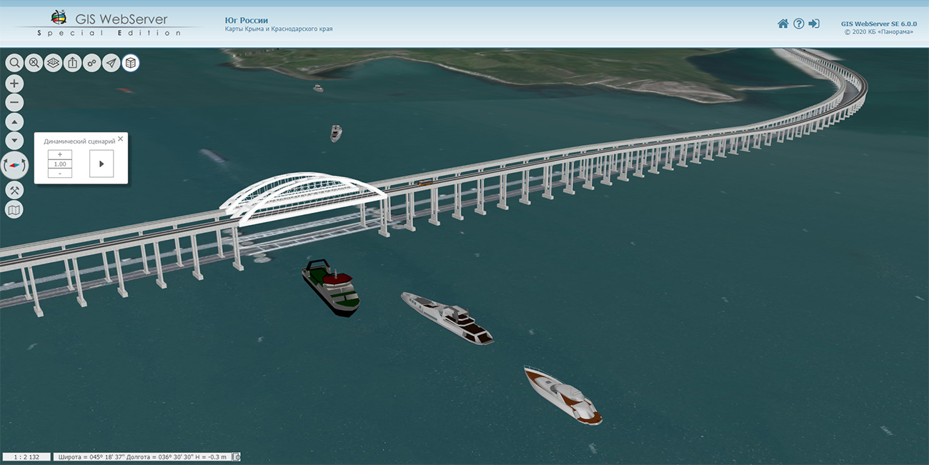
Geoportals and supplement spatial model with three-dimensional representation of terrain and/or specified objects (buildings, transport, results of modelling). The area of the territory and the degree of detail can be increased while maintaining high display speed due to the tiled structure of the three-dimensional database. The model can be filled by importing individual objects and/or territories from various exchange formats, as well as from photorealistic three-dimensional models of unlimited size (TLS, OC3). The model can vary from the view of the Earth against the background of stars to a detailed image of underground communications.
The portal presents the possibilities of organizing storage, accounting and issuance of cartographic materials in vector, raster and matrix form. The portal contains vector maps in SXF format, generated on the basis of data from open sources (OpenStreetMap, VMap0). The spatial data includes maps of: subjects of the Russian Federation, countries and cities of the near and far abroad. In total, over 200 vector maps and 6000 matrix data with a total volume of 50 GB. Specialists of KB "Panorama" weekly update and refresh the content of the information on the portal. All published data is distributed free of charge under a free license.
Agricultural producers get access to agricultural GIS of an enterprise from anywhere in the world through the use of the . The geoportal is intended for agricultural management, provides the creation of an electronic map of the contours of the fields of the economy, the maintenance of the soil fertility base and the electronic corded field history book. Agroportal is integrated with the monitoring system of agricultural machinery and vehicles and includes services for automating various calculations, including: the need for mineral fertilizers, vehicle mileage, cultivated arable land and others. The calculation results can be presented in the form of thematic cartograms displayed together with background information, cadastral data and the contours of agricultural land for a visual display of the analyzed indicator (distribution of crops, planned and actual yield, the progress of sowing or harvesting, and others).
provides systematized information about the forces of the Unified State System for the Prevention and Response of Emergency Situations (RSChS) and about facilities of economy and infrastructure on the territory of the Russian Federation. The geoportal of open data of the Ministry of Emergency Situations of Russia makes it possible to simulate the situation as a result of emergencies according to the following scenarios: terrorist act, man-made emergencies (at biological, chemical, radiation-hazardous facilities and others) and natural characters (fire, flood, flooding, mudflows/landslides and others). All simulation results, including spatial data, can be printed or saved into a file for later use. In addition, the Geoportal provides standard opportunities for working with spatial data (working with a map, selecting and viewing a territory, selecting objects on a map, and others).
Geoportal "Ecuador" provides information on the political and administrative division of the country (as of 2017). Information about the territorial structure of the state is presented in the form of maps and a short text description for each administrative unit. As a cartographical basis, the map of Ecuador at the scale of 1: 1 000 000 and the scheme of organizing the territory at level of provinces and cantons are used.
Geoprotal is intended for monitoring of motor transport based on GLONASS/GPS navigation of the technical means and provides: data collection from the onboard equipment installed on mobile technical means (objects of monitoring), displaying the location of monitoring objects and their characteristics against the background of the map.
The spatial data deployed in OC Ubuntu includes more than 2 TB of tiles created by SE tools and data prepared in the 54 GB of DEMs, 88 GB of orthophotoplans and satellite images, 32 GB of vector maps, 129 GB three-dimensional models of objects in DB3D format.
of KB "Panorama" allow you to build a web portal of any level: state (federal), regional, municipal, corporate or industry. The technology of building a scale geoinformation system is based on the use of a complex of products for maintaining the regional geoportal "Geoportal Region". The software products are certified in the certification system for information security requirements at the 2nd level of absence of undeclared capabilities.
The procedure for installing and configuring server programs is described in detail in the , is presented in educational and .
Users of server products the , , , for OS MS Windows can perform a preferential update to new versions for Linux OS until May 31, 2021. The update is free if the products were purchased in 2020 and at 24% of the product price if purchased earlier than 2020.


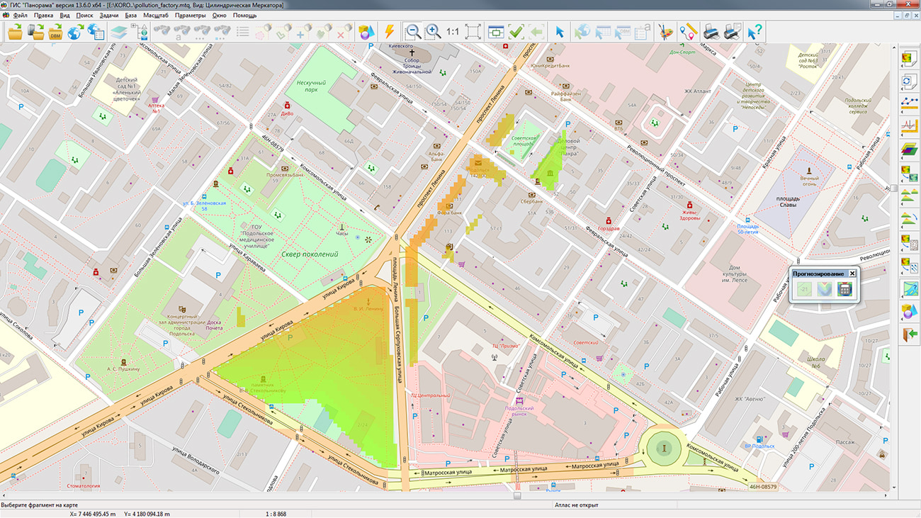
In KB "Panorama" the version 6 has been developed for the version 13. The new version of the program added a tool for performing mathematical and logical operations on matrices of qualities - the Matrix calculator. The matrix calculator is designed to perform operations of the maps' algebra over the matrices of qualities. Map algebra (local operations) - operations, during which, based on one or several initial matrices, a new matrix is created, and the values of the cells of this matrix depend only on the values of the cells of the initial matrices that have the same coordinates.
The values of the cells of the resulting matrix are calculated based on an expression, which can consist of various mathematical and logical operations. You can also use one or more conditional operators in an expression, which allow you to change the values of cells depending on the fulfillment of specified conditions. An important feature is the ability to check cells for presence of data and the ability to set cells to NULL (no value).
An example of the work of the matrix calculator can be the following task. A factory and a motorway are sources of pollution. It is necessary to build a matrix showing the areas in which the total pollution exceeds the maximum allowable rate for residential buildings, recreational areas and social facilities. As the initial data there are the matrixes reflecting levels of pollution from factory and a motorway, and also a matrix containing maximum permissible levels of pollution. The solution to such a problem will be a matrix built on the basis of the following expression: Con ("1.pollution_factory.mtq" + "2.pollution_road.mtq"> "3.mpc_value.mtq"; "1.pollution_factory.mtq" + "2.pollution_road .mtq "; setNull), which means that if the sum of pollution from the factory and the motorway is greater than the maximum permissible concentration, then this sum is written into the matrix cell, otherwise - NULL.
"Complex of 3D analysis" is intended for creating models of surfaces and solving the problems of spatial analysis with their use. A surface model can display such terrain properties as elevation, pollution concentration, precipitation, radiation levels, and others. Models of surfaces can be created according to data of a vector map, by the information from database tables, and also can be loaded from external formats (SRTM, GeoTIFF, LAS and others, more than 20 in total). Models of surfaces are used for formation of a three-dimensional terrain map, and also when solving problems of the analysis: calculation of distances, areas and volumes, profiling, construction of visibility zones, determining the directions of slopes, obtaining other derived surfaces.
The new version of the program is available for download in the section.


In KB "Panorama" the version 10.1.5 has been developed. The new version of the program adds support for large volumes of spatial data (satellite images, DEMs, vector maps), consisting of hundreds of millions of objects, trillions of points and occupying more than 4GB of hard disk space in one file. In KB "Panorama" a tiled background was created on to the territory of the entire Globe in the form of a multiscale project of spatial data. It consists of more than 6500 maps and matrices of various scale ranges from 1: 1 000 000 до 1: 5000. The total amount of data on the hard disk was 35 GB. In total, about 250 000 000 tiles were created, occupying about 10 TB of disk space. Tiles were formed on a 10-core Intel i9-9820x server with a clock frequency of 3.3 GHz, 64 GB of RAM in the Ubuntu 18.04 operating system. The total time for tile formation is 2 days 12 hours. The speed of forming tiles by Imagery Creator is comparable to the speed of copying data from disk to disk. The project is published in and and is available for review at the link .
Imagery Creator allows you to create tiles in the formats JPEG, PNG, PNG8, Mbtiles, BIR and GeoPackage according to the international standard OGC WMTS 07-057r7 version 1.0.0, TMS standard and OGC 12-128r15 GeoPackage version 1.2.1. Tile data generated by Imagery Creator is used by the GIS WebServer SE, GIS WebService SE software products to provide a high speed of execution of queries on the display of spatial data over vast territories with the simultaneous access of a large number of users.
The new version of the program is available for download on the page.

Ph.: +7 (495) 739-0245, +7 (925) 221-1603
www.gisinfo.ru | panorama@gisinfo.ru
105005, Russia, Moscow, Baumanskaya Street 7, building 1, office 229 (m. Baumanskaya)
Copyright © Panorama Group 1991 - 2024


 Mobile version
 Full version