Copyright © Panorama Group 1991 - 2024

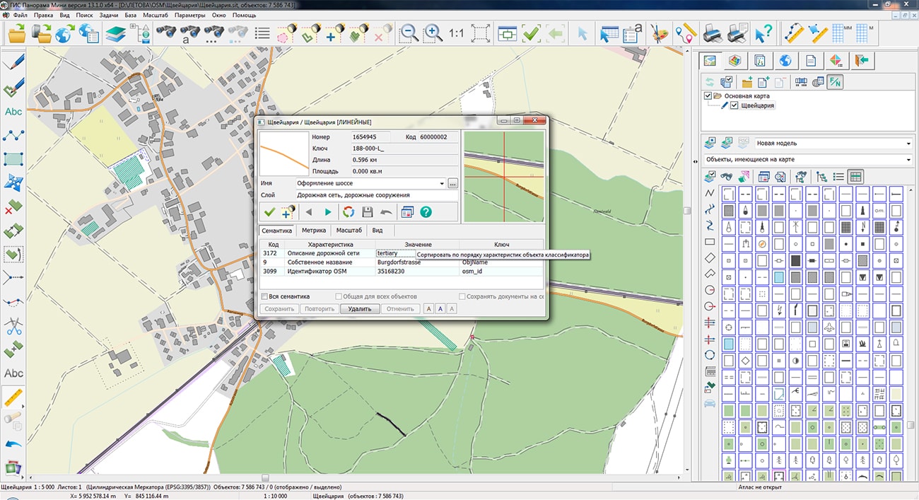
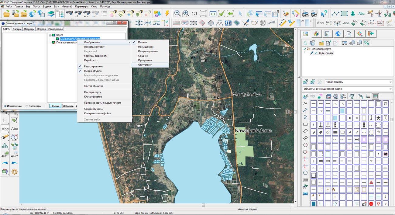
The geoportal have been supplemented with maps of Switzerland and Sri Lanka, formed according to OpenStreetMap data. Source data obtained from Geofabrik website. To work with the maps, you can use the program or other software products of KB "Panorama".
The map was led to the modernised classifier of large-scale plans of scale 1: 5 000 (map5000m.rsc). Publishing of updates in bank of spatial data is made by using the program of .
Publishing contents of bank of spatial data on the geoportal and data access for downloading are implemented by means of .
Free maps on the basis of OpenStreetMap data are available for download on the page "Digital maps".


In KB "Panorama" the GIS Constructor for Qt Designer SE has been developed for operating systems CentOS, Ubuntu, Astra Linux SE. The toolkit is adapted for work on a wide range of operating systems (Astra Linux SE, ALT Linux, Elbrus, Ubuntu, CentOS, QNX) and architectures (Intel, Elbrus, PowerPC, SPARC, ARM). The toolkit includes components of visual designing the GIS applications and library of a multiplatform multithreaded GIS core. GIS Constructor provides a cross-platform MAPAPI interface that allows a programmer to implement development in an operating system convenient for it. The developer can release GIS applications for a set of operating systems by simple assembly with minimal changes to the program source code.
In the new version the component "Map passport" has been added, which allows you to create vector maps and edit the data of the already existing passports. The component provides the ability to create new maps with automatic filling of projection parameters using the EPSG code, editing map metadata and transformations. In the "Print" dialog, the ways of setting the print scale have been expanded: stretch horizontally or vertically, stretch to page, fit the page, split by page. In the dialog "Data contents" there is added the ability to view the image and parameters of the projection of spatial data. Pyramids of tiles BIR, GPKG, multiscale packed maps MAPZ, MPTZ, SITZ are supported.
CentOS 8 is a community-supported Linux distribution based on the Red Hat Enterprise Linux source code. The main objective of the distribution is to provide a stable, predictable, manageable and reproducible platform for various fields of activity. Due to its large package base, stability and community support, this distribution is popular not only for workstations, but also for various servers, scientific data processing platforms and many other areas.
GIS Constructor is a set of geoinformation components for use in the visual programming environment of Qt Designer, which allows you to develop your own GIS applications. The visualization of the contents of digital maps is made in conventional symbols adopted for topographic, geographical and various special maps. Geoinformation system has ample opportunities for performing calculations, for providing display of spatial data on various graphic devices in standard and user systems of conventional symbols. The main functions can be executed in multithreaded mode. It supports automatic optimization of used memory for processing large amounts of data (tens of gigabytes) on limited resources (hundreds of megabytes).
The new version of the program is available for download in the section.


In KB "Panorama" the version 13.7.0 has been developed. In the new version a support of dynamic digital updating of territory has been expanded. The service supports technologies for creating and tracking spatial objects in near-real time mode, used in projects such as the "smart city". The use of GIS WebService SE in conjunction with in the program for digital transformation of the economy will reduce the financial and time costs of the company, increase the reliability and availability of spatial data.
In order to reduce the amount of transmitted data and increase the speed of data processing on the client, a support for multilevel geometry of objects has been added into the service. The volume reduction is achieved by filtering the geometry of objects and giving the client an already reduced number of points. There is implemented a support for searching for objects by mpt projects consisting of various classifiers.
Into service the requests for the issuance of documents and maps-schemes have been added. This document is the appendix to the documentation containing the information of cartographical character. On the map-scheme, over the main map, there is put a graphical detailing of program elements, such as power lines, substations and others. In the program the request for constructing thematic maps from the has been improved. The created map saves all the selected objects and characteristics of the main map, on which the request is built. New request for getting a list of virtual folders from the GIS Server has been added.
The interface of administrator has been improved. The new group of the data - databases SQLite was added. Logging of actions of service administrators has been implemented. Ability has been added to configure access rights to service operations by groups. Queries for working with dbm databases have been improved. Support for mpt projects consisting of many dbm files has been added.
In order to improve the security of working with data, requests from the "Service operations" group are available only to service administrators. Ability to write messages into the system log has been added. Transaction requests have been improved to allow the transfer of repeated semantic characteristics of objects.
GIS WebService SE supports all international standards (OGC WFS, WFS-T, WMS, WMTS, WCS), which are used to transfer and display spatial data. The program implements the ability to issue tiles for any user or local coordinate system. The application is implemented on Windows and Linux platforms and is compatible with Apache, IIS and nginx web servers.
The new version of the program and documentation are posted on the website in the section.


In KB "Panorama" the version 13.0.8 has been developed for creation of GIS-applications in the environment of C ++ Builder, Delphi Embarcadero. The new version allows significantly to speed up process of visualisation of the big data having a geographical binding. To display events on the background of the map the small images (pictograms) can be used. There can be a large number of such pictograms in the map (tens of thousands) and a caching mode has been added to display them, which reduces the time for a complete map drawing. The image for the map object is set in the classifier editor (it is called through the TMapRsc component). It is possible to specify a link or a graphic file in png, bmp, jpeg and tiff format as an object view. For greater clarity of the map, you can change the external view of the sign depending on one or two characteristics of the object.
To display densely spaced point signs, an automatic clustering algorithm has been implemented. If more than one object of a given type is located nearby, their conventional symbols will be automatically replaced with a conventional cluster symbol, the center of which will have the averaged coordinate of the objects included in it. When you change the scale, the cluster configuration automatically changes. If the map is very loaded, it is possible to combine signs of similar meaning into groups and, when the conditions are met, display one - generalizing, instead of several signs.
To track the occurrence moment of an event, it is possible to create objects, the view of which changes depending on time. The object will change its view after a termination of certain period.
The GIS ToolKit consists of a set of visual components (supplied in source code) and API functions of the GIS core for direct access to spatial data. The toolkit is intended for the development of client-server and desktop 32-bit and 64-bit applications that require processing and visualization of spatial data. Spatial data can be located both at the workplace (direct access to data), and in the local network or the Internet (components of access to the or data exchange using international protocols are used).
The new version of the program is available for download on the page.


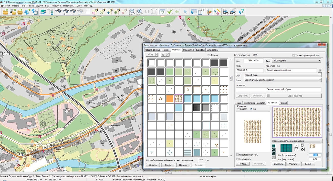
The geoportal has been supplemented with maps of the Republic of North Macedonia and the Grand Duchy of Luxembourg, formed according to OpenStreetMap data. Source data obtained from Geofabrik website. To work with the map, you can use the program or other software products of KB "Panorama".
The map was led to the modernised classifier of large-scale plans of scale 1: 5 000 (map5000m.rsc). Publishing of updates in bank of spatial data is made by using the program of . Publishing contents of bank of spatial data on the geoportal and data access for downloading are implemented by means of .
Free maps on the basis of OpenStreetMap data are available for download on the page "Digital maps".


Ph.: +7 (495) 739-0245, +7 (925) 221-1603
www.gisinfo.ru | panorama@gisinfo.ru
105005, Russia, Moscow, Baumanskaya Street 7, building 1, office 229 (m. Baumanskaya)
Copyright © Panorama Group 1991 - 2024


 Mobile version
 Full version