Copyright © Panorama Group 1991 - 2024

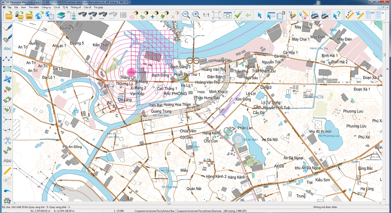
The geoportal has been supplemented with a map of the Socialist Republic of Vietnam, formed according to OpenStreetMap data. Source data obtained from website. To work with the map, you can use the GIS Panorama Mini program or other software products of KB "Panorama".
The map was led to the modernised classifier of large-scale plans of scale 1: 5 000 (map5000m.rsc). Publishing of updates in bank of spatial data is made by using the program of . Publishing contents of bank of spatial data on the geoportal and data access for downloading are implemented by means of .
Free maps on the basis of OpenStreetMap data are available for download on the page "Digital maps".


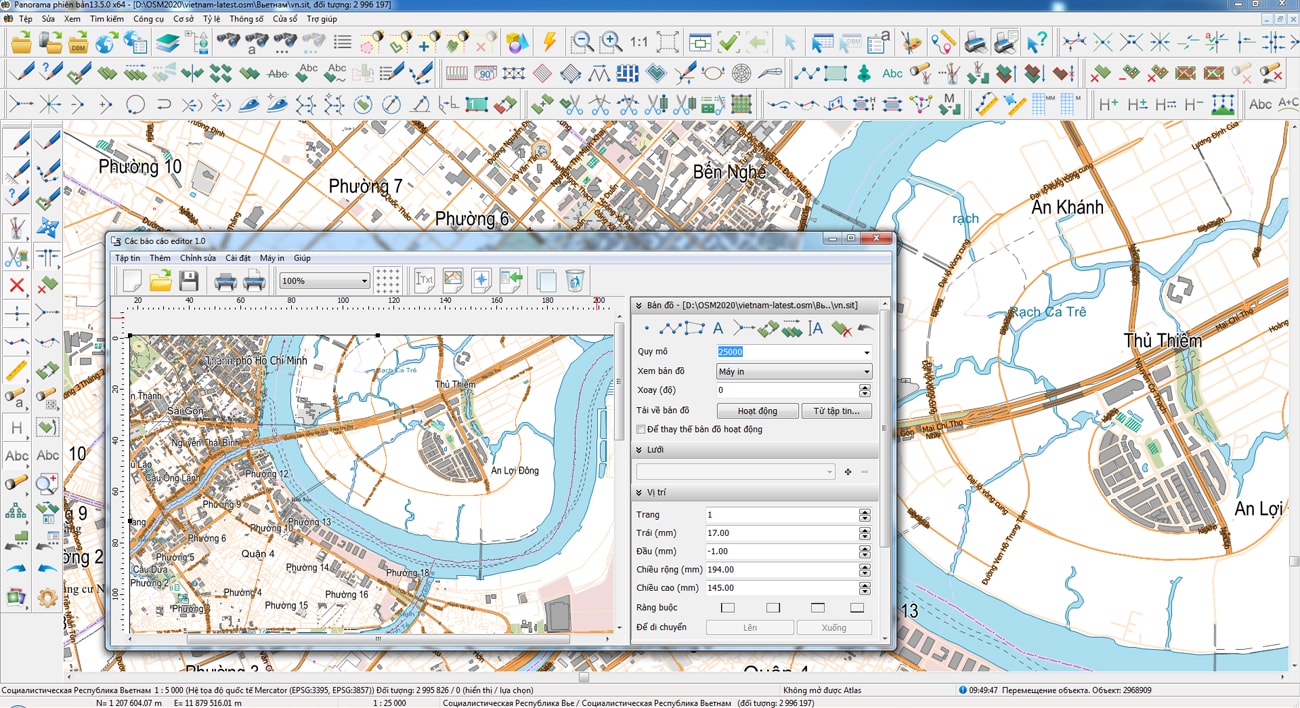


In KB "Panorama" the training materials have been prepared for developers of web-components in the environment. Development tools the GIS WebToolKit SE and SDK are used for creation of client-server web applications. In the documentation "GIS WebServiсe SE the system programmer's guide" in the chapter "Development and connection of libraries for executing extended REST requests" the order of creation and use of web-component is described.
Web-components can be of two types. The first type processes data on the client without accessing external services. For example, calculation of the area and length of object by its coordinates in the GeoJSON format, received on WFS-request from another component. Such component is implemented as JavaScript on the client. Another type of component requires interaction with a web service to process large amounts of spatial data located on the server and available for reading and updating by many users simultaneously.
For example, the server hosts matrix and vector geo-covers with relief over large areas. It is necessary to determine the height of a point by its coordinates on the ground. GIS WebService SE can use the functions of the MAPAPI interface, which provide automatic analysis of data available at a given point, selection of a source with the highest accuracy to determine the height at a point, performing geodetic calculations and interpolation of values by the surrounding objects. To take advantage of these tools, a new REST request is added into the web service on the basis of a set of SDK libraries written in C ++. SDK GIS WebServiсe SE automates analysis of request parametres, loads library and a method for its processing, provides access to the spatial layers published on service, and forms the service response (xml, json and others). On the web client side in JavaScript, input of request parametres and displaying the result are implemented.
The updated documentation uses examples to show how to add a new request to the GIS WebService SE and call it from the side. The examples are implemented using the GIS WebToolKit SE JavaScript client scripts library and run in a web browser.
In the first example, a button is added into the control panel to invoke the panel "Get Geo-Coverage value at a point". When you select a point on the map, the height value of the specified point is displayed in the table. Data exchange is performed via the GetCoveragePoint REST request added into the GIS WebService SE. The request is processed by a custom library written in C ++ and connected to the service.
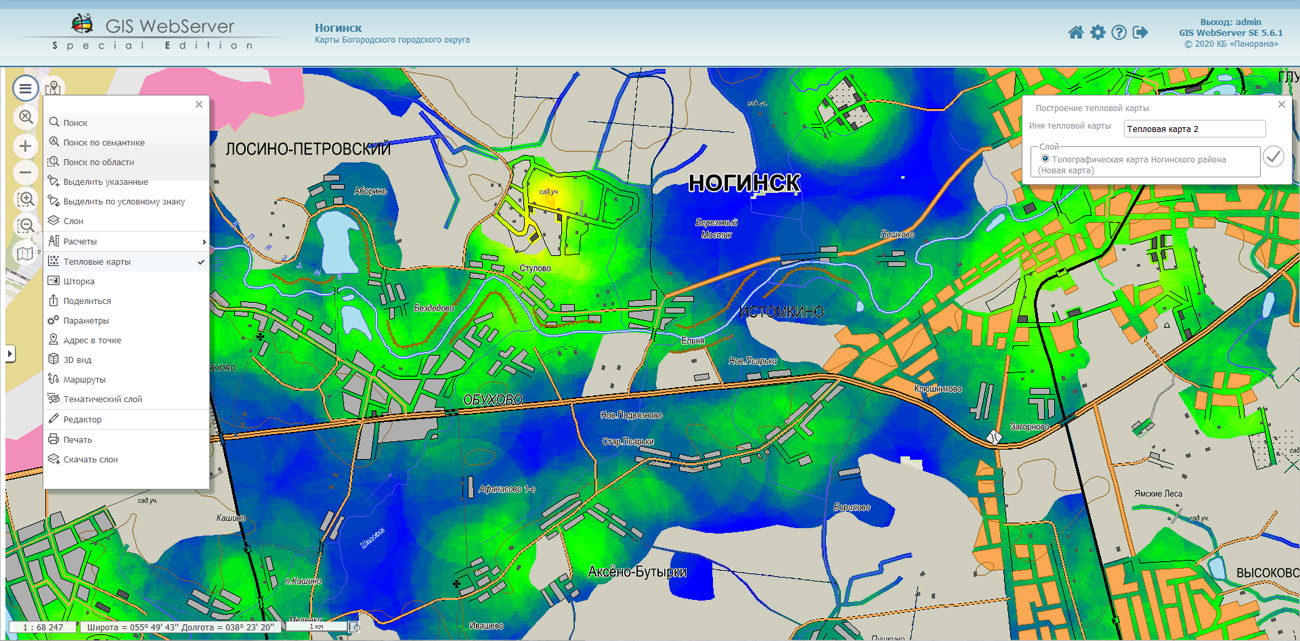
In the second example, a button is added to the control panel to invoke the panel "Building a heat map". On the panel the parameters of for building a heat map are set. Clicking on the "Build" button will display the heat map as a separate layer. Building a heat map is performed on the server using the BuildHeatMap REST request. The lifetime of the layer is determined by the request parameters or the service settings.
GIS WebService SE supports all international standards (OGC WFS, WFS-T, WMS, WMTS, WCS), which are used to transfer and display spatial data. The program implements the ability to issue tiles in a user or standard coordinate system. The application is implemented on Windows and Linux platforms and is compatible with Apache, IIS and nginx web servers.
Training materials are available on the website in the Documentation section.


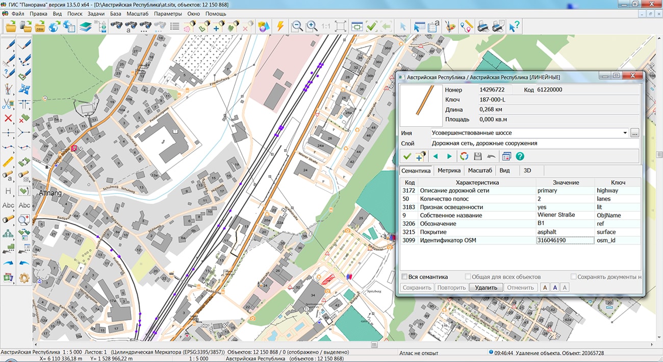
The geoportal has been supplemented with a map of the Republic of Austria, formed according to OpenStreetMap data. Source data obtained from website. To work with the map, you can use the GIS Panorama Mini program or other software products of KB "Panorama".
The map was led to the modernised classifier of large-scale plans of scale 1: 5 000 (map5000m.rsc). Publishing of updates in bank of spatial data is made by using the program of Databank of digital maps and remote sensing data. Publishing contents of bank of spatial data on the geoportal and data access for downloading are implemented by means of GIS WebServer SE.
Free maps on the basis of OpenStreetMap data are available for download on the page "Digital maps".


In KB "Panorama" the version 13.5.0 is developed. In the new version there is added an automatic formation of registration number of the document by a technique developed by Minstroy of Russia in accordance with the Decree of the Government of the Russian Federation № 279 dated March, 13th 2020г "On information support of urban planning activity". Provides accounting of urban planning information, documents and materials in accordance with the technical requirements for maintaining the GISOGD registers. Urban planning information is placed in specialized sections of the ISOGD with the ability to establish a spatial reference of documents on the duty cadastral map.
In addition to structured accounting of documents and materials, the program allows you to accumulate information about land plots, real estate, premises, engineering networks and other infrastructure facilities. Boundaries and cadastral information about accounting objects are created on the basis of electronic XML documents provided from the Unified State Register of Real Estate, using the mode "Reading the cadastral plan of the territory and updating the map".
The new version implements support for the XML scheme used for formation of the XML document - an extract about a zone with special conditions of using the territories, the territorial zone, the territory of the cultural heritage site, the territory of priority social and economic development, the zone of territorial development in the Russian Federation, gambling zone, forestry, forest park, a specially protected natural area, a special economic zone, a hunting ground, a coastline (border of a water object), a land surveying project in electronic form. Storage and collective use of the cadastral map located in relational DBMS are supported. To provide access to the contents of spatial databases (DB), the "Open a map DBM" mode is intended.
Urban planning information about accounting objects is associated with the register of documents and materials ISOGD. The established spatial-logical links between the registries provide a quick and visual search for the necessary information. The appearance of buttons located on the control panel of urban planning tasks has been updated with the use of a single corporate style "Panorama".
To get acquainted with the capabilities of the "Workstation of urban planner", a demo example has been developed, which includes a project of maps and a database of urban planning information, documents and materials. For a remote connection, you must use the IP addresses and parameters specified in the documentation.


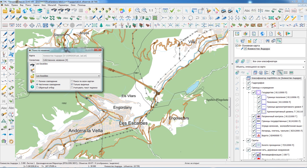
The geoportal has been supplemented with a map of the Principality of Andorra, formed according to OpenStreetMap data. Source data obtained from website. To work with the map, you can use the program or other software products of KB "Panorama".
The map was led to the modernised classifier of large-scale plans of scale 1: 5 000 (map5000m.rsc). Publishing of updates in bank of spatial data is made by using the program of . Publishing contents of bank of spatial data on the geoportal and data access for downloading are implemented by means of .
Free maps on the basis of OpenStreetMap data are available for download on the page "Digital maps".


Ph.: +7 (495) 739-0245, +7 (925) 221-1603
www.gisinfo.ru | panorama@gisinfo.ru
105005, Russia, Moscow, Baumanskaya Street 7, building 1, office 229 (m. Baumanskaya)
Copyright © Panorama Group 1991 - 2024


 Mobile version
 Full version