Copyright © Panorama Group 1991 - 2024

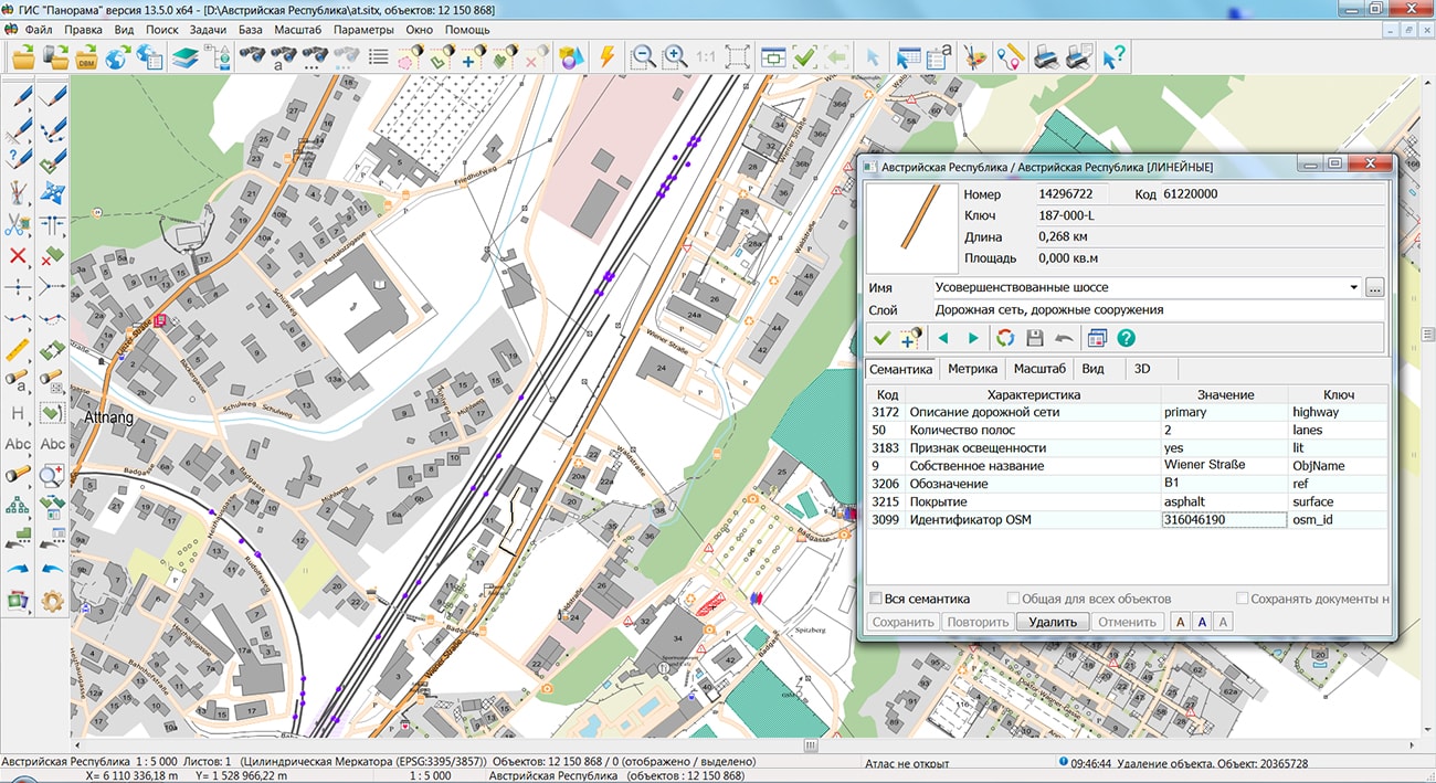
The geoportal has been supplemented with a map of the Republic of Austria, formed according to OpenStreetMap data. Source data obtained from website. To work with the map, you can use the GIS Panorama Mini program or other software products of KB "Panorama".
The map was led to the modernised classifier of large-scale plans of scale 1: 5 000 (map5000m.rsc). Publishing of updates in bank of spatial data is made by using the program of Databank of digital maps and remote sensing data. Publishing contents of bank of spatial data on the geoportal and data access for downloading are implemented by means of GIS WebServer SE.
Free maps on the basis of OpenStreetMap data are available for download on the page "Digital maps".


In KB "Panorama" the version 13.5.0 is developed. In the new version there is added an automatic formation of registration number of the document by a technique developed by Minstroy of Russia in accordance with the Decree of the Government of the Russian Federation № 279 dated March, 13th 2020г "On information support of urban planning activity". Provides accounting of urban planning information, documents and materials in accordance with the technical requirements for maintaining the GISOGD registers. Urban planning information is placed in specialized sections of the ISOGD with the ability to establish a spatial reference of documents on the duty cadastral map.
In addition to structured accounting of documents and materials, the program allows you to accumulate information about land plots, real estate, premises, engineering networks and other infrastructure facilities. Boundaries and cadastral information about accounting objects are created on the basis of electronic XML documents provided from the Unified State Register of Real Estate, using the mode "Reading the cadastral plan of the territory and updating the map".
The new version implements support for the XML scheme used for formation of the XML document - an extract about a zone with special conditions of using the territories, the territorial zone, the territory of the cultural heritage site, the territory of priority social and economic development, the zone of territorial development in the Russian Federation, gambling zone, forestry, forest park, a specially protected natural area, a special economic zone, a hunting ground, a coastline (border of a water object), a land surveying project in electronic form. Storage and collective use of the cadastral map located in relational DBMS are supported. To provide access to the contents of spatial databases (DB), the "Open a map DBM" mode is intended.
Urban planning information about accounting objects is associated with the register of documents and materials ISOGD. The established spatial-logical links between the registries provide a quick and visual search for the necessary information. The appearance of buttons located on the control panel of urban planning tasks has been updated with the use of a single corporate style "Panorama".
To get acquainted with the capabilities of the "Workstation of urban planner", a demo example has been developed, which includes a project of maps and a database of urban planning information, documents and materials. For a remote connection, you must use the IP addresses and parameters specified in the documentation.


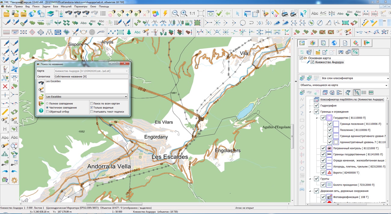
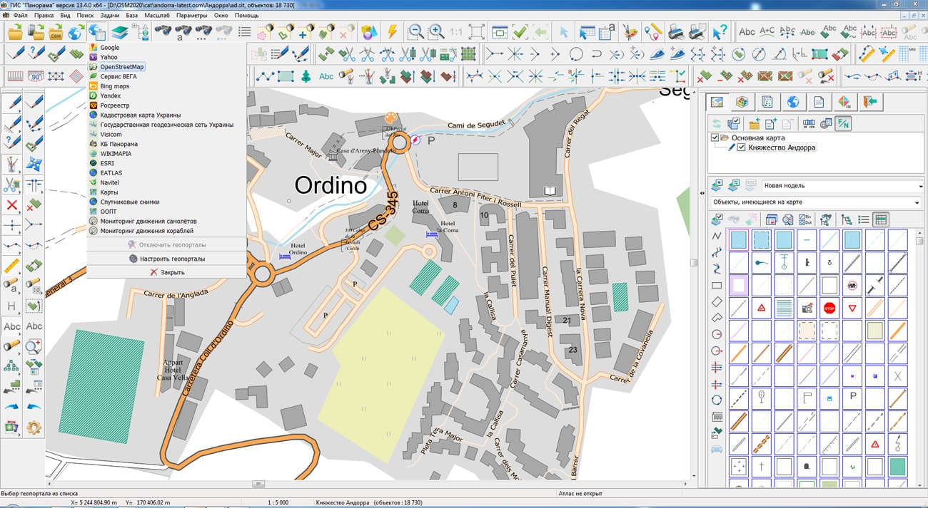
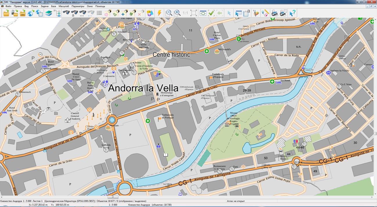
The geoportal has been supplemented with a map of the Principality of Andorra, formed according to OpenStreetMap data. Source data obtained from website. To work with the map, you can use the program or other software products of KB "Panorama".
The map was led to the modernised classifier of large-scale plans of scale 1: 5 000 (map5000m.rsc). Publishing of updates in bank of spatial data is made by using the program of . Publishing contents of bank of spatial data on the geoportal and data access for downloading are implemented by means of .
Free maps on the basis of OpenStreetMap data are available for download on the page "Digital maps".


In KB "Panorama" the "Workstation of cadastral engineer" version 13.5.0 has been developed. In the new version for processing cadastral information provided in the form of electronic XML documents from the EGRN, the algorithm for reading data and updating the cadastral map has been changed. The updates are aimed at improving the identification of cadastral objects and increasing the speed of data processing when updating an existing map. Controls were added for updating the cadastral map, including: updating, replacing and adding objects. When updating, a search for existing objects is performed and their metrics and semantics are updated with up-to-date information. When replacing, the map is cleared and filled with new relevant data. When adding to existing objects, new actual data are added.
Storage and collective use of the cadastral map located in a relational DBMS is supported. For providing access to contents of spatial databases (DB) the mode "Open a map DBM" is intended. To display spatial data (table, view or the result of an SQL query) in the form of a cartographic image, a file of DBM format is used, which contains a description of the parameters of a digital map.
In EGRN for identifying external contours of a multi-contour land plot, the cadastral number of the land plot and registration number of a contour are provided, and for zones and borders, the designations of external contours are not provided. This feature does not allow correctly to set a correspondence between objects that characterize external contours on the updated map and information in the XML file. The new version of the program implements an algorithm for identifying multi-contour cadastral objects for land plots, territorial and special zones, boundaries of territories and natural objects with automatic generation of the registration number of the outer contour. Indexing of objects of the updated map by identification data (cadastral or registration number and registration number of the contour) has been implemented. Map indexation increases speed of searching existing objects for their updating, especially at updating the map containing more than a hundred thousand objects.
New possibilities have been added in the dialog "Forming the signatures of characteristic points of borders". To identify characteristic points of borders, a copying of the semantics values of the initial cadastral objects into the semantics of the points has been implemented. For variability of placing the signatures of the created dot signs characterising borders of cadastral objects, formation of signatures vertically and along a bisector of angle of adjacent metrics segments of initial object is provided.
The new version of the program is available on the website in the Download section.


The geoportal has been supplemented with a map of the Italian Republic, formed according to OpenStreetMap data. Source data obtained from website. The composition includes 5 territories: Islands, the Northeast, the Northwest, the Center and the South. To work with maps, you can use the program or other software products of KB "Panorama".
The map was led to the modernised classifier of large-scale plans of scale 1: 5 000 (map5000m.rsc). Publishing of updates in bank of spatial data is made by using the program of . Publishing contents of bank of spatial data on the geoportal and data access for downloading are implemented by means of .
Free maps on the basis of OpenStreetMap data are available for download on the page "Digital maps".


Ph.: +7 (495) 739-0245, +7 (925) 221-1603
www.gisinfo.ru | panorama@gisinfo.ru
105005, Russia, Moscow, Baumanskaya Street 7, building 1, office 229 (m. Baumanskaya)
Copyright © Panorama Group 1991 - 2024


 Mobile version
 Full version