Copyright © Panorama Group 1991 - 2024

In KB "Panorama" the digital classifier of conventional symbols has been developed for the preparation of cartographic information in the field of civil defense, prevention and liquidation of consequences of emergencies by governing bodies, civil defense forces and the unified state system for the prevention and liquidation of emergency situations (RSChS). The classifier is created in accordance with the requirements of GOST R 42.0.03-2016 "Civil defense. Rules for mapping the predicted and current situation in the conduct of military conflicts and emergency situations of a natural and man-made nature. Conventional symbols". GOST R 42.0.03-2016 was approved and entered into force by order of the Federal Agency for Technical Regulation and Metrology of June 29, 2016 № 728-st instead of GOST R 22.0.10-96.
In the classifier there is implemented a general list of layers, objects and attributive characteristics of objects that provide solutions to problems in the field of civil defense (CD), prevention and response to emergency situations (ES) of natural and man-made nature and contains information:
- about territories, zones, objects, forces and means affecting the problems of organization, planning and conduct of measures for civil defense and the protection of the population and territories;
- about the forecast and operational situation arising in the course of military conflicts or as a result of these conflicts, as well as during emergencies of a natural and man-made nature;
- about planning and conducting activities on civil defense, prevention and liquidation of consequences of emergencies of a natural and man-made character.
The digital classifier is included into the software package and is available for download in the "Classifiers" section.


On the geoportal , the maps of the Yaroslavl and Kostroma regions, which were formed according to OpenStreetMap data, were updated. Source data were obtained from the website. For work with the maps it is possible to use the program of or other software products of KB "Panorama".
The maps were led to the modernised classifier of large-scale plans of scale 1: 5 000 (map5000m.rsc). Publishing of updates in bank of spatial data is made by using the program of . Publishing contents of bank of spatial data on the geoportal and data access for downloading are implemented by means of .
Free maps on the basis of OpenStreetMap data are available for download on the page "Digital maps and images".


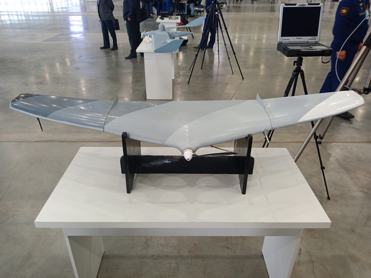
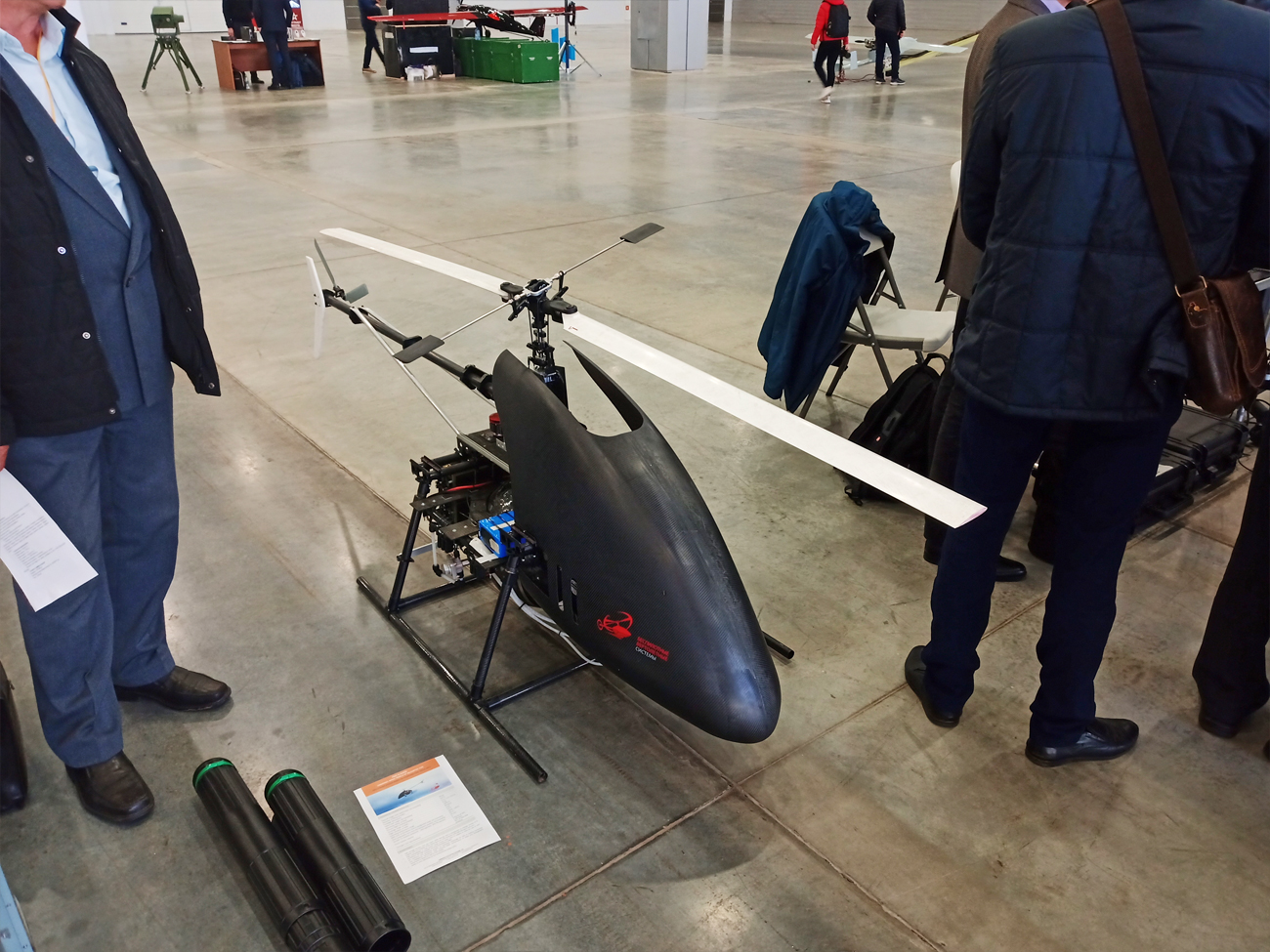
On October, 2nd, 2019 in the the was held. The event was organized by the Directorate (construction and development of the system of using the unmanned aerial vehicles) of the General Staff of the RF Armed Forces and the Center (research, combat use and military tests of unmanned aircraft) 924 of the State Center for Unmanned Aviation of the Russian Federation Ministry of Defense.
The conference was attended by representatives of research, production and educational organizations. Active attention to the topics of the conference on the development of domestic systems with UAVs was shown by representatives of the central command and control bodies of the armed forces, of all types and branches of the armed forces.
Specialists of KB "Panorama" presented technologies for creating and updating digital topographic maps and photoplans based on data from unmanned aerial vehicles using the GIS "Operator" and other software products of KB. The report "From the image to the map" was recognized as the best and awarded with a diploma signed by the head of the Directorate (construction and development of the system of using the unmanned aerial vehicles) of the General Staff of the Armed Forces of the Russian Federation, Major General A. Novikov.
The conference worked in the mode of meetings of four specialized sections, at which the issues of development, testing and application of complexes with UAVs were considered. After the conference, its participants visited the exhibition-exposition of complexes with unmanned aerial vehicles.


On the geoportal , the maps of the Bryansk and Ivanovo regions, which were formed according to OpenStreetMap data, were updated. Source data were obtained from the website. For work with the maps it is possible to use the program of or other software products of KB "Panorama".
The maps were led to the modernised classifier of large-scale plans of scale 1: 5 000 (map5000m.rsc). Publishing of updates in bank of spatial data is made by using the program of . Publishing contents of bank of spatial data on the geoportal and data access for downloading are implemented by means of .
Free maps on the basis of OpenStreetMap data are available for download on the page "Digital maps and images".


In KB "Panorama" the new version of is developed in which the software module of the automated generalization and updating of digital topographic maps (DTM) is implemented. The presentation illustrates the possibilities of the software product for cartographic generalization.
In the software module a processing of large regions of maps is accelerated. On a computer with average performance the automatic conversion of 36 sheets of a map of scale 1: 100 000 into 9 sheets of a map of scale 1: 200 000 takes less than two hours (up to 15 minutes per sheet). And with it there are performed a filtering and generalizing the contours of objects, transformation of the narrow areal rivers into linear ones, an assigning the thickness of the rivers (with thickening from source to mouth), a restricting the boundaries of visibility of rivers and roads of low significance, selecting buildings in compact planning, a leveling the buildings along roads, a creating the objects of the mathematical basis, a signing the objects with new types of symbols according to the semantics of objects.
The processing of small reservoirs has been accelerated, during the processing of which the search for adjacent cover objects (forests, meadows) and the uniting the removed small reservoirs with adjacent cover objects are performed. The uniting is performed if there is the presence of a significant area (contour) of adjacency of the analyzed objects.
Customizing filters of the objects processed at formation of an output map is simplified. The new method allows to perform faster and more flexible customization of the objects types copied onto the output map. The quality of signing the names of settlements has been improved: a new algorithm for selecting a place for signing perform a search for the most free place from the contours. New signatures are implemented in the form of vector symbols containing complex signatures that are used to sign characteristics of bridges, dams, locks, ferries, fords, forests, settlements and other objects. Complex signatures allow you to automatically adapt the type of signature taking into account the presence or absence of objects characteristics. It is enough to add, delete or change the semantics of such symbol and the type of signature automatically changes. This approach allows you to completely replace obsolete types of characters with the localization of "Mixed" with vector symbols.
You can familiarize yourself with the presentation materials on the automated generalization of digital topographic maps in the GIS "Panorama" on the website in the section.


Ph.: +7 (495) 739-0245, +7 (925) 221-1603
www.gisinfo.ru | panorama@gisinfo.ru
105005, Russia, Moscow, Baumanskaya Street 7, building 1, office 229 (m. Baumanskaya)
Copyright © Panorama Group 1991 - 2024


 Mobile version
 Full version