Copyright © Panorama Group 1991 - 2024

In KB "Panorama" the version 12.7.2 for x64 platform was developed.
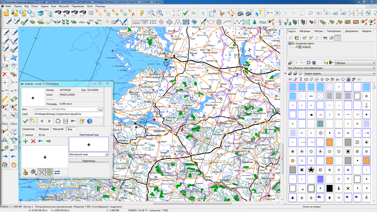
In the new version of the program on the basis of classifiers of digital topographic maps (DTM) of 1:50 000 and 1: 100 000 scales, modernized classifiers 50t05gm.rsc and 100t05gm.rsc were prepared, intended for the automated generalization and automation of the creating and updating DTM. The modernized DTM combines the basic properties of a topographic and navigation map. With the help of the task "Creating of passages in settlements" and prepared classifiers, streets and passages in settlements are automatically formed. Tools of automated control and correction of the quality of digital maps provide control of the topology according to the metrics of objects. By created streets and passages along with the road network objects when solving Navigation tasks a graph of roads is formed. A complete road and street network in settlements increases the degree of automation in the forming the maps of smaller scales (generalization). Significantly the composition of the layers is reduced by combining the data of the same type. The order of displaying objects in the classifier is set in accordance with the priority of the layers and the priority of objects in the layer, which makes it unnecessary to use additional layers. In the properties of some objects that are not used in practice when creating a DTM based on remote sensing data, the sign "Obsolete object" is set. Obsolete objects are not displayed in the objects list of the "Create object" dialog, unless the "Obsolete objects" field is enabled. This allows you to store in classifier the objects from the obsolete classifiers "05" and "09" for compatibility, but not display them when creating and updating the map to facilitate the selection of actual types of objects. For the automatic formation of labels using the task "Automatic labels alignment", the corresponding labels are customized according to the semantics of the objects.
The task "Geodesy Editor" is improved. The modes "Union of objects" and "Numbering of objects, in rows" have been developed. New modes are included into the panel "Processing of attributes of objects". The mode "Union of objects" is intended for automatic processing of selected objects, taking into account the value of one or several semantics that uniquely identify the object of accounting. The "Numbering of objects, in rows" mode is intended to form a unique object number using the algorithm of numbering from west to east, by rows from north to south.
The mode "Loading of cadastral data from file XML" is improved. The creation of multipolygons for parts of the section with several external contours is implemented. The mode "Land survey plan" is improved. When specifying the location of the border and/or area of a single land use, the rounding of the area value for information about the isolated land plot in its composition is performed up to two characters after the decimal point. Implementation is extremely important for land plots with a small area (less than one square meter). The mode "Technical building plan" is refined. The functions of editing location information have been changed to correctly record the names of the municipality and settlement for rural and urban settlements. Changes are made to the order of filling the area value in the XML file at the state cadastral registration of changes in the building - if the area has not changed (the value from the semantics coincides with that calculated on the map), then the Area element is not recorded.
In the "Select Object" dialog, new modes have been developed: "Select object on a map" and "Object autosave". The mode "Select object on a map" allows you to mark the selected object on the map. The mode "Object autosave" is intended for automatic saving the attributes and metrics of object with possibility of step-by-step restoration. For semantics of type the link to a file there is added the ability to select a folder. When referring to the semantics value, the dialog for selecting a file from this folder for viewing will be called. For files of zip type, a list of files compressed in the archive is displayed with automatic decompression and display of the selected file.
To simplify the preparation of reports in the "View Passport" dialog, there is added the ability of a map creation by a format of standard printed page with mapping of a frame of the print area in the form of graphic object. The frame of the print area is formed in accordance with the specified indents for the print area. To form a map by page format, select the menu item New\Plan and in the dialog enable property the "Frame by page size". When generating a report, the insets, documents, labels and other elements can be put to the created plan.
In the "Map Print" dialog box, the automatic setting of the parameters of the current printer has been added with the setting of the paper size and the printable area corresponding to the created plan.
There is added the ability to display insets under the vector maps, which simplifies the preparation of reports against the background of map fragments, images and other types of data that are connected as insets. The mode "Create object" of the task "Map Editor" has been improved. When creating an object using the "Arbitrary contour" mode for linear, polygonal and vector objects, the ability of dynamic entering the length of a segment is added.
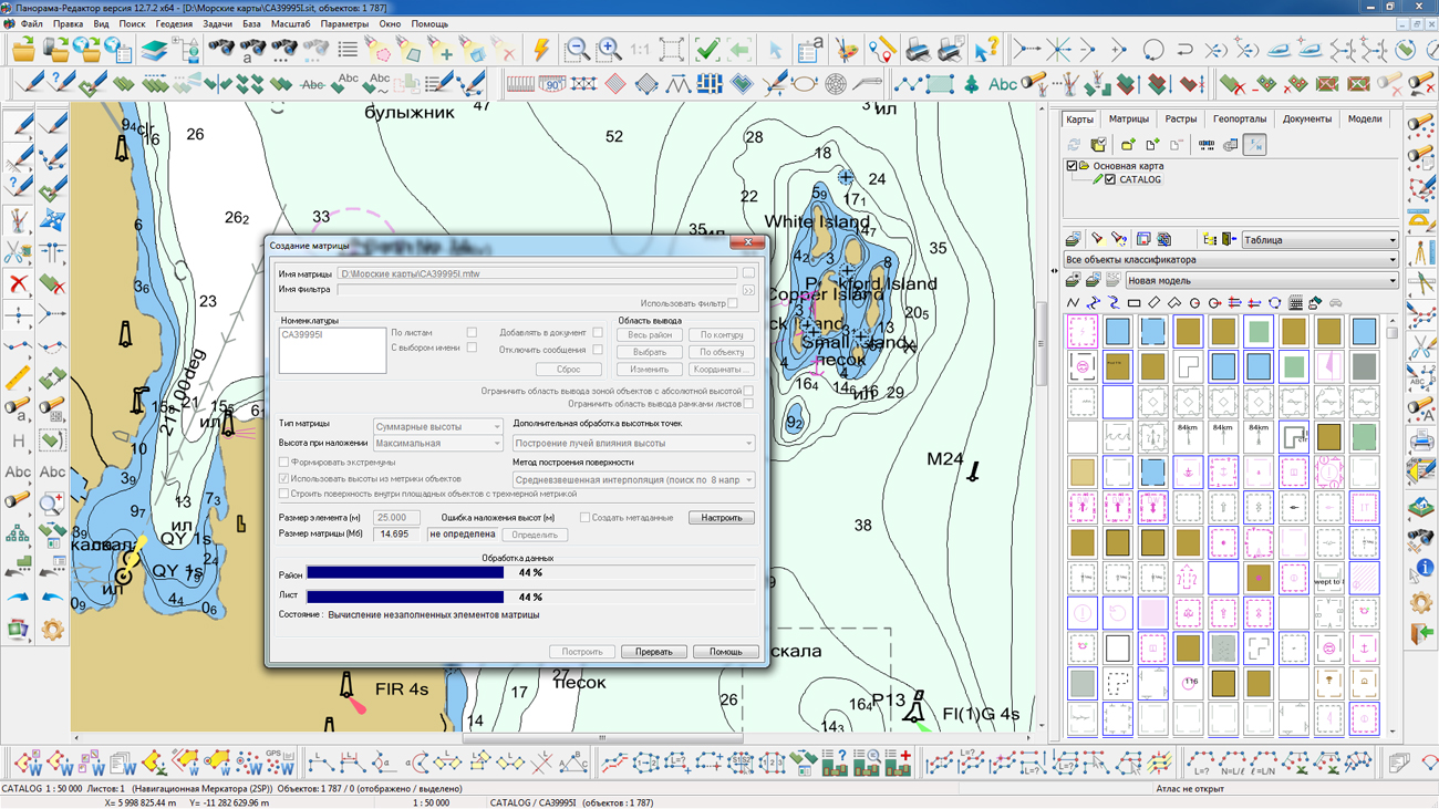
The task of creating a matrix of heights by a vector map is improved. Into the application directory there is added a filter of objects s57navy.imh used by default for creating a matrix of heights by sea maps with the s57navy.rsc classifier. When creating a matrix using sea maps, isobaths are used (semantics the "ISOBATH VALUE", code 174), depths marks (H coordinate from metric), as well as objects of the "OBSTACLE" layer, for example, "UNDERWATER DRYING ROCK", "SUNKEN SHIP" (semantics the "DEPTH VALUE", a code 179). To include the specified objects in the processing in the matrix creation dialog, you need to set the matrix type "Summary elevations" and enable the mode "Use elevations from 3D-metric of objects".
In the menu Options\Coordinate System\Geodetic (World WGS 1984 spheroid) the item "Degrees, Minutes" has been added to display the coordinate view, as in a number of applications for smartphones.
The transformation of the coordinate system of raster and matrix data is accelerated by 10-15 times due to the use of multi-thread processing for multi-core processors and new algorithms for tile processing.
Dialogs for editing conventional symbols of objects are improved. There are added the buttons for copying from one object and inserting into another one of any conventional symbol through the clipboard. A new type of conventional symbol is added: shift line of type the "Color glass". For lines of the type "Set of elements", the ability is added to change the color of all line elements simultaneously and swap the elements. Into dialog of editing a vector symbol the additional marking with the center in a point of a binding is added, which allows you to speed up the process of creating and editing of images of vector symbols.


In KB "Panorama" the version 3.3.4 for the x64 platform was developed. The new version adds the ability to process the type of an object when working by the XSD scheme. If type is specified directly in the XSD-scheme for objects, then there is allowed a repetition of the same code in different layers of the XSD-scheme on the assumption of different type. It provides storage of the objects having one classification code, but different type in different database tables. For example, the linear rivers are in one table, areal rivers with the same code - in another one, and the titles of rivers with the same code - in the third one. Previously, the presence of identical object codes was not allowed when working according to the XSD scheme.
In the program, the process of reading and analysing the XSD-scheme is accelerated in dozens of times. This is implemented by preloading the scheme nodes into RAM. Execution of streaming operations is accelerated due to additional caching of frequently used parameters. There are added the additional checks and corrections of the processed information, which increases the reliability of the program with incorrect data in the database or on the map (incorrect number of metric points, erroneous signs of multipolygon contours, and more). Utility, that is a part of the Panorama SpatialDB Service, for obtaining a SQL-script for creating a database structure according to the XSD-scheme is updated.
In Panorama SpatialDB Service, a separate process is allocated for working with each individual map. In case of failure and interruption of one process, the remaining processes will continue to work in normal mode. The program has the ability to automatically detect and restart the problem process.
Panorama SpatialDB Service is a service program that works as a client of . It provides the display of spatial databases in the form of vector maps in the adopted conventional symbols. The program performs updating of databases when editing a vector image, as well as updating the image when changing records of spatial databases. With the help of Panorama SpatialDB Service spatial databases in the form of vector maps can be published for multi-user access on the GIS Server. As a result, server clients get access to these databases and can make certain changes in accordance with their authority - create, edit or delete objects.
Panorama SpatialDB Service tracks changes of the information in a database and actions of users on editing of cartographical representation of this database and carries out synchronization of these changes. Thus, Panorama SpatialDB Service supports in up-to-date state the cartographical representation on the GIS Server of the information of a relational database and provides possibility of viewing and changing this information in a database by the clients of the server. Thus, access to this cartographical representation of a spatial database can be provided both by means of desktop applications, and through web - by means of . GIS WebService SE provides access to the data from base under reports OGC WMS, OGC WMTS, OGC WFS, OGC WFS - T, OGC WCS. The cartographical data can be реплицированы on other servers.


A delegation from the Ministry of Defense of Thailand, led by Vice-Marshal Pibun Voravanpreh, visited . The meeting was held with the assistance of the MIIGAiK Development Fund for Geodetic Education and Science.
Leading technology companies of the Russian geoinformation market: "Rakurs", "Finko" and KB "Panorama" presented their developments in the field of specialized software and aerial photography equipment to specialists of the Defense Ministry of Thailand.
The diversity of the geographical conditions of the Kingdom of Thailand poses difficult tasks for the cartographic software necessary for the development of the country and the security of its borders.
Thai specialists highly appreciated Russian technologies, including the SuperCam unmanned aerial surveying systems, photogrammetric solutions and .
News source:

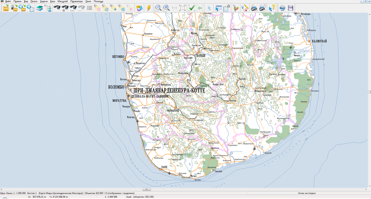
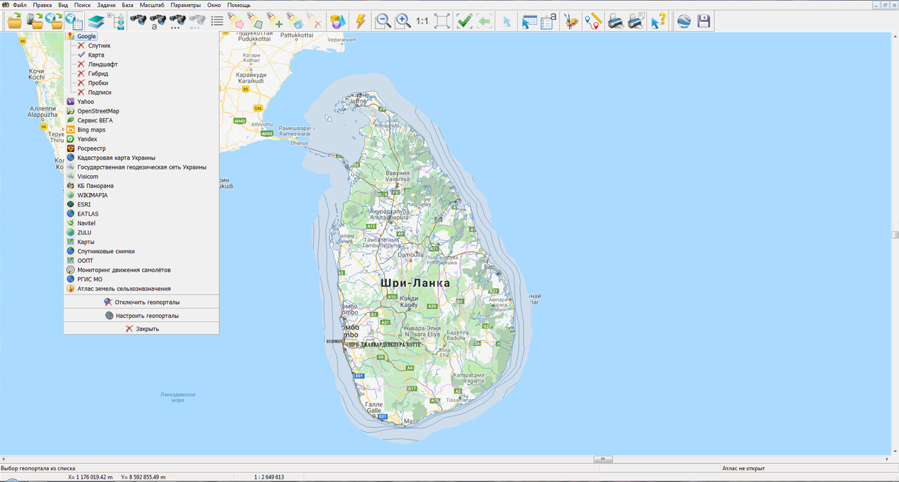
In KB "Panorama" a digital geographical map of 1: 1 000 000 scale in the SXF format for the territory of the Democratic Socialist Republic of Sri Lanka was prepared. obtained according to information from the website has served as source for map's preparation.
The map contains information about the quantity of inhabitants for cities and the names of settlements in Russian. As additional materials the World map of scale 1: 5 000 000 and data of were used. The map is led to the classifier of geographical maps of scale 1: 1 000 000 (1mogk13g.rsc). It can be used for the general estimation of the terrain and studying of an environment, an ensuring of educational process, as a basis for creation of geographical maps of smaller scale, thematic and special maps and solving other tasks.
The map is distributed free according to the free . Digital geographical map of scale 1: 1 000 000 in format SXF is available for downloading on page the "Digital maps and images".


In KB "Panorama" the version 12.4.2 is developed. In the new version of the service the request of forming a transaction log has been added with output in GeoJSON format. It allows you to display a list of modified, deleted and updated objects with the ability to limit the output in time. To increase server performance for all analytical and overlay operations, support for complex XML-RPC queries has been implemented, allowing you to perform several operations simultaneously.
In order to accelerate the display of three-dimensional terrain models used in , a request to build a reduced tile copy of the heights matrix has been added to the service. Tile copy allows you to save resources of the server and the user computer when working in 3D modeling of the Globe. The possibility of publishing spatial data, the names of which in their path contain the symbol "_" is implemented.
GIS WebService SE supports all international standards (OGC WFS, WFS-T, WMS, WMTS, WCS), with the help of which the transmission and display of spatial data is carried out. The program has the ability to issue tiles by any user or local coordinate system. The application is implemented on Windows and Linux platforms, is compatible with Apache, IIS and nginx web servers.
The new version of the program and documentation are available on the website in the section.


Ph.: +7 (495) 739-0245, +7 (925) 221-1603
www.gisinfo.ru | panorama@gisinfo.ru
105005, Russia, Moscow, Baumanskaya Street 7, building 1, office 229 (m. Baumanskaya)
Copyright © Panorama Group 1991 - 2024


 Mobile version
 Full version