Copyright © Panorama Group 1991 - 2024

May 2019 marks the 240th anniversary of the creation of the Moscow State University of Geodesy and Cartography (MIIGAiK). The program of the anniversary year includes a large number of events. Specialists of KB "Panorama" will take part in the and the international scientific and technical conference . The events will be held on the territory of Moscow State University of Geodesy and Cartography from May 27 to 29, 2019.
At the exhibition and conference the new possibilities of technologies of for automating the processes of creation, storage and publication of spatial information in the context of wide application of geoservices will be presented. The updated technology of automated generalization of topographic maps is adapted for application of the data placed on the , including when rendering the object-oriented databases. The supports the storage of various types of digital maps, remote sensing data of the Earth, catalogs of planning-height basis points, materials of engineering survey, including with the support of local coordinate systems. To maintain the base of three-dimensional models, tools for importing 3D data from PHOTOMOD, Geoscan and others programs have been developed.
New possibilities of processing and analyzing three-dimensional terrain models are implemented in desktop and web-based applications. They interact with geoservices and geoportals that can be deployed using software products: , , and others.
In the year of the 240th anniversary of Moscow State University of Geodesy and Cartography, the 100th anniversary of the creation of the Higher Geodesic Administration (VSU) and the development of the cartographic and geodetic industry, which are closely related to the history of MIIGAiK, is celebrated. The conference will be attended by representatives of science, business and government from Russia, the CIS and other countries. The conference will be held with the support of the Ministry of Economic Development of Russia, the Military Topographical Directorate of the Ministry of Defense of Russia, the Federal Registration Service.
Participants of the celebrations at MIIGAiK will be able to familiarize themselves with the software products of the domestic geo-information platform, the application of which solves the problems of limited performance of traditional methods of storing spatial data in the file system, automates the process of updating spatial data and allows you to organize cloud GIS technology.
On the basis of the software of KB "Panorama", geoportals for various purposes have been implemented, such as GIS "Rosseti", , , and others.


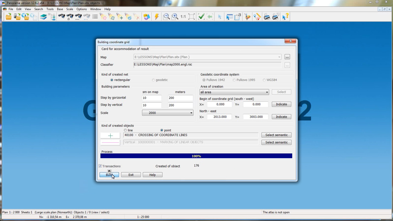
Specialists of KB "Panorama" prepared a video lesson . It is intended for the English-speaking users independently studying possibilities a . It is intended for the English-speaking users independently studying possibilities of the GIS "Panorama". In this lesson a creation of two types of maps is considered. Formation of a mathematical basis for a multi-sheet map and building a coordinate grid for a large-scale map are demonstrated.
From the training material, users will become familiar with the "Create map" dialog, which is started from the "File-New-Map" menu item. After filling all the required fields of the dialog box, you can save the map by giving it a name. To copy the map sheets, use the "View Passport" mode from the "Tools" panel. Creation of a mathematical basis of a map is carried out by means of the mode with the same name in the "Run applications" section. The final part of the video lesson demonstrates the creation of a simplified scale plan, the start of the mode is available from the menu item "File-New-Plan".
Previously other video lessons of this series were published: , , , , , .
You can get acquainted with training materials in English in the section .


KB "Panorama" developed the server software products: version 12.2.1, version 3.9.1, x64 version 8.4.5, version 3.3.3, version 9.5.6, version 8.4, version 4.5.1 for OS Astra Linux SE (release "Smolensk") and "Zarya-Data Center" 1.2. Server applications allow to work with an infrastructure of spatial data of any complexity. They provide access to geodatabase, collection, storage and search of spatial data, allow you to update vector data and tiles. User interface of applications is implemented in Russian, English, French, Spanish and other languages.
On the basis of server software, geoportals of various purposes are deployed: GIS "Rosseti", , and others.
GIS "Rosseti" increases the reliability and efficiency of management of the electric grid complex, distributed over the territory of 77 constituent entities of the Russian Federation. The main task of the GIS "Rosseti" is to provide information support in carrying out work to reduce the likelihood of accidents, technological failures and other abnormal situations, as well as to mitigate their negative consequences.
allows agricultural producers to get access to an agricultural GIS enterprise from anywhere in the world. Geoportal is designed to manage agriculture, provides for the creating an electronic map of the contours of the farm, maintaining a base of soil fertility and electronic corded book of field history.
was developed by the company's specialists within the framework of preparation for the VIII International Salon "Integrated Security 2015". The web application provides systematized information about the resources of the Unified State System for the Prevention and Response to Emergencies (RSChS) and about the objects of the economy and infrastructure in the territory of the Russian Federation.
Server solutions of KB "Panorama" provide users with the opportunity to use cloud technologies and provide access to spatial information from anywhere in the world from smartphones, tablets, personal computers. Applications are implemented on Windows and Linux platforms, are compatible with Apache, IIS and nginx web servers and support PHP versions 5, 6 and 7.
New versions of programs are available for download on the website in the section.


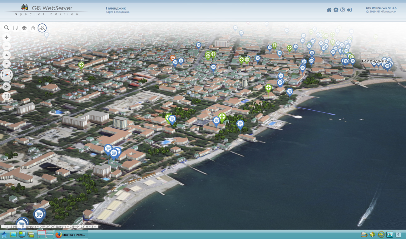

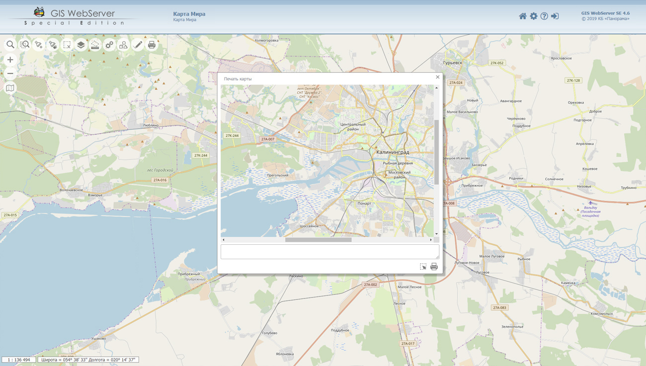
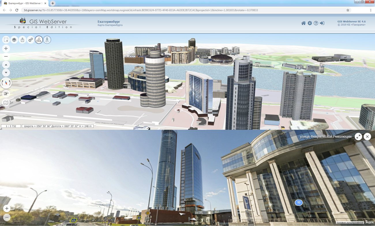
In KB "Panorama" the version 4.6 is developed. In the new version of the program "the Panorama" component is added. It allows you to display panoramic images of Yandex.Maps together with the map. With its help it is possible to arrange a virtual walk - to see the sights of cities and their suburbs, to get acquainted with road junctions and road signs. Panoramas are displayed in accordance with the terms of use of the Yandex.Maps API.
In the 3D map, the volume of data exchange with the GIS WebService SE service is optimized when receiving tiles of elevations matrixes. In the mode "Viewing from the air" the ability to connect flight routes files is implemented. Users can select a route and start movement along the map on it. Support for PHP version 7 is added.
In the administrator there are updated the user authorization module, application's localization. Tools of errors analysis are expanded - into the program log the information about version, an operating system, current PHP settings is recorded.
The toolkit of developing the Web-applications the GIS WebToolKit SE has been improved, which expands possibilities of GIS WebServer SE and can be integrated into other information systems. Access to data (images, vector maps and terrain information) is provided by Web services using common OGC protocols and ISO standards. Service of GIS WebService SE (OGC WMS/WMTS) provides spatial information in the form of graphic images. Various types of high-altitude data are used as a digital elevation model: matrixes (in the formats SRTM, GeoTIFF, IMG, MTW), TIN-models, point cloud and others. At request the most accurate data onto a specified terrain site with a given resolution is automatically sampled. To transfer data of the digital terrain model to the Web, the WCS protocol is used. The relief data is represented as tiles and cached on the client.
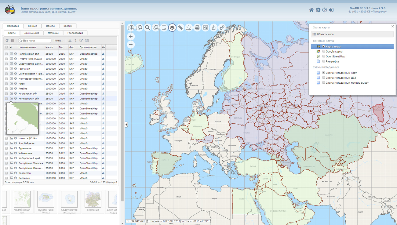
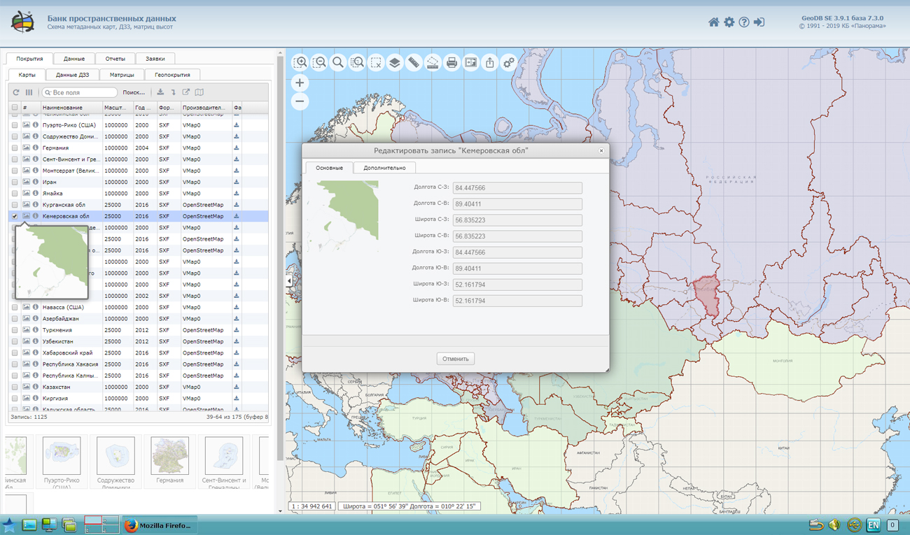
As a source of spatial data, the can be. It provides the collection, storage, search and delivery of spatial data in exchange formats, a displaying the state of the data bank in the form of maps-schemes, the automated formation and updating of geo-covers.
GIS WebServer SE is used in the construction of closed corporate systems to ensure the protection of data having a security classification or a trade secret. GIS WebServer SE is certified for Level 2 of absence of undeclared capabilities. The new version of the program expands the application's capabilities in solving problems of analysis, management and long-term planning of the territories development. GIS WebServer SE is implemented using the toolkit of GIS WebToolKit SE, which can be used in development tools that use the JavaScript.
The new version of the program is available on the website in the section.


Within the framework of the events to the 240th anniversary of the founding of Moscow State University of Geodesy and Cartography, a competition was held. The competition is aimed at attracting students to the practical application of knowledge on cartography, the development of the profile software, geo-information technologies and interpretation methods of aerial photographs.
The event was carried out in three stages, including: theoretical testing, error detection on a paper topographic map of 1: 50,000 scale and vectorization in the GIS "Panorama" program (version 12) of a fragment of the raster topographic plan of 1: 10,000 scale with observance of the rule of digital description.
In order to conduct the evaluation of the GeoSkills competition for cartography, a competition commission was appointed, consisting of: Deputy General Director for Research at KB "Panorama", Candidate of Technical Sciences Demidenko Albert Gennadyevich; Kirill Andreevich Baranchuk, Head of the Department of Geodesy and Cartography of the Office of Rosreestr in the Moscow Region; chief specialist of the department of cartography and photogrammetry of the JSC "Roscartography" Savenkova Valentina Arnoldovna; Head of the Department of Cartography MIIGAiK, prof. Vereshchaka Tamara Vasilyevna.
The competition was held from 01/04/2019 to 04/19/2019, 7 teams took part in the final part of the competition. Commission notes the high level of professional training and well-coordinated work of all participants in the competition. According to the results of the evaluation of the work, the competition committee decided to award: 1st place to the “Club Boys” team, 2nd place to the “Mr. Globe” team and 3rd place to the “Crjatography & maply” team. Winners and prize-winners were awarded licenses for the professional GIS "Panorama". The participants of the competition were awarded licenses for the .
Congratulations to the winners and we wish all participants further to improve the level of knowledge and practical skills in the development of important and necessary specialties: geodesy, cartography, geoinformatics, photogrammetry, land management, cadastre and land monitoring.
Ph.: +7 (495) 739-0245, +7 (925) 221-1603
www.gisinfo.ru | panorama@gisinfo.ru
105005, Russia, Moscow, Baumanskaya Street 7, building 1, office 229 (m. Baumanskaya)
Copyright © Panorama Group 1991 - 2024


 Mobile version
 Full version