Copyright © Panorama Group 1991 - 2024

In KB "Panorama" the version 12.6.0 for the x64 platform is developed with an interface in English, French and Spanish. In the new version a support of the geoportal is added for realisation of monitoring the movement of aircraft. Geoportal "Monitoring the Air Traffic" uses the public web service Flightradar24 allowing in real time to observe of position of aircrafts, being in air. The tracking with the help of service the position of the aircraft is possible only if it is equipped with a transponder of ADS-B type and that is switched on. An aircraft equipped with an ADS-B transponder, during the entire flight, approximately every second generates and sends into an air a broadcast, open radio message, which contains the actual data at the time of departure-its exact coordinates, current speed, altitude and other information. The service uses ADS-B receivers installed around the world that receive information from aircraft and send it to the Flightradar24 server. In order to improve the security of information exchange with geoportals, the ability to connect data via the https protocol is realized. The use of this protocol allows you to protect against attacks based on listening of a network connection.
There is added a support for zip-archives at opening the data sets (vector maps, images, matrices) and updating the open data. If the zip archive is encrypted, the user will be automatically prompted to enter a password to access the data. Into the task of importing a list of DIR map sheets into a multi-sheet MAP map, there is added a processing of ZIP files that can contain one or more files of one of the formats SXF, SHP/DBF, MIF/MID (in one archive one format is processed). Files of maps sheets can be grouped in folders.
Support for the SQLite database for pyramid tiles in Mbtiles format is implemented. Mbtiles format is used for storing tile data in one file. It ensures the rapid issuance of spatial information in accordance with the requested scale and territory. Satellite images in TIFF format can contain tens of gigabytes of information, which can lead to a slowdown in their display. To speed up the display and preserve the quality of the data, they are converted to the Mbtiles format. You can convert data into Mbtiles format using the program.
Changes have been made to the main menu of the program. In the File menu, the Example data item is added, which allows you to quickly open maps, rasters and matrixes from the installation. In the Help menu, the Documentation item is added, where you can view documents from the operational documentation. In the Help menu, the Forum item is added for quick transition in the browser to the web forum, designed for communication and information exchange between users and developers of the program. Into the Help menu, the "Video lessons" item is added to quickly jump to the page of training videos in the browser.
GIS reference system was updated. The new help system is organized in the form of HTML-files that allows to display it in the usual browser.
The new version of the program is available for download in the section.


In KB "Panorama" the version 12.0.9 is developed. The new version increases the reliability of the service in the mode of round-the-clock operation. With the help of built-in self-diagnostics, the service allows you to identify and fix problems and failures that occur at processing incorrect data, lack of server resources or when critical situations occur. An example of such situations is the lack of processing power to fulfill all received requests. The diagnostics subsystem collects information about the number of operations performed per second, the number of received requests, the number of system cores and other information. Based on these data, the service in an automated mode can make a decision about organization of the queue for executing requests. All processed information and decisions made by the program are recorded into the work log, providing the administrator with the necessary information to increase the server's processor capacities. Monitoring the state improves the reliability and fault tolerance of the application, speeds up the search for errors and decision-making by the service's administrator for changing the server's hardware. In order that the administrator could find quickly the necessary information on service's work, tools of viewing the log with possibility of events filtration are built-in into the module of remote administration.
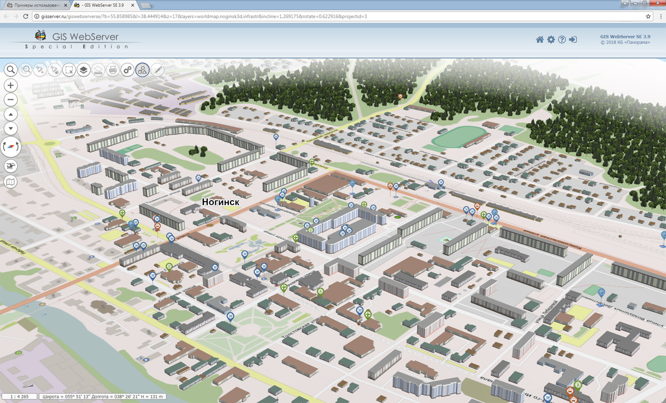
GIS WebServiсe SE supports all international standards (OGC WFS, WFS-T, WMS, WMTS, WCS) through which the transmission and display of spatial data is carried out. The program provides the ability to issue tiles for any user or local coordinate system. The application is implemented on Windows and Linux platforms, compatible with Apache, IIS and nginx web servers.
The new version of the program and the documentation are placed on the site in section.


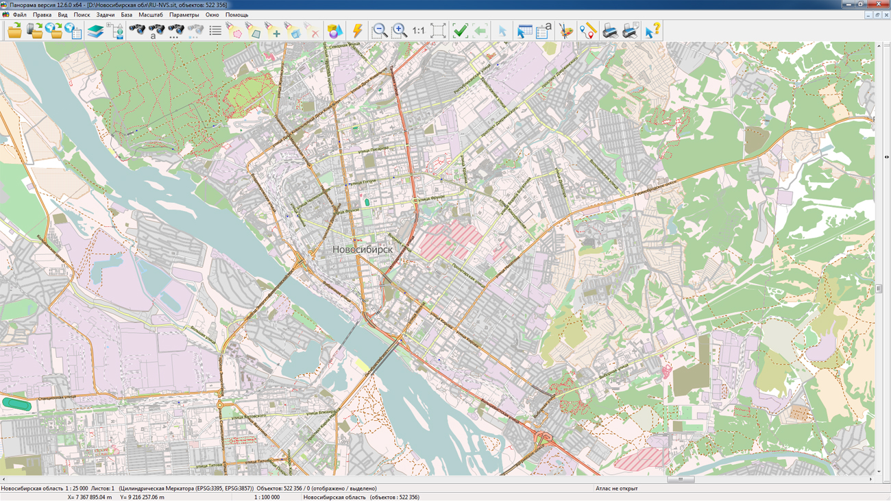
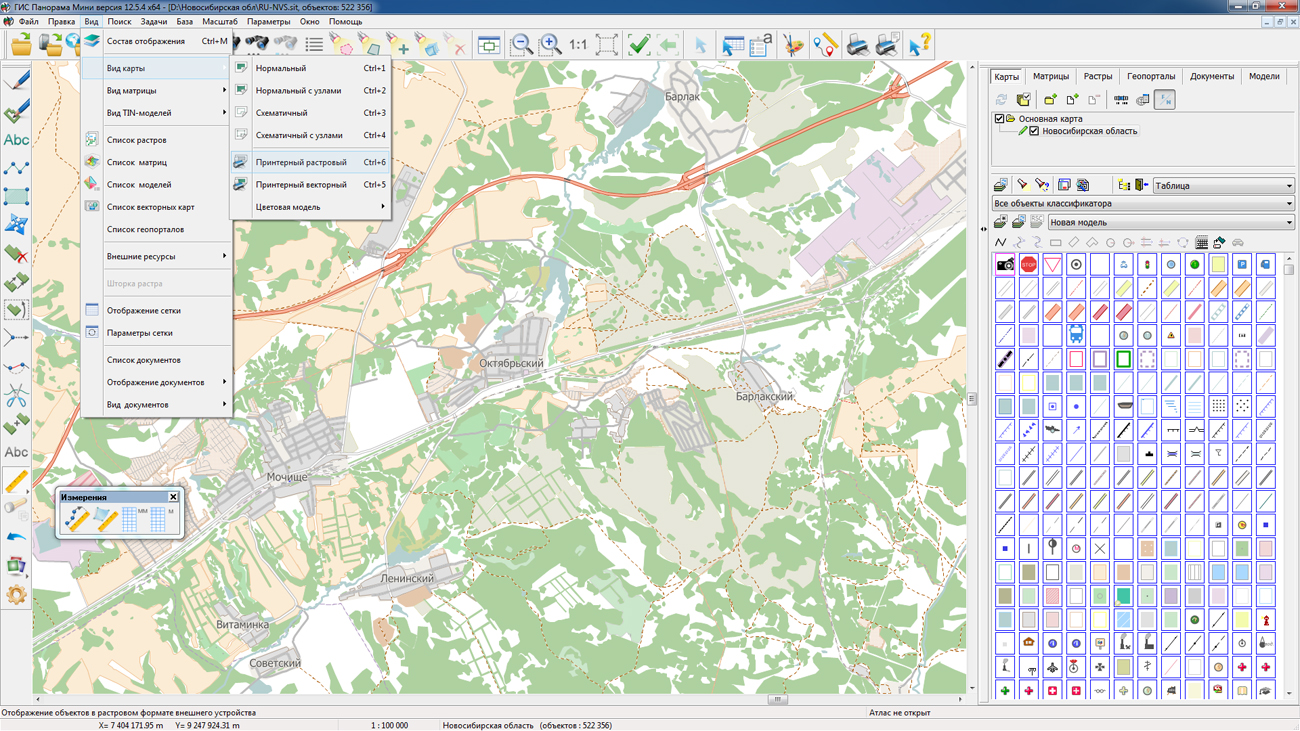
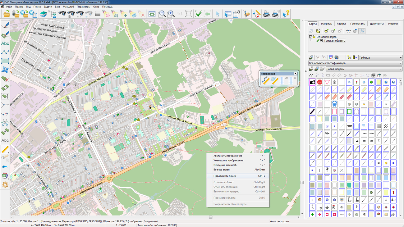
On the geoportal , the maps of Novosibirsk and Tomsk Oblast, formed according to OpenStreetMap data, were updated. Source data obtained from the GIS-Lab website are complemented by objects from maps of scale 1: 1 000 000. There are added the objects of hydrography, vegetation, road network. For work with the received maps it is possible to use the program of or other software products of KB "Panorama".
Publishing of updates in bank of spatial data is made by using the program of . Publishing contents of bank of spatial data on the geoportal and data access for downloading are implemented by means of GIS WebServer SE.
Free maps on the basis of OpenStreetMap data are available for download on the page "Digital maps and images".


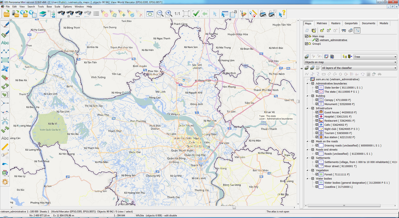
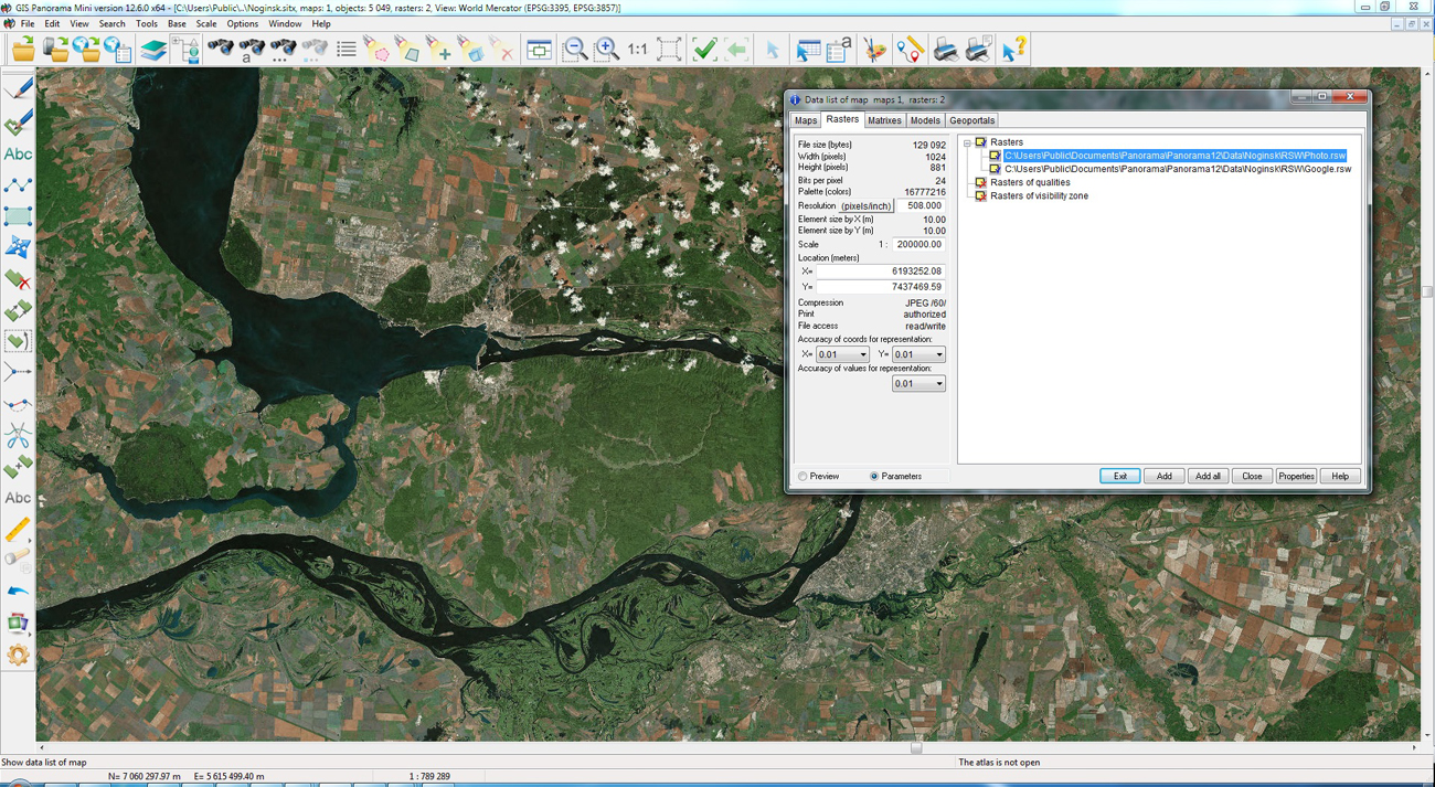
In KB "Panorama" the version 12.6.0 is developed for the x64 platform. The new version of the program adds support for the SQLite database for pyramid tiles in Mbtiles format. Mbtiles format is used for storing tile data in one file. It ensures the rapid issuance of spatial information in accordance with the requested scale and territory. Satellite images in TIFF format can contain tens of gigabytes of information, which can lead to a slowdown in their display. To speed up the display and preserve the quality of the data, they are converted to the Mbtiles format. The data in Mbtiles format is opened in the main menu item the File - Open. You can convert data into Mbtiles format using the program.
Into the task of importing a list of DIR map sheets into a multi-sheet MAP map, there is added a processing of ZIP files that can contain one or more files of one of the formats SXF, SHP/DBF, MIF/MID (in one archive one format is processed). Files of maps sheets can be grouped in folders.
In the "Data Base" task, the modes "Update of semantics" and "Update table by semantic" are improved. Ability is added to delete the values of the semantic characteristics of map objects when the fields of the table contain empty values.
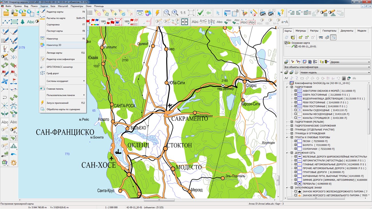
In the "Navigator 3D" task a support of 3D-tiles of spatial data in DB3D format is added for display of exact and realistic three-dimensional models of unlimitedly large size. DB3D format is intended for storaging and displaying the pyramids of three-dimensional tiles packed together with metadata tables in SQLite format. The format is intended for storing data in 3D-tiles pyramids of various type, for example, GoogleMapsCompatible ((a matrix compatible with Google data in projection EPSG:3857), GoogleCrs84Quad (a matrix compatible with Google data in projection EPSG:4326). Level of scale of data details and the coverage area is not limited. Import is supported to the DB3D format from formats of tile models TLS (Agisoft Tiled Mode) and point cloud Agisoft OC3. Vector 3D-tiles can be used for constructing three-dimensional terrain model together with other sources of data: vector maps, space and aerial photographs, geoportals, clouds of points, matrixes of heights.
Changes have been made to the main menu of the program. In the File menu, the Example data item is added, which allows you to quickly open examples of maps, rasters and matrixes from the installation. In the Help menu, the Documentation item is added, where you can view any document from the operational documentation that speeds up the search for necessary reference information. In the Help menu, the Forum item is added for quick transition in the browser to the web forum, designed for communication and information exchange between users and developers of the program. Into the Help menu, the "Video lessons" item is added to quickly jump to the page of training videos in the browser. The main menu item "Maps Synchronization" has been moved from the "Options" group into the "Window" group.
GIS reference system was updated. The new help system is organized in the form of HTML-files that allows to display it in the usual browser.
The new version of the program is available for download in the section.


On the geoportal , the maps of the Republics of Altai and Khakassia, formed according to OpenStreetMap data, were updated. Source data obtained from the GIS-Lab website are complemented by objects from maps of scale 1: 1 000 000. There are added the objects of hydrography, vegetation, road network. For work with the received maps it is possible to use the program of or other software products of KB "Panorama".
Publishing of updates in bank of spatial data is made by using the program of . Publishing contents of bank of spatial data on the geoportal and data access for downloading are implemented by means of GIS WebServer SE.
Free maps on the basis of OpenStreetMap data are available for download on the page "Digital maps and images".


Ph.: +7 (495) 739-0245, +7 (925) 221-1603
www.gisinfo.ru | panorama@gisinfo.ru
105005, Russia, Moscow, Baumanskaya Street 7, building 1, office 229 (m. Baumanskaya)
Copyright © Panorama Group 1991 - 2024


 Mobile version
 Full version