Copyright © Panorama Group 1991 - 2024

version 9.3.3 was developed in KB "Panorama". The new version of the program creates tiles according to the TMS standard. The main difference of this standard from OGC WMTS is the numbering of tiles and their location. They can be stored as separate files, or can be located in a database. Use of this standard will allow to access the tiles from other servers and services (, ), and also to use the API interface of libraries, such as MAPAPI, GDAL and others.
Specialists of KB "Panorama" have carried out tests on creation of tiles in order to improve the program's capabilities. For creating 700 000 000 tiles on Russian maps in the scale of 1: 10 000, consisting of 84 maps and 19 000 000 objects, the Imagery Creator program took 9 hours. Creation of tiles was carried out on the computer with 4 core Intel Core i5 - 3.5 Ghz and Windows 7. Total amount of created tiles was 2.5 TB.
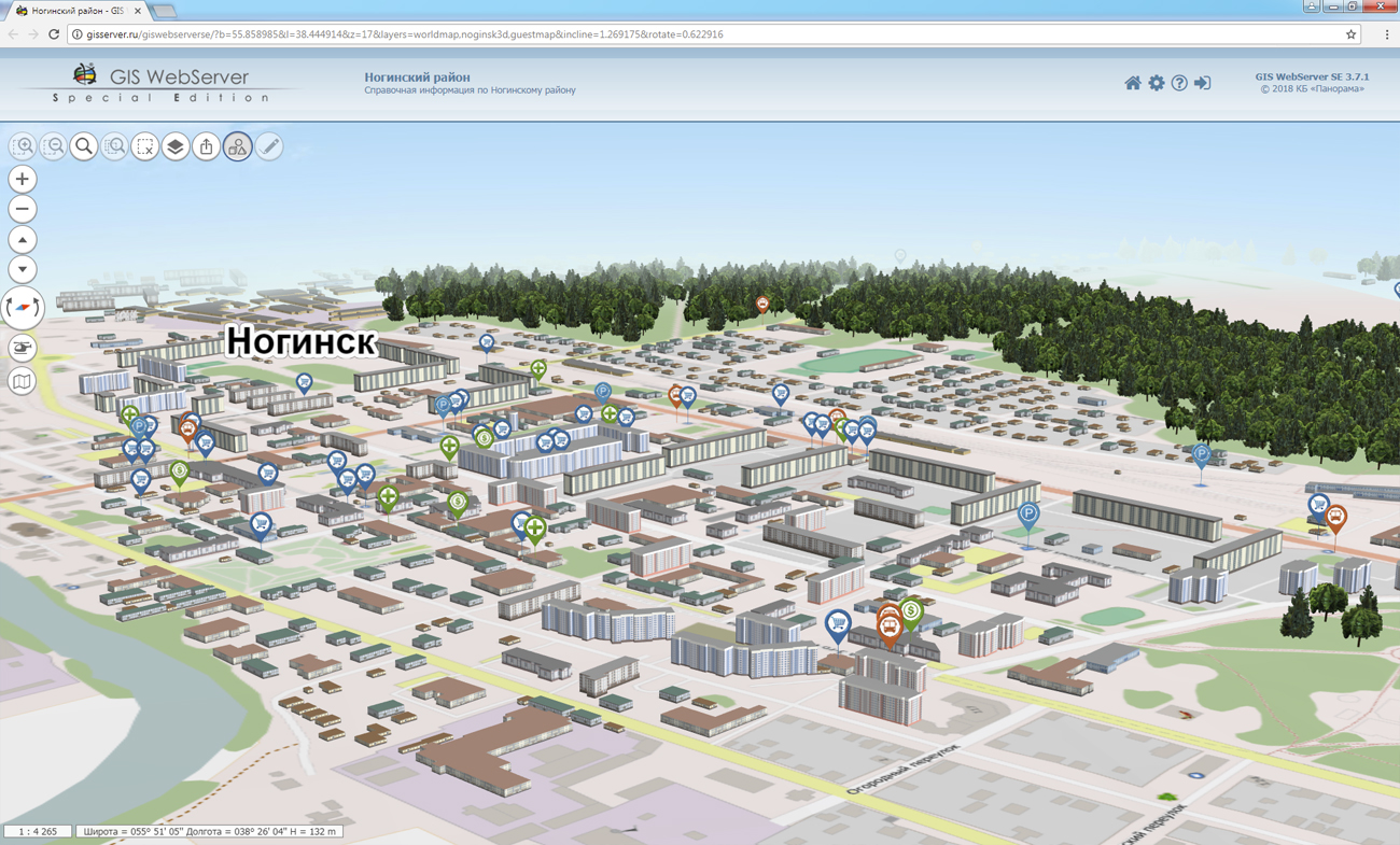
ImageryCreator allows you to create tiles in the formats JPEG, PNG, PNG8 and Mbtiles according to the international standard OGC WMTS 07-057r7 version 1.0.0 and the TMS standard. The tile data generated by the application are used by software the GIS WebServer SE, GIS WebService SE to provide high-speed query execution for displaying spatial data over large areas while simultaneously accessing a large number of users.
A new version of the program is available on the page.


In KB "Panorama" the version 3.8.1 is developed. In the new version the possibility is added for exchange by the metadata and the data between several copies of the Databank of digital maps and remote sensing data. The new mode of export and import allows you to exchange information when it is not possible to organize direct access to one Data Bank, for example, when data banks are installed in different organizations.
The bank's storehouse can include hundreds of terabytes of spatial information and contain vector maps, remote sensing data, elevation matrixes, terrain models and other types of data. The new version adds a mode of data integrity control. This mode, in addition to restoring the map-scheme, makes comparison of data sets being in storehouse with their backups. This makes it possible to restore files if there are differences in them.
The mode of specifying the values of metadata is added at loading of data sets into storehouse. For example, you can set the same date of survey, security classification, or the comment for all uploaded data.
Within the framework of a single geoinformation space, the Data Bank of digital maps and remote sensing data realises gathering, storage, search and delivery of the spatial data in exchange formats. The spatial data selected by means of the program can be placed for the multiuser access on the and be published according to the international standards OGC WFS, WFS-T, WMS, WMTS, WCS on application server the . Users can access data from both a thin client (by means of ) and from desktop applications (, ).
The databank of digital maps and remote sensing data provides construction of cloud storehouse of spatial data, provision of access to these data, the automated formation and updating of geo-covers. The current state of spatial data is displayed by means of maps-schemes that are maintained for each type of stored data: vector maps, remote sensing data, elevation matrixes and terrain models. It provides remote placing the sets of spatial data into file storehouse, keeping versions of stored sets, updating maps-schemes of data availability, the automated collection and formation of metadata, and the formation and updating of geo-covers. Automated collection and formation of metadata is performed according to the standards of ISO 19115: 2003, Geographic information - Metadata and ISO/TS 19139, Geographic information - Metadata - XML schema implementation. The reduced copies of data images are automatically formed, checksum of files and completeness of data sets are checked.
The new version of the program is available for download on the page.


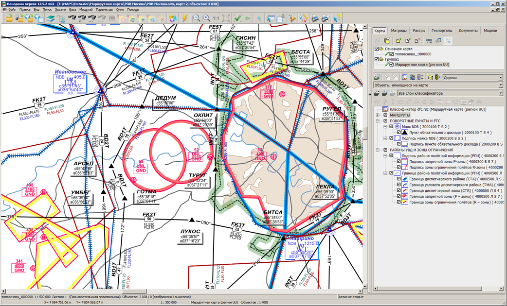
In KB "Panorama" the version 7.0.4 is developed. The new version optimizes the algorithms for input and output of airfield routes onto the map. Mode of drawing schemes SID/STAR/IAC is added, which allows to exclude common points and areas at the formation of schemes of departure and arrival.
In connection with the changes in the aviation legislation of the Russian Federation, the task "Evaluation of standards of fitness for aerodromes (according to the ESFA)" of the this complex was fully included into the task "Conformity assessment of airfields to FAR requirements". In the task "Conformity assessment of airfields to FAR requirements", there are implemented the modes of import of obstacles from documents in MS Excel format and formation of applications to the passport of the aerodrome in MS Excel format. The algorithm for creating the base turn procedure RNAV Fly-Over has been improved.
Complex of preparing documents of the aeronautical information is intended for the creation and maintenance of a database of aeronautical information, the formation of aeronautical charts, the designing of flight routes for aircraft and the exchange of data with other information systems. Information exchange is carried out in ARINC and AIXM 5.1 format. The main source of aeronautical information is the aeronautical data base created on the basis of the Aeronautical Information Conceptual Model (AICM), with additions for storing the planned information and the results of the route designing. The model is recommended by the international organization for planning and coordination of air traffic "Eurocontrol".
The new version of the program, examples of documents of aeronautical information, the operational documentation and presentations are available for download on the Download page.


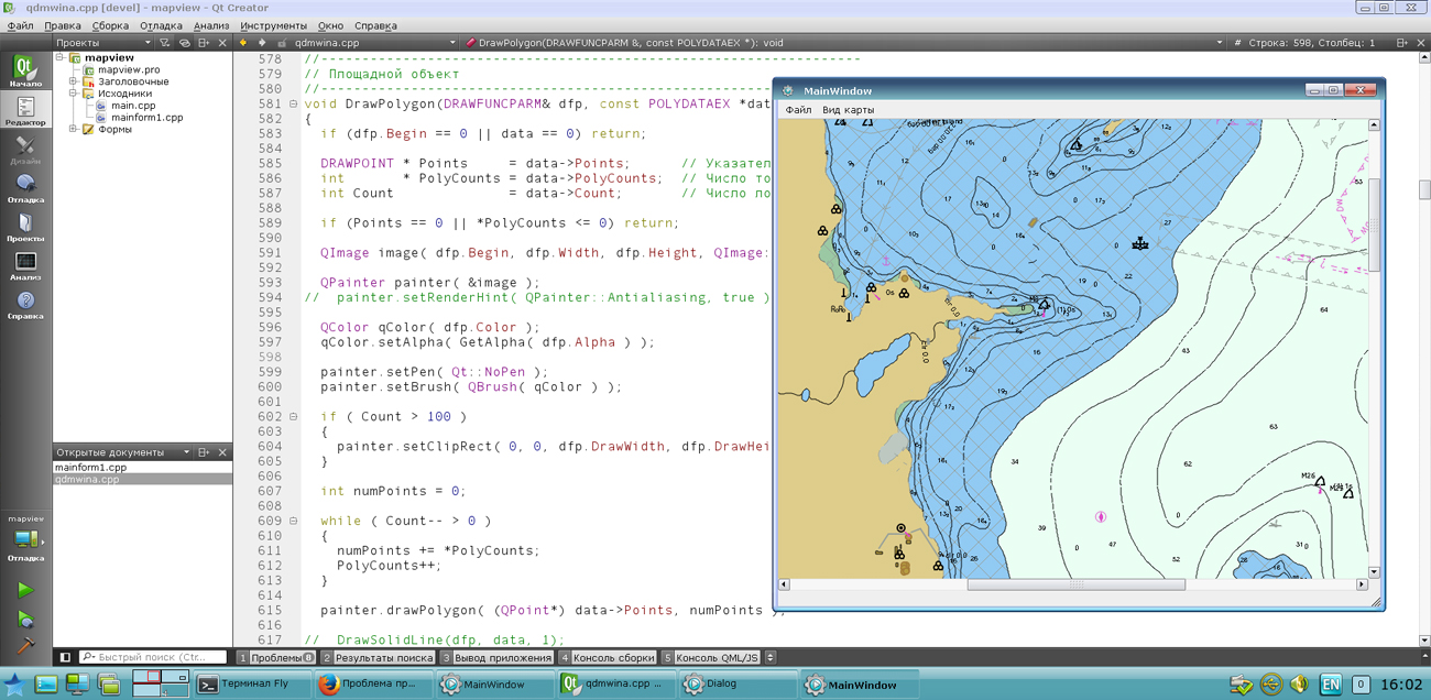
In KB "Panorama" the GIS Constructor for Qt Designer SE version 12.3.0 is developed. In the new version the list of examples is supplemented with the typical functionality of GIS-applications: changing coordinates and characteristics of objects, the uniting and intersection of objects, work with the transaction log, transformation of the individual points and digital maps, performing calculations on maps, search by conditions (intersection, finding the distance, etc.), import of exchange formats and work with a GPS receiver. An example of connecting geoportals includes the ability to enter an arbitrary geoportal address.
In the new version of a kernel of GIS applications a support of importing maps of SHP-format is added. Now the user can import as separate files SHP into maps of GIS "Panorama" format, and entirely a set of SHP-files, having specified the path to the directory. Reliability of working the visual components of Qt Designer is improved.
GIS Constructor is a set of geoinformation components for use in the visual programming environment of Qt Designer, which allows you to develop your own GIS applications. The visualization of the contents of digital maps is made in conventional symbols adopted for topographic, geographical and various special maps. Geoinformation system has ample opportunities for performing calculations, for providing display of spatial data on various graphic devices in standard and user systems of conventional symbols. The main functions can be executed in multithreaded mode. It supports automatic optimization of used memory for processing large amounts of data (tens of gigabytes) on limited resources (hundreds of megabytes).
The toolkit is adapted to work on a wide range of platforms and supports operating systems such as Astra Linux SE, MSVS, CRTOS Neutrino, Elbrus, Zarya, Ubuntu, Alt Linux, QNX, CentOS and others. It can be used in computer complexes with processors of architectures ARMv7, Elbrus, PowerPC, Intel x86, Intel x64 and others.
The new version of the program is available for download in the section.


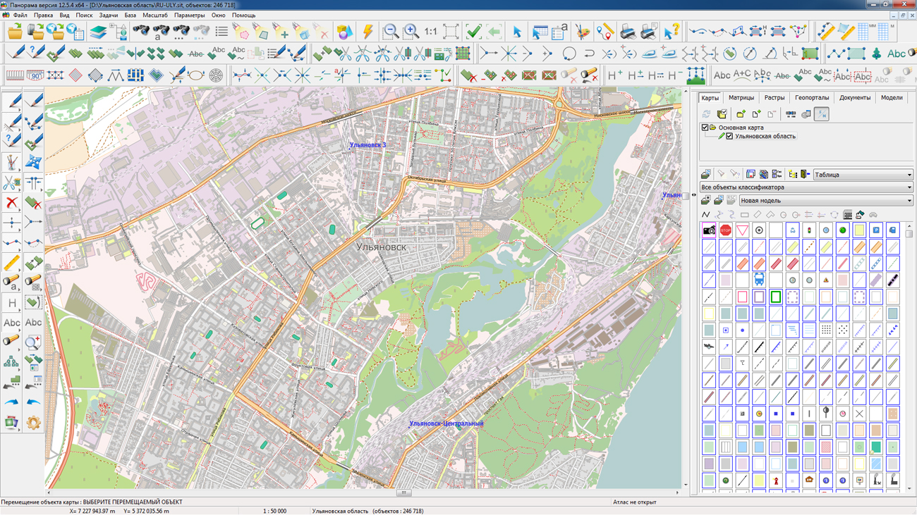
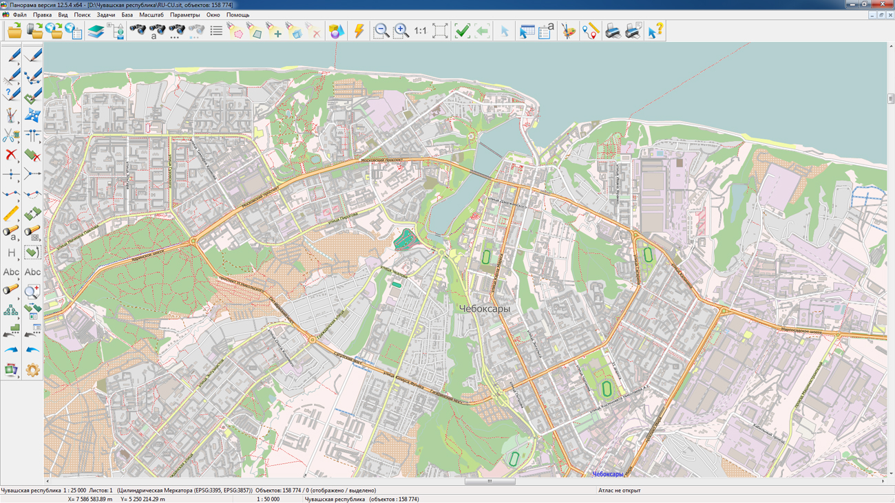
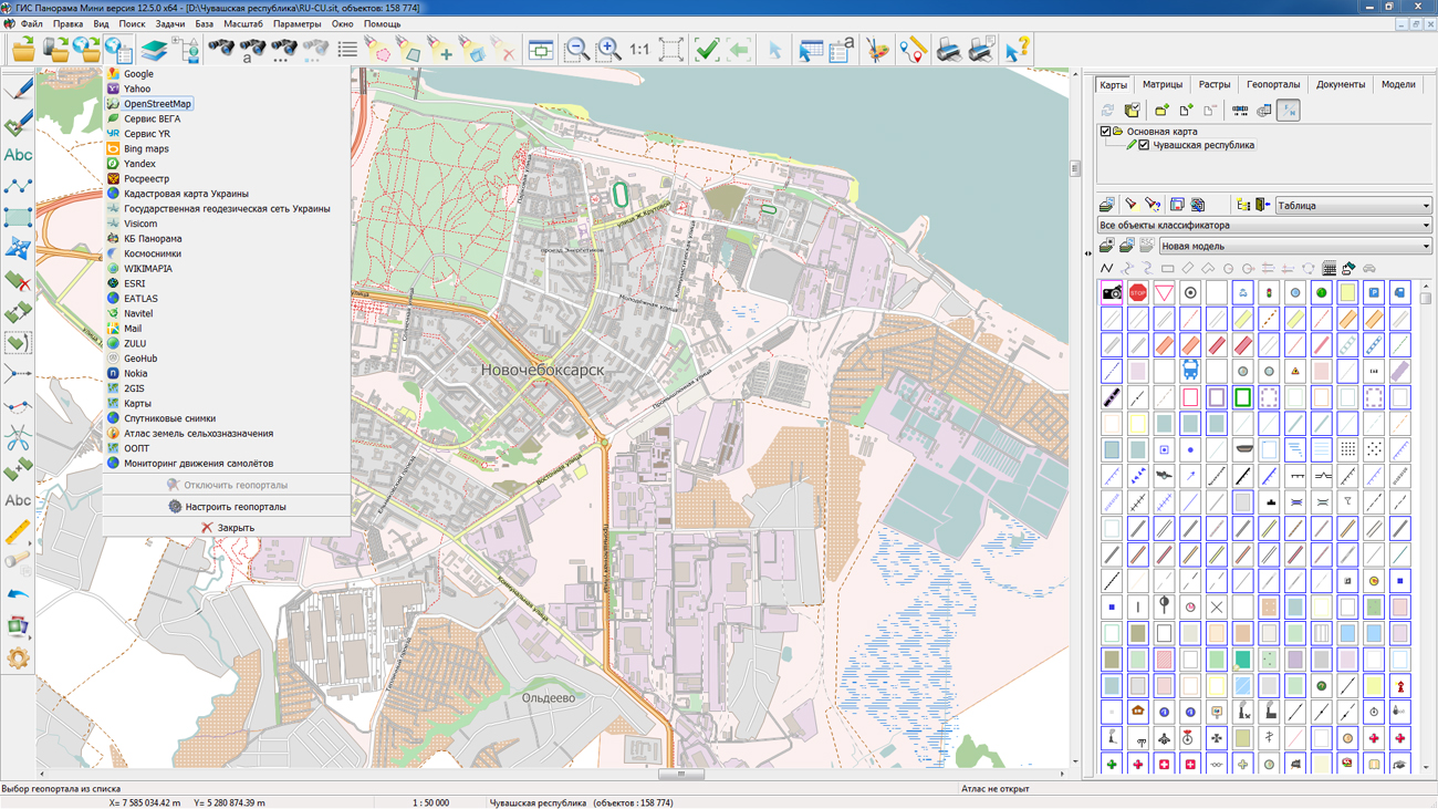
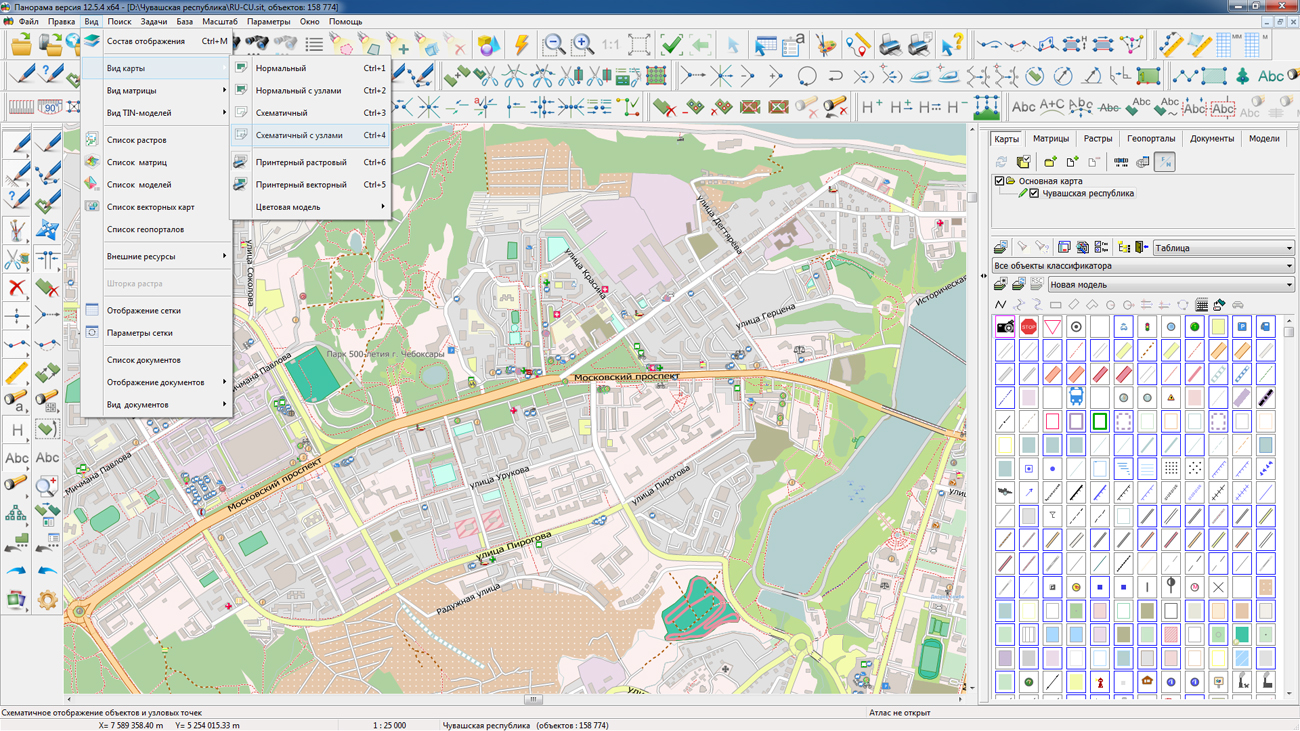
On the geoportal the map of the Ulyanovsk region and the Chuvash republic formed according to OpenStreetMap data, were updated. Source data obtained from the GIS-Lab website are complemented by objects from maps of scale 1: 1 000 000. There are added the objects of hydrography, vegetation, road network. For work with the received maps it is possible to use the program of or other software products of KB "Panorama".
Publishing of updates in bank of spatial data is made by using the program of . Publishing contents of bank of spatial data on the geoportal and data access for downloading are implemented by means of GIS WebServer SE.
Free maps on the basis of OpenStreetMap data are available for download on the page "Digital maps and images".


Ph.: +7 (495) 739-0245, +7 (925) 221-1603
www.gisinfo.ru | panorama@gisinfo.ru
105005, Russia, Moscow, Baumanskaya Street 7, building 1, office 229 (m. Baumanskaya)
Copyright © Panorama Group 1991 - 2024


 Mobile version
 Full version