Copyright © Panorama Group 1991 - 2024

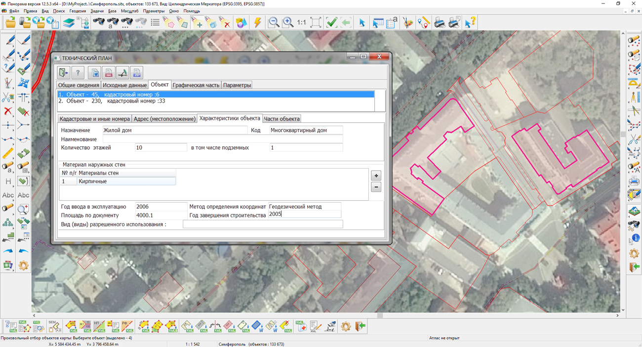
In KB "Panorama" the version 12.5.3 is developed. In the new version in the "Geodesy calculations complex" there are updated the modes for formation of a technical plan for the building, construction, the object under construction and premises. The program provides processing of several one-type real estate objects at creation of the text report and electronic XML document.
The initial information for forming a technical plan is taken from the map containing the boundaries of real estate objects. For buildings, constructions and objects under construction the digital cadastral map is used presented in the coordinate system that is applied to conducting the Unified State Real Estate Register. For the premises, the buildings plans or floor plans are used, presented in the local (conditional) coordinate system. For the purpose of collective use, a cadastral map, a building plan and floor plans can be located on the GIS Server. To support the simultaneous processing of several real estate objects the dialog "Technical plan" is refined. A new page "Objects" has been added, containing information on cadastral numbers, location, characteristics of objects, their parts and premises inside the real estate object. Transition to groups and elements for input and editing of the data is ordered. It is now possible to save the list of attached documents for reuse.At formation of XML-file for multiplanimetric real estate object the continuous numbering of characteristic points of borders for all contours of object is supported.
The new version is available for download in the Download section.


Specialists of KB "Panorama" tested compatibility of SE with for architecture x86_64. During tests, there was tested the interaction of the GIS "Operator" SE for the "Elbrus" OS with the server software solutions of and on Linux and Windows platforms. The result of tests demonstrates the readiness of using the GIS "Operator" SE as a component in a single geoinformation platform.
GIS "Operator" is an universal domestic geoinformation system for power structures. The program is intended for accumulation, the storage, the automated processing and displaying the data, results of calculations and the forecasts having a geospatial binding. GIS "Operator" contains tools for displaying and processing vector, raster and matrix maps. The application provides users with tools for solving specialized tasks of modeling the movement of special objects against the background of 3D model, a forecasting the consequences of emergencies on hazardous objects, a monitoring the movement of aircraft, a performing the geodetic and topographic work, processing data from GPS/GLONASS navigation devices, a printing the displayed spatial data to various output devices and many others. GIS "Operator" SE is certified by the 2nd level of control of the absence of undeclared capabilities in the RF Ministry of Defense.
OS Elbrus is a domestic operating system based on the Linux kernel for the Elbrus architecture processors, developed at JSC "MCST". The operating system provides multitasking and multi-user modes of operation. For it, special mechanisms have been created for managing processes, virtual memory, interrupts, signals, synchronization, and support by tagged computations. In the core of the Elbrus operating system, a set of information security tools (SIST) is built from unauthorized access. The full functioning the SIST of system of the "Elbrus" OS should provide the required level of information protection from unauthorized access during the work of the computer complex as part of specialized automated systems. SIST is implemented using system calls, subroutines libraries, system configuration.
The new version of the program is available on the web-site in the section.


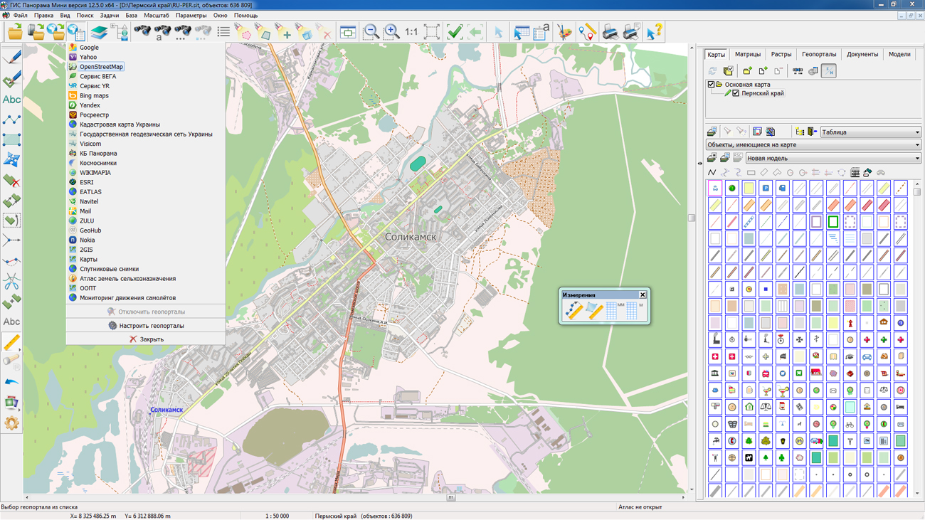
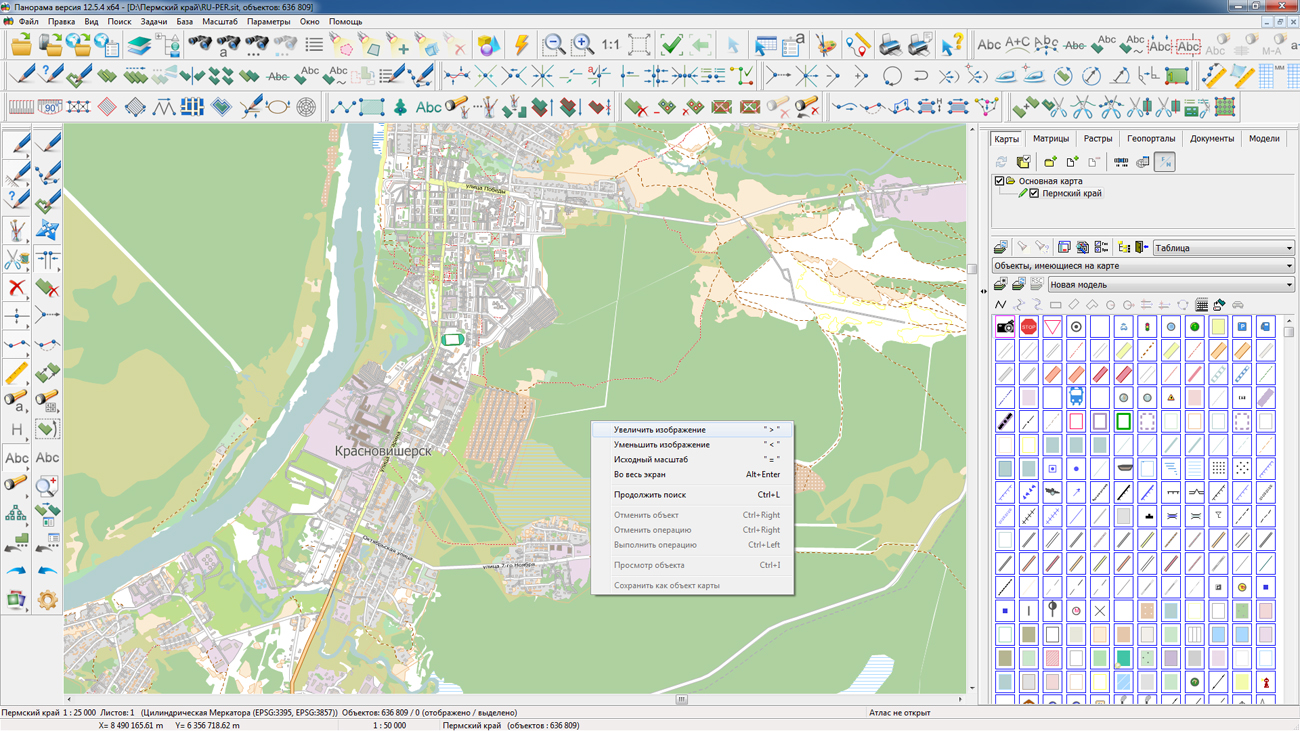
On the geoportal the map of the Perm Krai formed according to OpenStreetMap data, has been updated. Source data obtained from the GIS-Lab website are complemented by objects from maps of scale 1: 1 000 000. There are added the objects of hydrography, vegetation, road network. For work with the received maps it is possible to use the program of or other software products of KB "Panorama".
Publishing of updates in bank of spatial data is made by using the program of . Publishing contents of bank of spatial data on the geoportal and data access for downloading are implemented by means of GIS WebServer SE.
Free maps on the basis of OpenStreetMap data are available for download on the page "Digital maps and images".


KB Panorama created the geoportal "Ecuador", which displays information about the political and administrative division of Ecuador as of 2017. Information about the country territorial organization is represented by maps and small textual references for each province and canton.
Geoportal "Ecuador" uses version 3.6 as a platform and demonstrates the key properties of this system for reference and information systems creating. Users can change the map display scale, to seek for an administrative unit, the settlement and other map objects by their names or by a set of criteria, to measure the distance or the area, to print out interesting them map fragments etc, when working with data.
is a source for the geoportal cartographic data, that stores map of Ecuador on a scale of 1: 1000000 and a organizing territory scheme at the provincial and cantonal level. Cartographic data access is carried out using WMS, WMTS and WFS protocols. The provinces and cantons text information are reading from the MySQL database using standard sql-queries.
A link to go to the geoportal "Ecuador" : ecuador.gisisnfo.ru


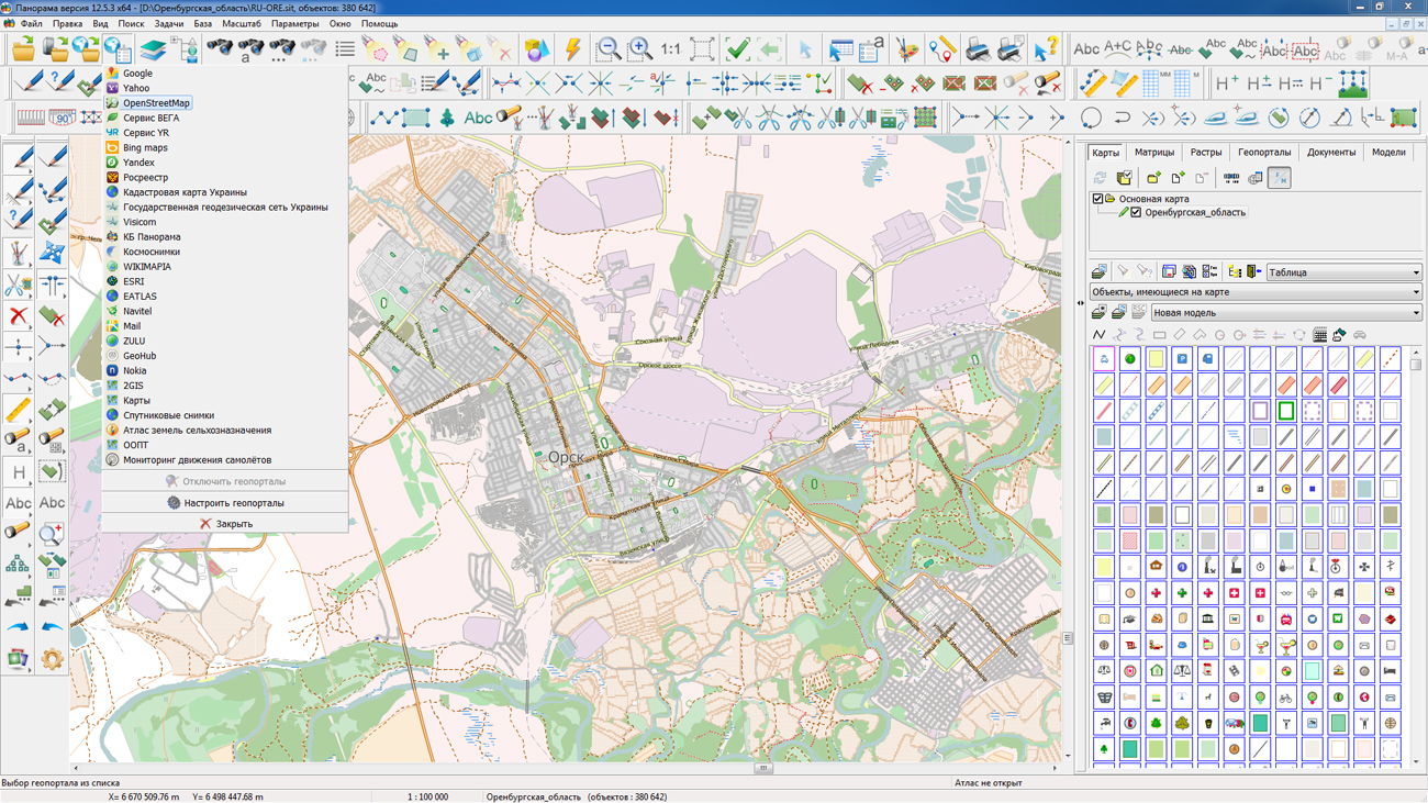
On the geoportal , maps of the Orenburg and Penza regions, formed according to OpenStreetMap data, have been updated. Source data obtained from the GIS-Lab website are complemented by objects from maps of scale 1: 1 000 000. There are added the objects of hydrography, vegetation, road network. For work with the received maps it is possible to use the program of or other software products of KB "Panorama".
Publishing of updates in bank of spatial data is made by using the program of . Publishing contents of bank of spatial data on the geoportal and data access for downloading are implemented by means of GIS WebServer SE.
Free maps on the basis of OpenStreetMap data are available for download on the page "Digital maps and images".


Ph.: +7 (495) 739-0245, +7 (925) 221-1603
www.gisinfo.ru | panorama@gisinfo.ru
105005, Russia, Moscow, Baumanskaya Street 7, building 1, office 229 (m. Baumanskaya)
Copyright © Panorama Group 1991 - 2024


 Mobile version
 Full version