Copyright © Panorama Group 1991 - 2024

In KB "Panorama" the version 11.6 is developed. In the new version there is accelerated a process of updating images of the vector maps which are issued by WMS protocol, at intensive editing the objects of maps on the . For example, at displaying tracks of vehicles' motion the updating of the vector data is carried out in parallel with drawing a current state. It reduces time of synchronisation of change of a vehicle position and the issuance of a picture with new position. In addition, it will enable end-users who use , always to obtain the data and the pictures that are close to real time.
Parametres of requests by WFS standard are expanded. There is added the possibility of display of graphic objects and the information on relative and absolute height of object. Records format of errors' log of service's work is changed. Codes of errors are described in the documentation. For convenience of the log's analysis into the module of remote administration of service the tools are added for viewing the log with possibility of events filtration.
GIS WebServiсe SE supports all international standards (OGC WFS, WFS-T, WMS, WMTS, WCS) with which help the transmission and display of spatial data is carried out. The application has the possibility of issuing tiles for any user or local coordinate system. The application is implemented on Windows and Linux platforms, is compatible with the Apache web-server, IIS, nginx.
The new version of the program is available for download in the section.


Geoportal updated the maps of Stavropol Territory and Republic of North Ossetia-Alania formed according to OpenStreetMap data. Source data obtained from the website are complemented by objects from maps of scale 1: 1 000 000.
There are added the objects of hydrography, vegetation, road network. For work with the received maps it is possible to use the program of GIS Panorama Mini or other software products of KB "Panorama".
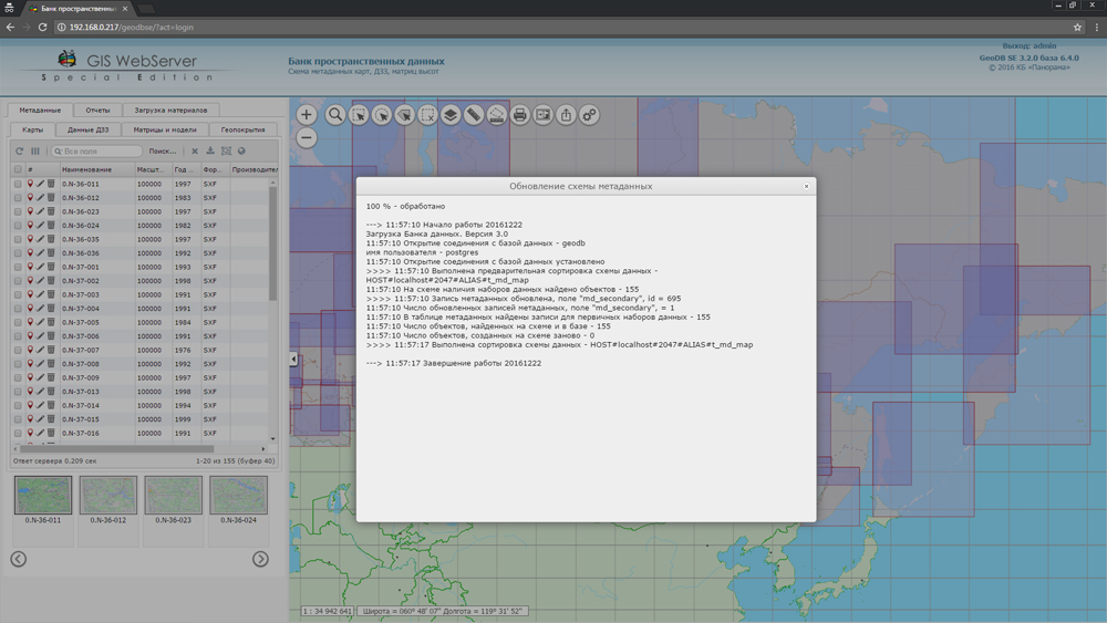
Publishing of updates in bank of spatial data is made by using the program of .
Publishing contents of bank of spatial data on the geoportal and data access for downloading are implemented by means of .
Free maps on the basis of OpenStreetMap data are available for download on the page "Digital maps and images".


In KB "Panorama" the version 11.5 is developed. In the new version the administrator of service by the pressing of one button can add the list of users, roles, groups, data located on the . Thus for the users who access the service, the same rights will extend as for the users of GIS Server. It will simplify process of administrating and will help to avoid the problems associated with incorrect filling the settings files by administrator.
For the purpose of accelerating the construction of 3D terrain models there is added the shared folder of saving a cache of tiles WMTS, WFS, WCS. For correct identification of vector tiles (WFS) the path of their placement is changed. In the path name there is taken into account the list of codes by which the tile is formed.
To reduce the load on in service the request for construction of thematic maps is implemented. It allows you to select objects in different colors, and save the result onto a new user map. The received thematic map can be requested by the WMS/WMTS standard.
GIS WebServiсe SE supports all international standards (OGC WFS, WFS-T, WMS, WMTS, WCS) with which help the transmission and display of spatial data is carried out. The application has the possibility of issuing tiles for any user or local coordinate system. The application is implemented on Windows and Linux platforms, is compatible with the Apache web-server, IIS, nginx.
The new version of the program and the documentation are placed on the website in the section.


In KB Panorama the new versions of server software products are developed for OS CentOS: and the . GIS WebService SE versions 11.4.0 minimises costs for hardware and the server software, allowing to receive thus the maximum performance and maintain a greater number of users when sending tiles. To this end, for the publication of the vector data there is added the matrix with sizes of the tile 1024x1024 pixels in PNG-8 format, for the publication of remote sensing data the matrix with the sizes of the tile 512x512 pixels in JPG format.
For maintenance of schemes and a map legend in an actual state in the application there is added the interface of data updating at change of the resources classifier. Reliability and convenience of work with the data on the is increased. There is implemented the possibility of processing layers directly from server's virtual folder without their additional putting into the list of parameters of configuration file wmsparam.xml.
Parametres of delivery of the metadata on objects of a map by WFS standard are expanded. There is added the ability to output the data with regard to their visibility at a certain scale.
The program the Databank of digital maps and Remote Sensing Data version 3.2.0 adds the ability to expand the list of metadata fields. New fields are automatically displayed in the appropriate section of the application. Expansion of the fields list allows to store and process the additional information on data sets, to connect external sources of the information, providing the integration with other systems.
New versions of software are available for download in the section.


Geoportal updated the maps of Novosibirsk region and Republic of Buryatia formed according to OpenStreetMap data. Source data obtained from the website are complemented by objects from maps of scale 1: 1 000 000.
For work with the received maps it is possible to use the program of GIS Panorama Mini or other software products of KB "Panorama".
Publishing of updates in bank of spatial data is made by using the program of .
Publishing contents of bank of spatial data on the geoportal and data access for downloading are implemented by means of .
Free maps on the basis of OpenStreetMap data are available for download on the page "Digital maps and images".


Ph.: +7 (495) 739-0245, +7 (925) 221-1603
www.gisinfo.ru | panorama@gisinfo.ru
105005, Russia, Moscow, Baumanskaya Street 7, building 1, office 229 (m. Baumanskaya)
Copyright © Panorama Group 1991 - 2024


 Mobile version
 Full version