Copyright © Panorama Group 1991 - 2024

In KB Panorama the version 2.4 is developed. In the new version the mode of creation of geo-coverings from stored data sets is implemented. The mode allows the operator of the Databank to select data sets by various criteria (territory, date of terrain shooting, scale, type of a material and others) and to form coverings from vector maps, rasters or matrixes in the chosen coordinate system. Procedure of forming a geo-covering is carried out on the by the command of the Databank operator.
Coverings are placed in the specified virtual folders of Server GIS that provides automatic access to them without additional administration of various groups of users. For convenience of conducting versions of geo-coverings in the specified virtual folder the separate folders for each covering automatically are created.
Configuring of virtual folders for placing geo-coverings is carried out by the Administrator of Databank of Digital Maps and Remote Sensing Data for each group of the data. Coordinate system of a covering can be specified by EPSG code (for example, "epsg:3857") or by a code of the user's coordinate system (for example, crslist:user_code).
In this case the coordinate system parameters are read on the GIS Server from the service file by the specified code of user's coordinate system (identifier). Parameters of the user's coordinate system can be added onto the GIS Server from the task "Map Passport" of system the .
Upon termination of procedure of forming the geo-covering to the user the work protocol is given. Data sets of geo-coverings are recorded in database of metadata and displayed on a map-scheme. Objects of geo-coverings of different groups of the data have different color filling on the scheme.
The complex of conducting the Databank of digital maps and remote sensing data is intended for gathering, storage, search, issuance of spatial data in exchange formats and displaying the status of a databank in the form of maps-schemes. Maps-schemes are conducted for each type of stored data: vector maps, remote sensing data, matrixes of elevations and terrain models. The reference to the Databank and data exchange is carried out via the web-interface. The program can work in operating systems with the closed contour where processing of the protected data is carried out. The databank includes applications the GIS Server and that are certified by Level 2 of absence of undeclared possibilities in system of certifying securities of information of the Ministry of Defence of the Russian Federation. For conducting the base of metadata there are used the DBMS PostgreSQL (OS Astra Linux SE), DBMS Zarya (OS Zarya Data Processing Center).
Programs of GIS WebService SE and GIS Server provide a remote placing the sets of spatial data into files storehouse, a conducting versions of stored sets, their recording in the base of metadata, the updating of maps-schemes of data presence. The automated gathering and formation of metadata is performed according to the standards of ISO 19115:2003, Geographic information - Metadata and ISO/TS 19139, Geographic information - Metadata - XML schema implementation. Also the reduced copies of data images are formed, file checksums and completeness of data sets are checked. At removal of data sets from storehouse there is automatically carried out the editing the base of metadata and maps-schemes of materials availability.
The module of administration of the Databank of Digital Maps and Remote Sensing Data is included into the Complex. It provides customizing the general parameters of the application's work, a customizing the parameters of metadata database, a choosing the formats of storage and the composition of groups of stored files, views of objects for maps-schemes, a conducting the groups of users and appointment of the users rights onto access to the data and allowed actions. Users of desktop programs of GIS "Panorama11", and others can connect to the Bank of metadata via the GIS Server.
Source codes of modules of loading the sets of spatial data and metadata into the Databank of Digital Maps and Remote Sensing Data are included into SDK for the and . Using SDK it is possible to expand operations on conducting archive of spatial data from other applications. New versions of software and documentation are available on the page.


In KB "Panorama" the of version 11.13.4 with the interface in English is developed. In the new version of the program there are refined the tools of creating and updating maps, tools of work with databases, maps designing by complex conventional signs, calculation tasks, the block of cadastral tasks and other modules.
There is added the possibility to open multisheet maps on top of other multi-sheet maps or previously opened raster, matrix data and geoportals. It accelerates displaying a great number of sets of vector maps and simplifies the administration of vector maps of various purposes through the using several levels of multisheet maps.
In the menu File \ New and File \ Update by list the possibility is added for creation and update of a multisheet map (MAP) or the project of vector maps (MPT) from a set of files SXF, TXF, RSC, SITX which are stored in ZIP-archives. At choosing files of format ZIP in the list of chosen maps the names of files from archive automatically will be added. Unpacking of archives is carried out automatically at import of maps into region of works. It allows to simplify actions of users at a choosing a plurality of data sets from the which are loaded from the server in the form of ZIP-archive.
Into the Map Legend dialog the "Model" bookmark is added intended for displaying and editing parameters of irregular models of a surface - TIN-models (model of terrain) and MTD-models (a cloud of points).
In application the "Database" the new mode is added, allowing to create reports in the OpenOffice format. Unloading into the report is made with using the tools of spreadsheet OpenOffice Calc which is a part of the OpenOffice.org suite.
List of units of measure is expanded at displaying distances and heights. There is added a choice of heights in feet and distances in nautical miles. Into dialog of building a profile of heights there are added the units of length measure - kilometers, nautical miles and the height measurement units - ft.Into dialog "Calculator" there are added the units of measure - inches, ft, yards.
The interface of dialog "Address search" is improved. The current line of the address is displayed in the header of the dialog box. There are added the buttons for fast transition along the list - Next and Back. In header of the dialog window the quantity of the found addresses and number of the current title among them is displayed. At moving under the list of addresses there is performed an automatic transition into a point corresponding to the address.
Into modes of Map Editor - "Create subobject", "Create subobject by copying", "Merge objects" - there is added the possibility of forming the multipolygon - the polygonal object with subobjects outside the object contour. At converting to SXF, TXF and back the multipolygon sign is saved. At calculating the area of multipolygon, the area of external subobjects will be added to the area of the main object, and the area of internal subobjects will be subtracted. Displaying multipolygons with hatching for correct filling of external contours is improved.
Into the bookmark "Metrics" of the dialog "Select object" the toolbar for processing of heights is added: load of values from a matrix, interpolation by spline, change of height of all points onto the specified size.
Into library of a map export into format DXF the new mode "Make line style by object key" is added. Use of this mode is possible only at export of a map in the form of "Scheme" (parameter "Draft type"). At converting there is preserved the object integrity of linear and polygon objects, with creation of lines styles which names correspond to the key of the object. External view of generated styles of lines can be changed further in the environment of work with format DXF. For example, in AutoCAD the "Designing Standard" can be applied or the file of lines styles may be loaded.
Updating the information resource is executed for English-speaking users of . According to new adaptive design there are re-issued the sections "About the firm", "Education", "Price", "Download" and "Products".
On information resources of the company (gisinfo.ru, gisinfo.net) there is always available for download the actual versions of software products - GIS "Panorama", GIS WebServer SE, GIS Server and others. Users can familiarise with the documentation and training materials on work with programs. On the page "Digital maps and images" and on the geoportal "Bank of the spatial data" there are presented free maps in format SXF on the basis of data from open sources. For acquaintance with possibilities of server solutions of KB "Panorama" on the gisserver.ru site there are presented the examples of information geoportals on the basis of GIS WebServer SE (GIS WebServer).
The new version of the program and the documentation are available for download in the .

In KB "Panorama" the version 2.3 is developed for Astra Linux SE operating system. In the new version the mode "3D View" is implemented which serves for displaying the spatial data in the form of three-dimensional terrain model on the basis of Web3D technology. The mode allows to build and display in real time into the browser the three-dimensional model of the Earth's surface onto any terrain fitted with spatial data. There is provided a movement in all territory of the Earth, a scaling the model, turn and tilt, selection of data sources. Moving and scaling the two-dimensional and three-dimensional views are fully synchronized.
Possibility is added for constructing the driving's routes between two points of map area. The path length and movement time on a route are displayed. The path of the route is displayed on the map and the route is accompanied by a route sheet. Route sheet - the list of movement pieces of a route (sections). Each section of the route is separated from the neighboring by maneuvers; near each section there are indicated its length, the name of the street, along which the section goes, and the direction of the maneuver (straight, to the right, to the left, more to the right, more to the left). You can change the direction of the constructed route onto the backward. Construction of route is performed using the map of the graph.
Access to the data (to images, maps and information on the terrain) is provided by the Web-services according to the standard OGC protocols and ISO standards. Service of (OGC WMS/WMTS) provides spatial information in the form of graphic images - tiles. As digital model of a relief the various kinds of elevation data are used: matrixes (in formats SRTM, GeoTIFF, IMG, MTW), TIN-models, a cloud of points and others. At request there is executed an automatic selection of the most accurate data on a predetermined portion of the terrain with the specified resolution. For sending the data of digital model of the relief in Web the WCS protocol is used. The data are also contained in the form of tiles and are cached. GIS WebServer SE can be used in the construction of private enterprise systems to ensure protection of data having security classification or trade secrets.
GIS WebServer SE is certified to Level 2 of undeclared capabilities absence. The new version of the program extends the application's possibilities in solving problems of the analysis, management and forward planning of territories development.
The new version of the program, the documentation and are available on the website in the Download section.


Representatives of KB "Panorama" took part in II International Conference on creation of Eurasian SDI and Road Show of National geoinformational system on 27-29 July 2016 in Astana the Republics of Kazakhstan. Organizers of the conference: and .
The conference was attended by representatives of the National Geographic Institute of the Republic of Korea, JSC "ZERDE" NIH", JSC "NC «KAZAKHSTAN GHARYSH SAPARY", group of companies "SCANEX", JSC KB "Panorama", BentlySystems, ESRI, LLC "ESTI MAP", company "Sovzond", HexagonGeospatial, ForceWaveCo., PlanetLabsInc and many others.
During the conference the experience of constructing the National infrastructure of spatial data in the world's countries was discussed, there was an exchange of experience and practices on national infrastructures of spatial data and national geo-information systems of the countries of the Euroasian region. Cooperation at national, international levels was discussed. At a conference the companies were invited to participate in the project "National Geographic Information System of the Republic of Kazakhstan".
Joint-Stock Company KB "Panorama" has presented presentation "Building a national geoinformation system of the Republic of Kazakhstan on the platform of GIS Panorama"", which presented a proposal of KB "Panorama" on the creation, filling and conducting of ISD, construction of NGIS RK.
Download the presentation .


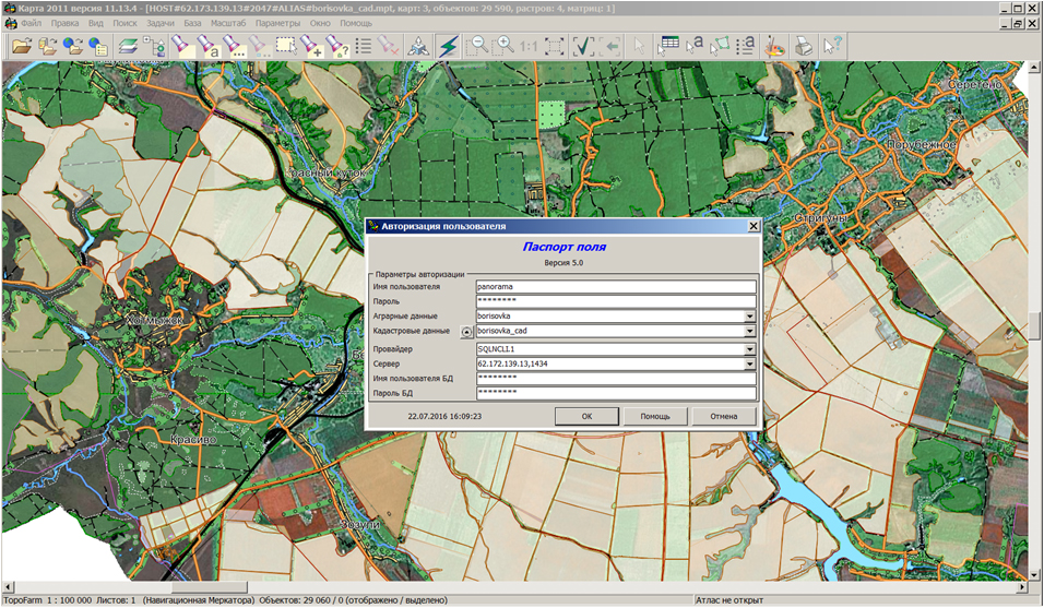
KB "Panorama" released the "Complex of agronomical tasks" of version 5.0, that is a part of "Workstation of agronomist" of version 11.13.4.1. The new version of the complex is integrated with the "Municipal GIS "Land and Real Estate "and "Workstation of urban-planner". All these software products use a single cadastral database for registration of land plots and objects of capital construction. Land registration and analysis of the land bank is one of the most important tasks of agricultural enterprise's management. Farmers need to know exactly what ground areas are already put onto the state cadastral registration, which lands are in the process of registration and which areas are leased or rented. "Workstation of agronomist" provides conducting the intraeconomic cadastral registration in the complex with taking into account the contours of agricultural land used in agriculture and animal husbandry.
For primary filling the register of the ground areas there are stipulated the procedures of import of data from the state real estate cadastre by stream loading of XML-files - cadastral passports of territory. There are stipulated a storage of such attributes as cadastral number, number of cadastral affairs, cadastral cost, the tax rate, land tax, land category, type of permitted use and so on. It supports functions of editing the land cards, a conducting the directories and specifying the adress by the address registry of cadastral database.
Coordinate description of land plots boundaries is stored in the cadastral map, posted on a user's computer or on the for collective use by various structural units of a farm. For search of the location of the land plot on the cadastral map there is provided a link of the record in the register of land plots with the map object or a direct coordinate binding.
For acquaintance with functions of the intraeconomic cadastral registration on demonstration "Agroportal" the map of land plots and the cadastral database are placed. Cadastral map and the filled register of land plots are prepared onto territory of a part of Borisovsky District of Belgorod Oblast. Demonstration data are placed in open access the connection to which is carried out via the IP-address from "Workstation of agronomist".
The new version of the program does not require updating a database and is placed on the website in the Download section.


Ph.: +7 (495) 739-0245, +7 (925) 221-1603
www.gisinfo.ru | panorama@gisinfo.ru
105005, Russia, Moscow, Baumanskaya Street 7, building 1, office 229 (m. Baumanskaya)
Copyright © Panorama Group 1991 - 2024


 Mobile version
 Full version