Copyright © Panorama Group 1991 - 2024

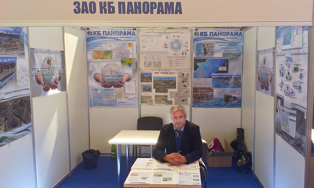
Representatives of KB "Panorama" took part in work of the . The event was held from 2 to 5 June 2016 in Astana on the territory of Air Base of Armed Forces of Republic of Kazakhstan. During the exhibition there were held scientific seminars on the theme "Problems and prospects of development of armaments, military and special equipment of the army of the XXI century".
During the seminars the chief technologist of KB "Panorama" Alekseev Sergey had presented the report, which aroused great interest among the participants. Such software solutions as the , , were considered. During the exhibition there were a series of business meetings of specialists of KB "Panorama" with representatives of Kazakhstan, Belarus and Russian companies, scientific and educational institutions. Work of the company's specialists at a forum was highly appreciated by its organizers. By the results of the forum, KB "Panorama" was awarded by a diploma and a medal.
The forum was organized by the Ministry of Defense of the Republic of Kazakhstan, NC "Kazakhstan Engineering", "Kazspetsexport". "Kazakhstan GIS Center "- the partner of KB"Panorama" in the Kazakhstan market of geoinformation technology was the technical sponsor of an exhibition. The exhibition was attended by over 350 companies from 44 countries. The exhibition was visited by the President of Kazakhstan, as well as the Ministers of Defence of Kazakhstan and the Republic of Belarus.


In KB "Panorama" the version 6.3.3 is developed for Astra Linux SE operating system. The new version fully implemented the technology of pass-through trusted authentication Kerberos. Kerberos is a protocol that provides centralized users authentication and uses technical data masking to counter different kinds of attacks. With the help of "GIS Administrator" program, you can configure user authentication by Kerberos means. GIS Server x64 SE is intended for providing remote access to cartographical data of users of the , and other applications developed in the environment of GIS Constructor of version 11 and later. The connection to the server is established via TCP/IP protocol.
Data posted on the GIS Server are protected from unauthorized reading, editing, copying, printing and substitution. Possibility of encoding the transferred data is supported. This prevents data interception and substitution at the time of transmission by open communication channels. Data are encoded by 256-bit key, installed onto a particular session. Encoding is performed when reading and writing data. GIS Server x64 SE is certified by Level 2 of undeclared capabilities absence of the system of certification of means of information protection of the Ministry of Defense of the Russian Federation.
The new version of the program is always available for download in the section.

In KB "Panorama" the Converter of large-scale plans into format DXF of version 8.3 is developed. In the new version of the program there are updated the RSC classifiers for large-scale charts and plans of scales 1: 500, 1: 1 000, 1: 2 000, 1: 5 000. There are refined the modes of scaling the DXF classifier objects and function of saving settings files of the program interface.
Converter allows you to form a large-scale topographic map or a plan in DXF format in the standard conventional symbols adopted for performance of cartographical works in the Russian Federation. Previously there is carried out a creation, quality control and designing a map in SXF format by use of RSC classifiers. Prepared maps are converted into format DXF with observance of uniform requirements on designing of conventional symbols of maps and plans. Delivery set includes classifiers and libraries of conventional symbols of DXF format for large-scale maps and plans of scales 1: 500, 1:1 000, 1: 2 000, 1: 5 000.
The new version of the program is available for download on the page.


Geoportal updated the maps of Republic of Tatarstan and the Ulyanovsk region formed according to OpenStreetMap data. Source data obtained from the website are complemented by objects from maps of scale 1: 1 000 000. There are added the objects of hydrography, vegetation, road network. For work with the received map it is possible to use the program of or other software products of KB "Panorama".
Publishing of updates in bank of spatial data is made by using the program of Complex of conducting a databank of digital maps and remote sensing data. Publishing contents of bank of spatial data on the geoportal and data access for downloading are implemented by means of .
Free maps on the basis of OpenStreetMap data are available for download on the page "Digital maps and images".

In KB "Panorama" the is developed. In the new version the tools of creation and designing of multipolygons consisting of a set of external and internal contours are enhanced. Into modes of Map Editor - Create subobject, Create subobject by copying, Merge objects - the possibility of multipolygon formation is added. At converting to SXF, TXF and back at objects the multipolygon sign is saved. At calculating the area of multipolygon the area of external subobjects will be added to the area of the main object, and the area of internal subobjects will be subtracted. Displaying multipolygons with shading for correct filling of external contours is improved.
In new dialog "Select object" the bookmark "View" is added, that contains tools of editing the view of a conventional symbol. New implementation of the dialog allows you to carry out copying the view of object via the clipboard with appointment of the view to the other conventional symbol, simultaneous editing a printer and screen view of the symbol in one window, automatic synchronisation of changes for both views. There is added the possibility of assigning a view of a new primitive's dot sign "Graphic symbol". The new primitive contains the image of a symbol in one of formats PNG, JPG, BMP, TIFF, ICO. Difference from a primitive the "Graphic file" is that the primitive the "Graphic symbol" contains not the link to a file, but the image itself in RSC classifier file. The new primitive can contain the image of any size in pixels in volume up to 16000 bytes. To minimize the size of symbols storage it is recommended to use formats PNG or JPG by the size 64x64 pixel.
In the list of embedded documents in the Inset bookmark there is added the possibility to set a transparent background of map inset.
In dialog of connecting to the there is added the possibility to choose Group of data for placement of data sets in the Databank of digital maps and remote sensing data or to allow automatic selection of data group. In the task the Creation of works region (menu File \ New) the possibility is added for creation of a multisheet map (MAP) or the project of vector maps (MPT) from a set of files SXF, TXF, RSC, SITX which are stored in zip-archives. At choosing files of format ZIP in the list of chosen maps the names of files from archive automatically will be added. Unpacking of archives is carried out automatically at import of maps into region of works. It allows to simplify actions of users at a choosing a plurality of data sets from the Databank of digital maps and remote sensing data which are loaded from the server in the form of zip-archive.
Possibility is added for reading and recording a name of characteristic and unit of measure for matrixes of qualities in the task the Map Legend, the Matrix bookmark, the Matrix parameters button.
The block of geodesy tasks is updated. Changes are made in forms "Map (plan) of object of land management", "Territorial zones" and "Data about land plots". There is changed the algorithm of filling a hierarchical tree in dialog the "Land Survey plan" regarding displaying information about ground areas. In the event that both one-planimetric and multiplanimetric ground areas are simultaneously selected, the program automatically calculates a serial number of the main object of a set for a multiplanimetric plot in the general list of external contours of the land plots and uses its semantics as attributes of all ground area. Means are developed for copying information about the document confirming a type of permitted use of land for the subsequent insert of the copied information into another plot. There is corrected a calculating the area of multiplanimetric land plot at formation of the text report of the land plot creation by partitioning the existing plot with cadastral number. At formation of the textual report the "Scheme of arrangement of plot (plots) on the cadastral plan of territory" there is implemented a processing of multiplanimetric plots.
The task "Connection of geoportals" is refined. The list of geoportals of Rosreestr is updated, address of connection to the data is changed onto the new one.
The program of quality control of a vector map is improved. In control of topology of objects metric two types of control of self-crossings and reentrant of subobjects are united. Execution of control of subobjects reentrant is accelerated. The maximum acceleration is achieved in the processing of objects with the number of vertexes more than 10000 and the subobjects more than 100. At execution of new control there is reduced the number of duplicated error messages about reentrant of crossed contours. The new version of the program is available for download in the section.


Ph.: +7 (495) 739-0245, +7 (925) 221-1603
www.gisinfo.ru | panorama@gisinfo.ru
105005, Russia, Moscow, Baumanskaya Street 7, building 1, office 229 (m. Baumanskaya)
Copyright © Panorama Group 1991 - 2024


 Mobile version
 Full version